Area Overview for S18 1XY
Photos of S18 1XY
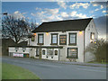
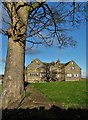


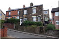
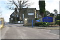
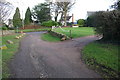
42 photos from this area
Area Information
Key information about the S18 1XY including its size, population, and administrative classification.
- Area Type
- Postcode
- Area Size
- 3.0 hectares
- Population
- 1551
- Population Density
- 2560 people/km²
House Prices in S18 1XY
48
Properties
£168,718
Average Sold Price
£48,500
Lowest Price
£399,950
Highest Price
Showing 48 properties
| Address | Type | Beds | Baths | Last Sale Price | Last Sale Date | |
|---|---|---|---|---|---|---|
| 24 Cemetery Road, Dronfield, S18 1XY | Semi-detached | 3 | 1 | £260,000 | Sep 2025 | |
| 20 Cemetery Road, Dronfield, S18 1XY | Detached | 3 | 1 | £255,000 | Aug 2025 | |
| 22 Cemetery Road, Dronfield, S18 1XY | Semi-detached | 3 | 2 | £250,000 | Aug 2025 | |
| 44 Cemetery Road, Dronfield, S18 1XY | Semi-detached | 2 | 1 | £242,500 | Sep 2024 | |
| 32 Cemetery Road, Dronfield, S18 1XY | Bungalow | 3 | 1 | £205,000 | Mar 2024 | |
| 36 Cemetery Road, Dronfield, S18 1XY | Semi-detached | 2 | 1 | £242,000 | Jan 2024 | |
| 28 Cemetery Road, Dronfield, S18 1XY | Detached | 5 | 3 | £399,950 | Nov 2023 | |
| 56 Cemetery Road, Dronfield, S18 1XY | Semi-detached | 2 | - | £219,000 | Jul 2023 | |
| 8 Cemetery Road, Dronfield, S18 1XY | Semi-detached | 3 | 1 | £285,000 | Feb 2023 | |
| 6 Cemetery Road, Dronfield, S18 1XY | house | - | - | £211,300 | Oct 2019 |
Page 1 of 5
Energy Efficiency in S18 1XY
Amenities
Schools
| Rank | School | Type | Entry gender | Ages |
|---|
Explore more schools in this area
Go to Schools tabDemographics
Household Size
One person
most common
Accommodation Type
Houses
most common
Tenure
64
majority
Ethnic Group
White
most common
Religion
N/A
most common
Household Composition
N/A
most common
Age
47
median
Adults (30-64 years)
most common
Household Deprivation
N/A
with no deprivation
NS-SEC
37
in Lower managerial occupations
Explore more demographic insights in this area
Go to Demographics tabPlanning
Planning Constraints
- Flood RiskPremium
- Ramsar Wetland SitesPremium
- Area of Outstanding Natural BeautyPremium
- Protected Nature ReservePremium
- Protected WoodlandPremium