Area Overview for S18 1XJ
Photos of S18 1XJ
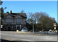
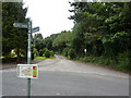
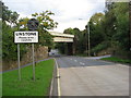
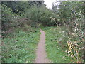
40 photos from this area
Area Information
Key information about the S18 1XJ including its size, population, and administrative classification.
- Area Type
- Postcode
- Area Size
- 13.0 hectares
- Population
- 1359
- Population Density
- 1054 people/km²
House Prices in S18 1XJ
22
Properties
£311,900
Average Sold Price
£50,000
Lowest Price
£585,000
Highest Price
Showing 22 properties
| Address | Type | Beds | Baths | Last Sale Price | Last Sale Date | |
|---|---|---|---|---|---|---|
| 268 Chesterfield Road, Dronfield, S18 1XJ | Detached | 4 | 3 | £585,000 | Sep 2025 | |
| 262 Chesterfield Road, Dronfield, S18 1XJ | Semi-detached | 3 | 1 | £290,000 | Nov 2023 | |
| 361 Chesterfield Road, Dronfield, S18 1XJ | house | - | - | £575,000 | Aug 2021 | |
| 266 Chesterfield Road, Dronfield, S18 1XJ | house | - | - | £514,000 | Aug 2018 | |
| 258 Chesterfield Road, Dronfield, S18 1XJ | Semi-detached | 3 | 1 | £205,000 | Mar 2018 | |
| 270 Chesterfield Road, Dronfield, S18 1XJ | Detached | 4 | - | £435,000 | Aug 2015 | |
| 260 Chesterfield Road, Dronfield, S18 1XJ | Semi-detached | - | - | £160,000 | Feb 2015 | |
| 359 Chesterfield Road, Dronfield, S18 1XJ | house | 3 | - | £250,000 | Sep 2011 | |
| 357 Chesterfield Road, Dronfield, S18 1XJ | Semi-detached | 4 | - | £50,000 | Sep 2003 | |
| 355 Chesterfield Road, Dronfield, S18 1XJ | Semi-detached | - | - | £55,000 | Sep 2003 |
Page 1 of 3
Energy Efficiency in S18 1XJ
Amenities
Schools
| Rank | School | Type | Entry gender | Ages |
|---|
Explore more schools in this area
Go to Schools tabDemographics
Household Size
One person
most common
Accommodation Type
Houses
most common
Tenure
48
majority
Ethnic Group
White
most common
Religion
N/A
most common
Household Composition
N/A
most common
Age
47
median
Adults (30-64 years)
most common
Household Deprivation
N/A
with no deprivation
NS-SEC
30
in Lower managerial occupations
Explore more demographic insights in this area
Go to Demographics tabPlanning
Planning Constraints
- Flood RiskPremium
- Ramsar Wetland SitesPremium
- Area of Outstanding Natural BeautyPremium
- Protected Nature ReservePremium
- Protected WoodlandPremium