Area Overview for S18 1YF
Photos of S18 1YF
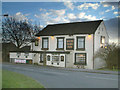
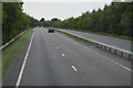
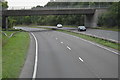
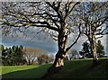
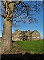


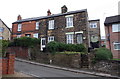
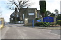
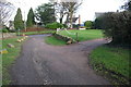
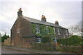
42 photos from this area
Area Information
Key information about the S18 1YF including its size, population, and administrative classification.
- Area Type
- Postcode
- Area Size
- 2.6 hectares
- Population
- 1206
- Population Density
- 2444 people/km²
House Prices in S18 1YF
26
Properties
£216,709
Average Sold Price
£89,950
Lowest Price
£380,000
Highest Price
Showing 26 properties
| Address | Type | Beds | Baths | Last Sale Price | Last Sale Date | |
|---|---|---|---|---|---|---|
| 18 Moorgate Crescent, Dronfield, S18 1YF | Bungalow | 3 | 2 | £380,000 | Nov 2024 | |
| 17 Moorgate Crescent, Dronfield, S18 1YF | house | - | - | £290,000 | Dec 2022 | |
| 2 Moorgate Crescent, Dronfield, S18 1YF | Detached | - | - | £315,000 | Sep 2016 | |
| 14 Moorgate Crescent, Dronfield, S18 1YF | Detached | 3 | 1 | £297,500 | Nov 2015 | |
| 1 Moorgate Crescent, Dronfield, S18 1YF | Bungalow | 2 | - | £217,500 | Oct 2015 | |
| 2A Moorgate Crescent, Dronfield, S18 1YF | Bungalow | - | - | £209,000 | Oct 2013 | |
| 6 Moorgate Crescent, Dronfield, S18 1YF | Bungalow | - | - | £225,000 | Sep 2013 | |
| 9 Moorgate Crescent, Dronfield, S18 1YF | Bungalow | 3 | 1 | £250,000 | Nov 2012 | |
| 16 Moorgate Crescent, Dronfield, S18 1YF | Bungalow | - | - | £182,250 | Sep 2009 | |
| 5 Moorgate Crescent, Dronfield, S18 1YF | house | - | - | £215,000 | May 2006 |
Page 1 of 3
Energy Efficiency in S18 1YF
Amenities
Schools
| Rank | School | Type | Entry gender | Ages |
|---|
Explore more schools in this area
Go to Schools tabDemographics
Household Size
Family (3-5 people)
most common
Accommodation Type
Houses
most common
Tenure
91
majority
Ethnic Group
White
most common
Religion
N/A
most common
Household Composition
N/A
most common
Age
47
median
Adults (30-64 years)
most common
Household Deprivation
N/A
with no deprivation
NS-SEC
45
in Lower managerial occupations
Explore more demographic insights in this area
Go to Demographics tabPlanning
Planning Constraints
- Flood RiskPremium
- Ramsar Wetland SitesPremium
- Area of Outstanding Natural BeautyPremium
- Protected Nature ReservePremium
- Protected WoodlandPremium