Area Overview for NN6 7TR
Photos of NN6 7TR
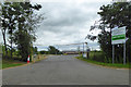
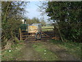
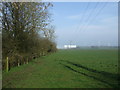
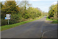
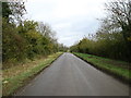
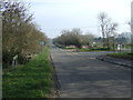

7 photos from this area
Area Information
Key information about the NN6 7TR including its size, population, and administrative classification.
- Area Type
- Postcode
- Area Size
- 7.6 hectares
- Population
- 2533
- Population Density
- 115 people/km²
House Prices in NN6 7TR
18
Properties
£344,473
Average Sold Price
£84,000
Lowest Price
£1,000,000
Highest Price
Showing 18 properties
| Address | Type | Beds | Baths | Last Sale Price | Last Sale Date | |
|---|---|---|---|---|---|---|
| 8 Yelvertoft Road, Crick, NN6 7TR | Terraced | 2 | 1 | £192,000 | Oct 2025 | |
| Aubrey House, 25 Yelvertoft Road, Crick, NN6 7TR | Detached | 4 | 3 | £1,000,000 | Jun 2025 | |
| 10 Yelvertoft Road, Crick, NN6 7TR | Terraced | 2 | 1 | £205,000 | Mar 2024 | |
| Westerley, 24 Yelvertoft Road, Crick, NN6 7TR | Detached | 5 | 3 | £499,000 | Nov 2022 | |
| 12 Yelvertoft Road, Crick, NN6 7TR | Semi-detached | 3 | 1 | £250,000 | Sep 2021 | |
| 18 Yelvertoft Road, Crick, NN6 7TR | Detached | 5 | 3 | £564,250 | Nov 2020 | |
| 4 Yelvertoft Road, Crick, NN6 7TR | Terraced | 2 | 1 | £210,000 | Dec 2019 | |
| Ranmoor, 26 Yelvertoft Road, Crick, NN6 7TR | Detached | 5 | 3 | £530,000 | Oct 2011 | |
| Raylyn, 3 Yelvertoft Road, Crick, NN6 7TR | Detached | - | - | £125,000 | Sep 2002 | |
| 2 Yelvertoft Road, Crick, NN6 7TR | Terraced | - | - | £129,950 | Aug 2002 |
Page 1 of 2
Energy Efficiency in NN6 7TR
Amenities
Schools
| Rank | School | Type | Entry gender | Ages |
|---|
Explore more schools in this area
Go to Schools tabDemographics
Household Size
Family (3-5 people)
most common
Accommodation Type
Houses
most common
Tenure
78
majority
Ethnic Group
White
most common
Religion
N/A
most common
Household Composition
N/A
most common
Age
47
median
Adults (30-64 years)
most common
Household Deprivation
N/A
with no deprivation
NS-SEC
45
in Lower managerial occupations
Explore more demographic insights in this area
Go to Demographics tabPlanning
Planning Constraints
- Flood RiskPremium
- Ramsar Wetland SitesPremium
- Area of Outstanding Natural BeautyPremium
- Protected Nature ReservePremium
- Protected WoodlandPremium