Area Overview for NN6 7TF
Photos of NN6 7TF
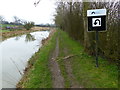
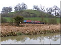
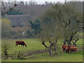
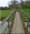
63 photos from this area
Area Information
Key information about the NN6 7TF including its size, population, and administrative classification.
- Area Type
- Postcode
- Area Size
- 2.2 km²
- Population
- 2533
- Population Density
- 115 people/km²
House Prices in NN6 7TF
10
Properties
£485,000
Average Sold Price
£485,000
Lowest Price
£485,000
Highest Price
Showing 10 properties
| Address | Type | Beds | Baths | Last Sale Price | Last Sale Date | |
|---|---|---|---|---|---|---|
| Filbert Lodge, Yelvertoft Road, Crick, NN6 7TF | house | - | - | £485,000 | Aug 2006 | |
| Papillion Fields, Yelvertoft Road, Crick, NN6 7TF | office_workshop | 5 | - | - | - | |
| 54 Yelvertoft Road, Crick, NN6 7TF | Detached | - | - | - | - | |
| Foxes Farm, Yelvertoft Road, Crick, NN6 7TF | Detached | 3 | 2 | - | - | |
| Ate Farms Ltd, Tall Trees, Yelvertoft Road, Crick, NN6 7TF | Restaurant | - | - | - | - | |
| Crackshill Farm, Yelvertoft Road, Crick, NN6 7TF | Detached | - | - | - | - | |
| Crick Community Sports Centre, Yelvertoft Road, Crick, NN6 7TF | Leisure | - | - | - | - | |
| Bungalow, Tall Trees, Yelvertoft Road, Crick, NN6 7TF | Detached | 3 | 1 | - | - | |
| Sue Whitling Exercise And Training Ltd, Crick Community Sports Centre, Yelvertoft Road, Crick, NN6 7TF | Leisure | - | - | - | - | |
| Crackshill Farm Bungalow, Crackshill Farm, Yelvertoft Road, Crick, NN6 7TF | Bungalow | - | - | - | - |
Energy Efficiency in NN6 7TF
Amenities
Schools
| Rank | School | Type | Entry gender | Ages |
|---|
Explore more schools in this area
Go to Schools tabDemographics
Household Size
Family (3-5 people)
most common
Accommodation Type
Houses
most common
Tenure
78
majority
Ethnic Group
White
most common
Religion
N/A
most common
Household Composition
N/A
most common
Age
47
median
Adults (30-64 years)
most common
Household Deprivation
N/A
with no deprivation
NS-SEC
45
in Lower managerial occupations
Explore more demographic insights in this area
Go to Demographics tabPlanning
Planning Constraints
- Flood RiskPremium
- Ramsar Wetland SitesPremium
- Area of Outstanding Natural BeautyPremium
- Protected Nature ReservePremium
- Protected WoodlandPremium