Area Overview for NN4 6UX
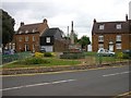
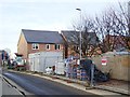
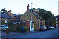
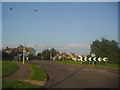
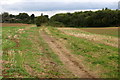
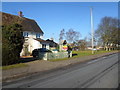
Photos of NN4 6UX


Area Information
Living in NN4 6UX means residing in a compact residential cluster covering just 2.1 hectares with a population of 1,590 people. This specific postcode area represents a tight-knit community where residents live in close proximity to one another. With a population density of 184 people per square kilometre, the area feels intimate compared to larger urban developments. The location offers a quiet residential setting within the NN4 region, suitable for those seeking a smaller footprint. Daily life here revolves around the immediate surroundings and nearby town centres rather than the street itself. Buyers should understand that this is a defined locality rather than a broad district, meaning every property is within a short walk of its neighbours. The small scale ensures that the character of the neighbourhood remains consistent across the entire postcode. You will find a stable environment where the boundaries are clearly defined by the area size and resident numbers. This makes NN4 6UX an area where community interactions can be frequent and familiar. The layout supports a predictable routine for local families and individuals who value a distinct residential zone.
- Area Type
- Postcode
- Area Size
- 2.1 hectares
- Population
- 1590
- Population Density
- 184 people/km²
The housing market in NN4 6UX is characterized by a strong preference for owner-occupied homes. With 73% of households owning their property, this area functions primarily as an owner-occupied zone rather than a rental hub. Houses predominate the local stock, meaning you will find traditional family dwellings rather than high-rise apartments or conversion flats. This ownership rate implies that many current residents have lived in the area for an extended period, passing down local knowledge to new buyers. When assessing homes in NN4 6UX, expect to encounter a market where sellers have a vested interest in the long-term value of their properties. The small area size of 2.1 hectares limits the total number of properties available, creating a niche market with limited inventory. Buyers looking for this specific postcode should expect competition from local sellers who are unlikely to move frequently. The high home ownership percentage also suggests that resale transactions occur less often than in transient rental areas. Legislation regarding planning consent and building regulations will apply to these houses as standard UK properties. This stability makes the area attractive to those seeking to settle permanently rather than short-term tenants.
House Prices in NN4 6UX
Showing 47 properties
| Address | Type | Beds | Baths | Last Sale Price | Last Sale Date | |
|---|---|---|---|---|---|---|
| 10 Hardy Drive, Northampton, NN4 6UX | Detached | 4 | 3 | £440,000 | Aug 2025 | |
| 6 Hardy Drive, Northampton, NN4 6UX | Detached | 4 | - | £625,000 | Aug 2024 | |
| 8 Hardy Drive, Northampton, NN4 6UX | Detached | 4 | 1 | £418,000 | Sep 2022 | |
| 3 Hardy Drive, Northampton, NN4 6UX | Detached | 4 | - | £492,000 | Feb 2022 | |
| 4 Hardy Drive, Northampton, NN4 6UX | house | - | - | £362,500 | Jun 2021 | |
| 2 Hardy Drive, Northampton, NN4 6UX | house | - | - | £390,000 | Oct 2020 | |
| 1 Hardy Drive, Northampton, NN4 6UX | Detached | 4 | 2 | £411,500 | Dec 2019 | |
| 7 Hardy Drive, Northampton, NN4 6UX | Detached | 4 | - | £205,000 | Aug 2012 | |
| 5 Hardy Drive, Northampton, NN4 6UX | house | - | - | £231,000 | Oct 2009 | |
| 24 Hardy Drive, Northampton, NN4 6UX | Detached | 4 | 2 | - | - |
Energy Efficiency in NN4 6UX
Residents of NN4 6UX benefit from a range of amenities located within practical commuting distance. The nearest retail options include Co-op Wootten, Waitrose Wootton, and Tesco East, providing comprehensive grocery and daily shopping needs. These three outlets form the core of the local high street experience for the 1,590 people living in the cluster. Transport links are well developed with two major bus hubs nearby: the Northampton Bus Interchange and the University Bus Interchange. These stops connect residents to wider county destinations efficiently. One railway station, Northampton Railway Station, serves the region, offering train services for those requiring rail travel. The combination of retail chains and transport interchanges means you rarely need to travel far for essentials. Shopping trips at Waitrose or runs to the Co-op are short commutes. The bus network allows for car-free travel to Northampton for leisure or business. This mix of shops and transit points supports a balanced lifestyle without requiring a vehicle for every outing. The area serves as a quiet residential base with all necessary conveniences nearby.
Amenities
Schools
Families living in NN4 6UX have access to specific educational options, most notably Great Houghton School within the immediate vicinity. Great Houghton School operates as an independent school, providing an alternative to the state-funded system. The presence of this independent institution offers residents a choice regarding curriculum and educational ethos. While no secondary states schools are listed in the immediate data for this cluster, Great Houghton serves as the primary educational reference point for the local community. The independent status suggests a fee-paying environment, which aligns with the high home ownership rates seen in the area. You should verify admission policies directly with the school as independent institutions manage their own entry criteria. The mix of school types in the surrounding region provides options for parents seeking specific educational methodologies. Great Houghton School stands out as the key facility mentioned for the NN4 6UX postcode. Its location makes it a practical choice for residents of this 2.1-hectare cluster. Parents planning to move here must consider travel time to Great Houghton School when evaluating their needs.
| Rank | School | Type | Entry gender | Ages |
|---|
Explore more schools in this area
Go to Schools tabDemographics
The community in NN4 6UX is defined by a mature demographic profile with a median age of 47 years. The majority of residents fall into the adult age range of 30 to 64 years, indicating a settlement dominated by working-age individuals and retirees. Home ownership stands at a high rate of 73%, reflecting long-term stability within this postcode. Most residents own their property outright or via a mortgage, which contrasts sharply with rental-heavy districts. Houses form the primary accommodation type in this cluster, offering detached or semi-detached living arrangements rather than flats. The predominant ethnic group in the area is White, aligning with the broader demographic trends of the local region. This homogeneity contributes to an established social fabric where long-standing families often reside together. The high percentage of homeowners suggests a wealthier demographic comfortable with property investment. Residents typically value stability over transient living arrangements. This profile means the area is likely populated by established families or downsizers rather than single young professionals. The lack of significant youth or elderly outliers indicates a balanced household structure.
Household Size
Accommodation Type
Tenure
Ethnic Group
Religion
Household Composition
Age
Household Deprivation
NS-SEC
Explore more demographic insights in this area
Go to Demographics tabPlanning
Planning Constraints
- Flood RiskPremium
- Ramsar Wetland SitesPremium
- Area of Outstanding Natural BeautyPremium
- Protected Nature ReservePremium
- Protected WoodlandPremium