Area Overview for NN4 6EN
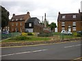
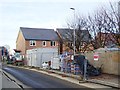
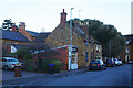
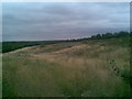
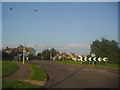
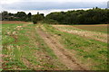
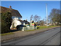
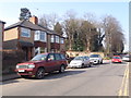
Photos of NN4 6EN


Area Information
NN4 6EN is a small, compact residential cluster in England, spanning 1.2 hectares and home to 1,590 residents. With a population density of 184 people per square kilometre, it balances intimacy with practicality. This area is defined by its modest scale and proximity to essential services, making it a convenient choice for those seeking a settled lifestyle. The community is predominantly composed of adults aged 30–64, reflecting a stable, family-oriented demographic. While the area lacks sprawling green spaces or major landmarks, its strength lies in accessibility. Nearby amenities include retail hubs like Waitrose Wootton and Co-op Wootten, alongside transport links such as Northampton Railway Station and two bus interchanges. For buyers, NN4 6EN offers a snapshot of suburban living—compact, functional, and anchored by local infrastructure. Its small size means residents are likely to know their neighbours, though the area’s limited footprint also means housing stock is finite. The presence of an independent school, Great Houghton School, adds to its appeal for families prioritising educational options.
- Area Type
- Postcode
- Area Size
- 1.2 hectares
- Population
- 1590
- Population Density
- 184 people/km²
NN4 6EN is a predominantly owner-occupied area, with 73% of homes owned by residents rather than rented. The accommodation type is largely houses, which suggests a focus on family-sized properties rather than flats or apartments. Given the area’s small size—just 1.2 hectares—housing stock is limited, meaning buyers should consider proximity to surrounding areas for more options. The high home ownership rate indicates a stable market, but the small footprint may lead to competition for available properties. For those seeking a home here, the emphasis on houses aligns with a preference for private, space-efficient living. However, the area’s compact nature means that any property purchase will likely involve a careful balance between location, size, and local amenities. Buyers should also factor in the area’s proximity to transport links and schools, which are key selling points for families.
House Prices in NN4 6EN
Showing 29 properties
| Address | Type | Beds | Baths | Last Sale Price | Last Sale Date | |
|---|---|---|---|---|---|---|
| 53 Bouverie Road, Northampton, NN4 6EN | Maisonette | 2 | 1 | £137,000 | Oct 2025 | |
| 49 Bouverie Road, Northampton, NN4 6EN | Maisonette | 3 | 1 | £125,000 | Feb 2025 | |
| 21 Bouverie Road, Northampton, NN4 6EN | Flat | - | - | £107,500 | Sep 2006 | |
| 41 Bouverie Road, Northampton, NN4 6EN | Flat | - | - | £49,995 | Jul 2000 | |
| 31 Bouverie Road, Northampton, NN4 6EN | Flat | - | - | £38,000 | Aug 1998 | |
| 59 Bouverie Road, Northampton, NN4 6EN | Semi-detached | - | - | £11,200 | Jul 1997 | |
| 47-51 Bouverie Road, Northampton, NN4 6EN | Flat | - | - | - | - | |
| 55 Bouverie Road, Northampton, NN4 6EN | house | - | - | - | - | |
| 15 Bouverie Road, Northampton, NN4 6EN | Flat | - | - | - | - | |
| 3 Bouverie Road, Northampton, NN4 6EN | house | - | - | - | - |
Energy Efficiency in NN4 6EN
Daily life in NN4 6EN is shaped by its proximity to retail and transport hubs. The area’s retail scene includes five notable venues, such as Waitrose Wootton and Tesco East, offering a range of shopping options from groceries to specialty goods. These stores cater to both everyday needs and occasional indulgences, supporting a convenient lifestyle. Transport links are similarly robust, with Northampton Railway Station and two bus interchanges providing access to broader networks. The presence of the University Bus Interchange suggests connections to higher education, while the Northampton Bus Interchange links to local businesses and services. Though the area lacks dedicated parks or leisure facilities, its compact design ensures that amenities are within walking or short driving distance. This balance of retail, transport, and proximity to nearby towns makes NN4 6EN suitable for those valuing accessibility over expansive recreational spaces.
Amenities
Schools
The nearest school to NN4 6EN is Great Houghton School, an independent institution. This type of school typically offers fee-paying education with a focus on academic and extracurricular excellence. While the data does not include an Ofsted rating, the presence of an independent school suggests the area may attract families prioritising private education. However, the absence of state-funded schools in the immediate vicinity could be a consideration for those seeking free or subsidised options. For families reliant on public education, the nearest state schools may lie further afield, requiring careful planning for commuting. The mix of school types here is limited, with only one listed, so prospective buyers should investigate additional educational provisions in nearby towns.
| Rank | School | Type | Entry gender | Ages |
|---|
Explore more schools in this area
Go to Schools tabDemographics
The population of NN4 6EN skews towards middle-aged adults, with a median age of 47 and 73% of residents owning their homes. This suggests a community of long-term residents, many of whom are likely to be in their prime working years. The majority of households are owner-occupied, with houses being the predominant type of accommodation. This contrasts with areas dominated by rental properties or high-density housing. The demographic profile indicates a low proportion of younger families or elderly residents, which may influence local services and amenities. The predominant ethnic group is White, though the data does not specify further diversity metrics. With 1,590 residents, the area is small enough to foster a close-knit community but large enough to support basic services. The high home ownership rate implies stability, though it may also limit housing availability for newcomers.
Household Size
Accommodation Type
Tenure
Ethnic Group
Religion
Household Composition
Age
Household Deprivation
NS-SEC
Explore more demographic insights in this area
Go to Demographics tabPlanning
Planning Constraints
- Flood RiskPremium
- Ramsar Wetland SitesPremium
- Area of Outstanding Natural BeautyPremium
- Protected Nature ReservePremium
- Protected WoodlandPremium