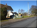
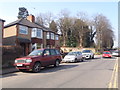
Area Overview for NN4 6FD
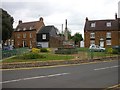
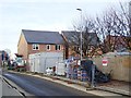
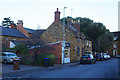
Photos of NN4 6FD


Area Information
Living in NN4 6FD means inhabiting a tightly knit residential cluster in England, where 2,298 residents occupy just 9,255 square metres. This compact area, with a population density of 248,286 people per square kilometre, reflects a mature community characterised by a median age of 47. The area’s small size fosters a sense of familiarity, with homes predominantly owner-occupied (77%) and focused on single-family residences. Proximity to schools like Hardingstone Primary and Northampton High School, along with retail outlets such as Waitrose Wootton and Co-op Wootten, ensures daily needs are met locally. The area’s safety profile is strong, with low crime risk and no flood or environmental constraints. While its density is high, the mix of amenities and low crime rates suggests a balance between urban convenience and residential tranquillity. For buyers, NN4 6FD offers a snapshot of a well-established, family-oriented neighbourhood where proximity to services and schools is a key draw.
- Area Type
- Postcode
- Area Size
- 9255 m²
- Population
- 2298
- Population Density
- 2930 people/km²
The property market in NN4 6FD is dominated by owner-occupied homes, with 77% of households owning their residences. This suggests a community of long-term residents rather than a rental-heavy area. The accommodation type is primarily houses, which, given the area’s small size, implies limited availability of flats or apartments. Buyers should consider that the housing stock is finite, with little scope for new development due to the area’s compact footprint. The focus on single-family homes may appeal to families seeking space, though the high population density means proximity to neighbours is inevitable. For those prioritising proximity to schools and amenities, the area’s immediate surroundings offer a mix of retail and transport links, making it a practical choice for those valuing convenience over expansive property options.
House Prices in NN4 6FD
Showing 30 properties
| Address | Type | Beds | Baths | Last Sale Price | Last Sale Date | |
|---|---|---|---|---|---|---|
| 15 Casterbridge Court, Northampton, NN4 6FD | Semi-detached | 2 | 1 | £230,000 | Mar 2025 | |
| 28 Casterbridge Court, Northampton, NN4 6FD | Terraced | 2 | 1 | £205,000 | May 2023 | |
| 17 Casterbridge Court, Northampton, NN4 6FD | Terraced | 2 | 1 | £265,000 | Feb 2023 | |
| 21 Casterbridge Court, Northampton, NN4 6FD | house | - | - | £243,000 | Aug 2021 | |
| 27 Casterbridge Court, Northampton, NN4 6FD | Semi-detached | 3 | 1 | £255,000 | Aug 2020 | |
| 8 Casterbridge Court, Northampton, NN4 6FD | Terraced | 3 | 1 | £235,000 | Nov 2019 | |
| 3 Casterbridge Court, Northampton, NN4 6FD | Semi-detached | 2 | 1 | £192,500 | Nov 2016 | |
| 7 Casterbridge Court, Northampton, NN4 6FD | house | - | - | £180,000 | Aug 2016 | |
| 5 Casterbridge Court, Northampton, NN4 6FD | Semi-detached | - | - | £122,000 | Dec 2015 | |
| 25 Casterbridge Court, Northampton, NN4 6FD | Terraced | 2 | - | £150,000 | May 2015 |
Energy Efficiency in NN4 6FD
Daily life in NN4 6FD is shaped by its proximity to retail, dining, and transport hubs. The area’s retail landscape includes Waitrose Wootton, Co-op Wootten, and Tesco East, providing a range of shopping options from premium to budget. These stores cater to both everyday needs and occasional indulgences. The presence of Northampton Bus Interchange and University Bus Interchange ensures easy access to public transport, while Northampton Railway Station connects residents to broader regional networks. Though the area is small, its amenities are strategically located to serve residents without requiring long journeys. The compact nature of NN4 6FD means that essentials are within walking or short driving distance, fostering a convenient, low-maintenance lifestyle.
Amenities
Schools
Residents of NN4 6FD have access to a range of educational institutions, including Hardingstone Primary School, which serves younger children, and Northampton High School, an independent institution offering specialist education. Hardingstone Academy, an academy with a good Ofsted rating, provides secondary education with a focus on academic achievement. The mix of state and independent schools offers families flexibility, whether they prioritise public education or seek the resources of a private institution. The presence of three schools within practical reach ensures children have multiple options for schooling, reducing the need for long commutes. This diversity in educational provision is a key advantage for families considering the area, as it accommodates different preferences and financial circumstances.
| Rank | School | Type | Entry gender | Ages |
|---|
Explore more schools in this area
Go to Schools tabDemographics
The population of NN4 6FD skews towards adults aged 30–64, with a median age of 47. This suggests a community of settled, likely working-age residents, many of whom are homeowners—77% of households own their homes. The area is dominated by single-family houses, reflecting a preference for private, spacious living over flats or shared accommodation. The predominant ethnic group is White, which aligns with broader trends in the region. The high home ownership rate and mature age profile indicate a stable, long-term resident base rather than a transient population. With no data on deprivation levels, the area’s quality of life appears supported by its amenities and safety record. However, the lack of diversity in ethnicity and household types may limit the range of cultural or social dynamics present.
Household Size
Accommodation Type
Tenure
Ethnic Group
Religion
Household Composition
Age
Household Deprivation
NS-SEC
Explore more demographic insights in this area
Go to Demographics tabPlanning
Planning Constraints
- Flood RiskPremium
- Ramsar Wetland SitesPremium
- Area of Outstanding Natural BeautyPremium
- Protected Nature ReservePremium
- Protected WoodlandPremium