Area Overview for NN3 9NT
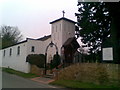
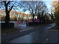
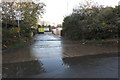
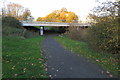
Photos of NN3 9NT


Area Information
Living in NN3 9NT means inhabiting a tightly packed residential cluster in England, where 1611 people reside across just 2.1 hectares. This density creates a compact, closely knit community, though it also means space is at a premium. The area’s small size means daily life is centred around nearby amenities, with shops, transport hubs, and schools within practical reach. The population, predominantly adults aged 30–64, suggests a mature demographic, likely with established careers and families. While the area lacks natural landscapes or protected sites, its proximity to Northampton’s transport networks and retail centres offers convenience. However, the high population density—76,427 people per square kilometre—means privacy is limited, and community interactions are frequent. For those prioritising accessibility over space, NN3 9NT’s compact footprint and strong connectivity to Northampton’s infrastructure make it a practical choice, though it may not suit those seeking expansive living environments.
- Area Type
- Postcode
- Area Size
- 2.1 hectares
- Population
- 1611
- Population Density
- 4062 people/km²
NN3 9NT’s property market is dominated by owner-occupied homes, with 64% of residents owning their properties. The accommodation type is primarily houses, which is unusual for a small, densely populated area. This suggests a mix of semi-detached or terraced housing, possibly catering to families or professionals seeking stability. The high population density—76,427 people per square kilometre—means the area is likely built to maximise space, with limited scope for larger properties. For buyers, this implies a competitive market for existing homes, with limited new developments. The focus on owner-occupation suggests long-term residency, though the lack of rental data means it’s unclear how many properties are available for lease. Those considering the area should factor in the compact nature of the housing stock and its proximity to Northampton’s infrastructure.
House Prices in NN3 9NT
Showing 30 properties
| Address | Type | Beds | Baths | Last Sale Price | Last Sale Date | |
|---|---|---|---|---|---|---|
| 21 Shepperton Close, Northampton, NN3 9NT | Detached | 5 | 2 | £504,000 | Jan 2025 | |
| 25 Shepperton Close, Northampton, NN3 9NT | Detached | 4 | 2 | £420,000 | Dec 2023 | |
| 3 Shepperton Close, Northampton, NN3 9NT | house | 4 | - | £430,000 | Sep 2021 | |
| 6 Shepperton Close, Northampton, NN3 9NT | Detached | 4 | - | £355,000 | Aug 2020 | |
| 17 Shepperton Close, Northampton, NN3 9NT | Detached | 4 | 2 | £360,000 | Feb 2020 | |
| 1 Shepperton Close, Northampton, NN3 9NT | Detached | 4 | - | £306,000 | Sep 2016 | |
| 16 Shepperton Close, Northampton, NN3 9NT | Detached | 4 | - | £237,000 | Jun 2014 | |
| 10 Shepperton Close, Northampton, NN3 9NT | house | - | - | £228,000 | Apr 2014 | |
| 23 Shepperton Close, Northampton, NN3 9NT | house | - | - | £235,500 | Mar 2014 | |
| 9 Shepperton Close, Northampton, NN3 9NT | house | - | - | £225,000 | Feb 2013 |
Energy Efficiency in NN3 9NT
Residents of NN3 9NT have access to a range of nearby amenities, including five retail outlets such as Co-op Bellinge and Asda Nene Valley, offering everyday shopping needs. The area’s proximity to Northampton Bus Interchange and University Bus Interchange ensures regular public transport links, while Northampton Railway Station provides connections to further destinations. Though the data does not specify leisure or dining options, the presence of multiple retail points suggests a focus on convenience over specialised services. The compact nature of the area means amenities are closely clustered, reducing travel time for daily tasks. However, the absence of parks or recreational spaces in the data implies that outdoor activities may require venturing beyond NN3 9NT. The lifestyle here is practical, prioritising accessibility to essential services over expansive leisure options.
Amenities
Schools
The nearest school to NN3 9NT is The Spires Academy, though its type and Ofsted rating are unspecified in the data. This lack of detail means it’s unclear whether the school is state-funded, independent, or specialist. The absence of additional schools nearby suggests families may need to look beyond the immediate area for educational options. The single listed school may indicate limited local provision, requiring parents to consider commuting or broader catchment areas. Without performance metrics, it’s difficult to assess the quality of education available, though the presence of a named institution suggests some level of service. For families prioritising schools, further research into The Spires Academy’s offerings and alternatives in Northampton would be necessary.
| Rank | School | Type | Entry gender | Ages |
|---|
Explore more schools in this area
Go to Schools tabDemographics
The community in NN3 9NT is predominantly composed of adults aged 30–64, with a median age of 47. This suggests a population skewed towards middle-aged individuals, likely in stable employment and family life. Home ownership rates stand at 64%, with houses being the primary accommodation type, indicating a mix of owner-occupied properties and rentals. The predominant ethnic group is White, though specific data on diversity or deprivation is not provided. The high population density—76,427 people per square kilometre—implies a compact, possibly urbanised environment where shared spaces and communal living are common. This density may influence quality of life, with potential trade-offs between accessibility to services and personal space. The absence of specific deprivation metrics means broader socioeconomic factors remain unexplored, but the demographic profile suggests a stable, established community.
Household Size
Accommodation Type
Tenure
Ethnic Group
Religion
Household Composition
Age
Household Deprivation
NS-SEC
Explore more demographic insights in this area
Go to Demographics tabPlanning
Planning Constraints
- Flood RiskPremium
- Ramsar Wetland SitesPremium
- Area of Outstanding Natural BeautyPremium
- Protected Nature ReservePremium
- Protected WoodlandPremium