Area Overview for NN3 9EN
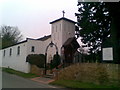
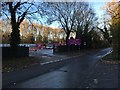
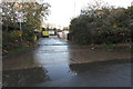
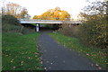
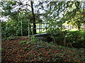
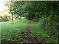
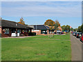
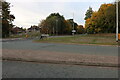
Photos of NN3 9EN


Area Information
Living in NN3 9EN means inhabiting a compact residential cluster in England, where 1,611 people reside across 3,533 square metres. This postcode area, though small, offers a mix of practicality and connectivity. Its high population density—456,042 people per square kilometre—suggests a tightly knit community, though the area’s size limits expansion. Residents benefit from proximity to Northampton, with nearby amenities including retail outlets, bus interchanges, and a railway station. Daily life here is shaped by its position as a practical suburb, balancing residential tranquillity with access to urban services. The area’s compact nature means neighbours are close, and local facilities are within walking or short driving distance. While it lacks sprawling green spaces, its infrastructure ensures ease of movement. For those seeking a place with a strong sense of community and straightforward access to transport, NN3 9EN provides a focused environment. However, its limited size means housing options are finite, requiring buyers to consider nearby areas for broader choices.
- Area Type
- Postcode
- Area Size
- 3533 m²
- Population
- 1611
- Population Density
- 4062 people/km²
The property market in NN3 9EN is defined by a strong emphasis on owner-occupation, with 64% of homes owned by residents. This contrasts with areas where rental markets dominate, suggesting a community of long-term residents rather than transient tenants. The accommodation type is exclusively houses, which are more common than flats or apartments in this postcode. This housing stock likely appeals to families or individuals seeking traditional living arrangements, though the small area size means the inventory of homes is limited. Buyers should consider that the compact nature of NN3 9EN may mean competition for properties, particularly as the area’s proximity to Northampton offers additional appeal. For those prioritising stability and a focus on family homes, this market aligns with those needs. However, the lack of newer developments or varied property types could limit options for buyers seeking specific features like modern amenities or larger spaces.
House Prices in NN3 9EN
Showing 6 properties
| Address | Type | Beds | Baths | Last Sale Price | Last Sale Date | |
|---|---|---|---|---|---|---|
| 1 Old School Close, Northampton, NN3 9EN | house | - | - | £237,000 | Aug 2018 | |
| 3 Old School Close, Northampton, NN3 9EN | house | - | - | £425,000 | Jul 2017 | |
| 4 Old School Close, Northampton, NN3 9EN | Land | - | - | - | - | |
| 5 Old School Close, Northampton, NN3 9EN | Detached | 5 | 4 | - | - | |
| 6 Old School Close, Northampton, NN3 9EN | house | - | - | - | - | |
| 2 Old School Close, Northampton, NN3 9EN | house | - | - | - | - |
Energy Efficiency in NN3 9EN
The lifestyle in NN3 9EN is shaped by its proximity to retail, transport, and essential services. Within practical reach are five retail outlets, including Co-op Bellinge and Asda Nene Valley, offering grocery and general shopping needs. The area’s two bus interchanges and a railway station provide reliable connections to Northampton and beyond, facilitating commuting or weekend travel. While there are no named parks or leisure facilities in the data, the presence of multiple retail points and transport hubs suggests a focus on convenience over expansive recreational spaces. The compact nature of the area means amenities are clustered, reducing travel time for daily tasks. However, residents seeking more extensive leisure options may need to venture to nearby towns. The mix of retail and transport infrastructure supports a functional lifestyle, though the absence of detailed information on dining or cultural venues leaves gaps in understanding the area’s social character.
Amenities
Schools
The nearest school to NN3 9EN is The Spires Academy, categorised as an ‘other’ school type. No Ofsted rating is provided in the data, so its performance cannot be assessed here. The absence of additional schools in the area means families must look beyond NN3 9EN for a broader range of educational options. The single listed school suggests limited diversity in school types, which may impact choices for parents seeking specific curricula or facilities. For families relying on local schools, this could necessitate commuting to nearby areas, though the area’s transport links may ease this. The Spires Academy’s presence provides a basic educational service, but its adequacy depends on factors not detailed in the data. Prospective buyers with children should investigate further into the school’s reputation and whether it meets their needs.
| Rank | School | Type | Entry gender | Ages |
|---|
Explore more schools in this area
Go to Schools tabDemographics
The community in NN3 9EN is predominantly middle-aged, with a median age of 47 and the majority of residents falling within the 30-64 age range. This suggests a population skewed towards established adults, likely with families or long-term careers. Home ownership is strong, with 64% of properties owned by residents, indicating stability and a focus on long-term residency. The area is characterised by houses rather than flats, reflecting a preference for traditional family homes. The predominant ethnic group is White, and while specific data on diversity is not provided, the absence of notable minority statistics implies a relatively homogeneous population. The high population density—456,042 people per square kilometre—raises questions about living space per person, though this is typical for compact urban areas. For quality of life, this density may mean limited private outdoor space but proximity to services. The community’s age profile suggests a balance between active professionals and retirees, with fewer young families compared to other areas.
Household Size
Accommodation Type
Tenure
Ethnic Group
Religion
Household Composition
Age
Household Deprivation
NS-SEC
Explore more demographic insights in this area
Go to Demographics tabPlanning
Planning Constraints
- Flood RiskPremium
- Ramsar Wetland SitesPremium
- Area of Outstanding Natural BeautyPremium
- Protected Nature ReservePremium
- Protected WoodlandPremium