Area Overview for NN3 9DS
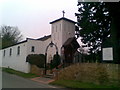
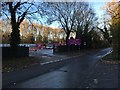
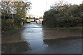
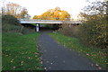
Photos of NN3 9DS


Area Information
NN3 9DS is a small, tightly packed residential cluster in England, spanning just 4.9 hectares and home to 1,611 residents. Its high population density of 32,943 people per square kilometre reflects a compact, closely knit community. The area is characterised by its focus on housing, with 64% of residents owning their homes. This suggests a stable, long-term population, with the median age of 47 indicating a mature demographic. Daily life here is likely to revolve around local amenities, with shops, transport hubs, and schools within practical reach. The area’s proximity to Northampton Bus Interchange and Northampton Railway Station offers easy access to regional travel, while nearby retail outlets like Asda Nene Valley and Co-op Bellinge provide essential services. Though small, NN3 9DS balances residential comfort with connectivity, making it suitable for those prioritising convenience over sprawling landscapes.
- Area Type
- Postcode
- Area Size
- 4.9 hectares
- Population
- 1611
- Population Density
- 4062 people/km²
The property market in NN3 9DS is dominated by owner-occupied homes, with 64% of residents living in houses rather than flats or rental properties. This suggests a stable, long-term market with limited turnover. The small area size of 4.9 hectares means housing stock is concentrated, likely comprising a mix of semi-detached and detached homes. Buyers should consider the proximity to transport links, such as Northampton Railway Station and nearby bus interchanges, which may influence property values. The area’s compact nature means competition for available homes could be fierce, particularly for those seeking family-friendly housing. For investors, the focus on owner-occupation may indicate lower rental demand, though the exact dynamics of the local market are not detailed in the data.
House Prices in NN3 9DS
Showing 61 properties
| Address | Type | Beds | Baths | Last Sale Price | Last Sale Date | |
|---|---|---|---|---|---|---|
| 22 Station Road, Northampton, NN3 9DS | Detached | 3 | 1 | £347,500 | Jul 2025 | |
| 18 Station Road, Northampton, NN3 9DS | Semi-detached | 3 | 1 | £335,000 | Aug 2024 | |
| 58A Station Road, Northampton, NN3 9DS | Bungalow | 3 | 1 | £375,000 | Jul 2024 | |
| 48 Station Road, Northampton, NN3 9DS | Semi-detached | 2 | 1 | £230,000 | Dec 2023 | |
| 89 Station Road, Northampton, NN3 9DS | Semi-detached | 3 | 1 | £290,000 | Sep 2023 | |
| 44 Station Road, Northampton, NN3 9DS | Retail | 3 | 1 | £320,000 | Mar 2022 | |
| 9 Station Road, Northampton, NN3 9DS | house | - | - | £495,000 | Feb 2022 | |
| 10 Station Road, Northampton, NN3 9DS | Bungalow | - | - | £385,000 | Nov 2021 | |
| 11 Station Road, Northampton, NN3 9DS | Detached | 4 | - | £500,000 | Jun 2021 | |
| 69 Station Road, Northampton, NN3 9DS | house | - | - | £245,000 | May 2021 |
Energy Efficiency in NN3 9DS
The lifestyle in NN3 9DS is shaped by its proximity to retail and transport hubs. Local shops include Asda Nene Valley and Co-op Bellinge, offering everyday essentials. The area’s two bus interchanges and nearby railway station provide easy access to Northampton and beyond, facilitating both commuting and leisure travel. While no parks or leisure facilities are listed, the compact layout ensures amenities are within walking or short driving distance. The mix of retail and transport options supports a practical, convenience-driven lifestyle, ideal for those prioritising accessibility over expansive recreational spaces.
Amenities
Schools
The nearest school to NN3 9DS is The Spires Academy, categorised as an "other" type in the data. No Ofsted rating is provided, so its educational quality remains unspecified. The absence of additional schools in the data suggests limited options for families, though The Spires Academy may serve the area’s needs. The single school listed indicates a reliance on this institution for primary and secondary education. Families considering NN3 9DS should assess whether The Spires Academy aligns with their children’s academic and extracurricular requirements. The lack of diverse school types may be a consideration for those seeking specialist or independent education options.
| Rank | School | Type | Entry gender | Ages |
|---|
Explore more schools in this area
Go to Schools tabDemographics
The community in NN3 9DS is predominantly composed of adults aged 30–64, with a median age of 47. This suggests a population skewed towards middle-aged residents, likely including families and professionals. Home ownership is strong, with 64% of households owning their properties, indicating a settled community. The area is largely composed of houses rather than flats, reflecting a preference for single-family living. The predominant ethnic group is White, though no specific data on diversity or deprivation is provided. The high population density of 32,943 people per square kilometre implies a mix of household types, though the exact distribution is not specified. For residents, this density may mean a vibrant local scene but also potential challenges with space and congestion.
Household Size
Accommodation Type
Tenure
Ethnic Group
Religion
Household Composition
Age
Household Deprivation
NS-SEC
Explore more demographic insights in this area
Go to Demographics tabPlanning
Planning Constraints
- Flood RiskPremium
- Ramsar Wetland SitesPremium
- Area of Outstanding Natural BeautyPremium
- Protected Nature ReservePremium
- Protected WoodlandPremium