Area Overview for NN3 9AH
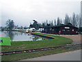
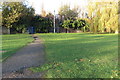
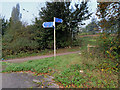
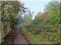
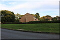
Photos of NN3 9AH


Area Information
NN3 9AH is a compact residential postcode in England, covering just 3,500 square metres and home to 1,643 residents. Its high population density — 469,443 people per square kilometre — reflects its small, tightly knit nature. This area is not a sprawling suburb but a focused cluster of homes, likely centred around local amenities and transport links. Daily life here is shaped by proximity to Northampton’s infrastructure, including the Northampton Railway Station and nearby bus interchanges. The area’s character is defined by its mature demographic, with a median age of 47 and a strong presence of adults aged 30–64. Residents benefit from excellent broadband connectivity, with a score of 100, ensuring seamless internet access for both work and leisure. While the area is small, it is strategically positioned to offer access to larger retail hubs like Tesco Northampton and Co-op Bellinge, blending residential tranquillity with urban convenience.
- Area Type
- Postcode
- Area Size
- 3500 m²
- Population
- 1643
- Population Density
- 7717 people/km²
The property market in NN3 9AH is characterised by a 44% home ownership rate, meaning the majority of residents are renters. This suggests a rental market rather than a strong buyer-occupied community, which may be due to the area’s limited housing stock and small size. The accommodation type is predominantly houses, which is notable for a densely populated postcode. This mix of larger properties could appeal to families or individuals seeking more space, but the area’s compact nature means buyers have limited options. The high population density indicates that properties here are likely to be in close proximity to each other, with little room for expansion. For buyers, this means the immediate surroundings may offer more variety, but within NN3 9AH itself, the housing stock is likely to be homogeneous and well-established.
House Prices in NN3 9AH
Showing 9 properties
| Address | Type | Beds | Baths | Last Sale Price | Last Sale Date | |
|---|---|---|---|---|---|---|
| 8 Leyswell Court, Northampton, NN3 9AH | Terraced | 3 | 1 | £165,000 | Dec 2018 | |
| 1 Leyswell Court, Northampton, NN3 9AH | house | 3 | - | £139,000 | Sep 2017 | |
| 4 Leyswell Court, Northampton, NN3 9AH | house | - | - | £124,995 | Mar 2016 | |
| 7 Leyswell Court, Northampton, NN3 9AH | house | - | - | £104,500 | Apr 2008 | |
| 6 Leyswell Court, Northampton, NN3 9AH | Terraced | 3 | 1 | - | - | |
| 5 Leyswell Court, Northampton, NN3 9AH | house | 3 | 1 | - | - | |
| 9 Leyswell Court, Northampton, NN3 9AH | Terraced | 3 | 2 | - | - | |
| 2 Leyswell Court, Northampton, NN3 9AH | house | - | - | - | - | |
| 3 Leyswell Court, Northampton, NN3 9AH | house | - | - | - | - |
Energy Efficiency in NN3 9AH
Living in NN3 9AH offers access to a range of nearby amenities, including five retail outlets such as Lidl Lings, Tesco Northampton, and Co-op Bellinge. These shops provide everyday convenience, from groceries to household essentials. The area’s transport links are equally robust, with the Northampton Railway Station and two major bus interchanges ensuring easy access to larger urban centres. While the postcode itself is small, its proximity to Northampton’s infrastructure means residents can enjoy the vibrancy of a larger town without the congestion. The compact nature of the area fosters a sense of community, with amenities clustered closely together. For those who prefer local shopping, the nearby retail options are sufficient, while the transport network allows for quick travel to more extensive leisure and cultural opportunities.
Amenities
Schools
| Rank | School | Type | Entry gender | Ages |
|---|
Explore more schools in this area
Go to Schools tabDemographics
The community in NN3 9AH is predominantly composed of adults aged 30–64, with a median age of 47. This suggests a mature population, likely with established careers and families. Home ownership is relatively low at 44%, indicating that a significant portion of residents are renters, which may reflect the area’s compact size and limited housing stock. The accommodation type is primarily houses, which is unusual for a densely populated area but may point to a mix of older, larger properties. The predominant ethnic group is White, though specific data on diversity is not provided. The high population density — 469,443 people per square kilometre — implies a tightly packed residential environment, which could influence the pace of life and availability of communal spaces. This density, combined with the age profile, suggests a community that is stable but not rapidly changing.
Household Size
Accommodation Type
Tenure
Ethnic Group
Religion
Household Composition
Age
Household Deprivation
NS-SEC
Explore more demographic insights in this area
Go to Demographics tabPlanning
Planning Constraints
- Flood RiskPremium
- Ramsar Wetland SitesPremium
- Area of Outstanding Natural BeautyPremium
- Protected Nature ReservePremium
- Protected WoodlandPremium