Area Overview for NN3 9UZ
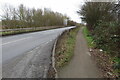
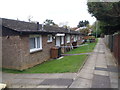
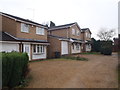
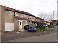
Photos of NN3 9UZ
Area Information
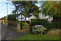
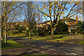
Living in NN3 9UZ offers a compact, residential experience within a small cluster of homes. The area covers just 1.7 hectares, housing 1,597 people in a densely populated setting, with 93,935 people per square kilometre. This suggests a tight-knit community where proximity to amenities and services is a key feature. The area is predominantly home to adults aged 30–64, with a median age of 47, reflecting a mature demographic. Most residents own their homes, with 64% of properties in private ownership, and the accommodation is largely composed of houses rather than flats. Daily life here is shaped by the availability of nearby retail, transport hubs, and schools, making it practical for families and commuters. The absence of major environmental constraints, such as protected woodlands or AONB designations, means development pressures are minimal. However, the high population density may influence the character of the neighbourhood, blending residential comfort with a sense of shared space. For those seeking a compact, functional area with access to essential services, NN3 9UZ provides a focused, community-oriented environment.
- Area Type
- Postcode
- Area Size
- 1.7 hectares
- Population
- 1597
- Population Density
- 2657 people/km²
The property market in NN3 9UZ is characterised by a high rate of home ownership, with 64% of properties privately owned. This indicates a community where long-term residency is common, and the housing stock is primarily composed of houses rather than flats or apartments. The small area size of 1.7 hectares suggests a limited number of properties, which may contribute to a competitive market for buyers. The dominance of owner-occupied homes implies that rental demand is likely lower compared to areas with higher tenant populations. For prospective buyers, this means a focus on purchasing rather than renting, with homes potentially offering more space and stability. However, the compact nature of the area may also mean that property choices are constrained, requiring buyers to consider nearby extensions or alternative locations. The presence of nearby retail and transport hubs, such as Northampton Bus Interchange and Tesco Northampton, adds practical value to properties in the area, supporting a lifestyle that balances residential comfort with accessibility.
House Prices in NN3 9UZ
Showing 38 properties
| Address | Type | Beds | Baths | Last Sale Price | Last Sale Date | |
|---|---|---|---|---|---|---|
| 1 The Fairoaks, Northampton, NN3 9UZ | Detached | 4 | 1 | £222,000 | Nov 2019 | |
| 40 The Fairoaks, Northampton, NN3 9UZ | Semi-detached | 3 | 2 | £253,000 | Nov 2019 | |
| 37 The Fairoaks, Northampton, NN3 9UZ | Detached | 3 | 2 | £217,000 | Apr 2018 | |
| 25 The Fairoaks, Northampton, NN3 9UZ | Semi-detached | 3 | 2 | £218,000 | Nov 2017 | |
| 35 The Fairoaks, Northampton, NN3 9UZ | Semi-detached | 3 | - | £215,000 | Jul 2017 | |
| 15 The Fairoaks, Northampton, NN3 9UZ | Detached | 3 | 1 | £205,000 | Apr 2017 | |
| 19 The Fairoaks, Northampton, NN3 9UZ | Detached | 3 | - | £220,000 | Nov 2016 | |
| 33 The Fairoaks, Northampton, NN3 9UZ | house | - | - | £177,000 | Nov 2015 | |
| 58 The Fairoaks, Northampton, NN3 9UZ | Detached | 3 | 1 | £182,000 | Oct 2015 | |
| 52 The Fairoaks, Northampton, NN3 9UZ | Detached | 4 | 2 | £170,000 | Aug 2015 |
Energy Efficiency in NN3 9UZ
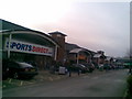
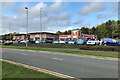
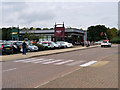
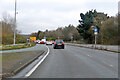
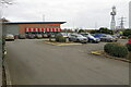
The lifestyle in NN3 9UZ is supported by a range of nearby amenities, including retail outlets such as Lidl Lings, Tesco Northampton, and Co-op Bellinge, which provide everyday shopping needs. These stores are within practical reach, reducing the necessity for long commutes to larger centres. The area’s transport links, including University Bus Interchange and Northampton Bus Interchange, offer access to broader networks, facilitating both leisure and work-related travel. While there is no mention of parks or recreational spaces in the immediate vicinity, the proximity to Northampton suggests opportunities for outdoor activities in nearby green spaces. The presence of a railway station adds convenience for those seeking to explore further afield. Overall, the combination of retail, transport, and connectivity creates a functional lifestyle, where daily needs are met without excessive travel. The compact nature of the area ensures that amenities are closely integrated with residential life, supporting a practical, community-oriented existence.
Amenities
Schools
The nearest school to NN3 9UZ is Standens Barn Primary School, which serves the local community with primary education. While no Ofsted rating is provided, the presence of a primary school within the area is a key consideration for families. The school’s proximity to homes in NN3 9UZ means that parents can easily access educational services for their children, reducing travel time and supporting a family-friendly environment. The absence of secondary schools in the immediate vicinity may require students to attend institutions in nearby areas, such as Northampton, which has a larger range of educational facilities. For families prioritising primary education, Standens Barn Primary School offers a local solution, though additional research into secondary schooling options would be necessary for long-term planning. The single primary school in the area suggests a focused educational landscape, with the need for complementary services in larger towns.
| Rank | School | Type | Entry gender | Ages |
|---|
Explore more schools in this area
Go to Schools tabDemographics
The community in NN3 9UZ is defined by its mature age profile, with a median age of 47 and the majority of residents falling within the 30–64 age range. This suggests a population largely composed of working-age adults and older homeowners, which may influence local services and amenities. Home ownership is strong, with 64% of properties owned by residents, indicating a stable, long-term demographic. The accommodation type is predominantly houses, reflecting a preference for single-family homes over flats or apartments. The predominant ethnic group is White, with no specific data on other groups provided. The high population density of 93,935 people per square kilometre highlights the compact nature of the area, which may impact social dynamics and the availability of private space. While no deprivation data is available, the high home ownership and mature age profile suggest a relatively stable economic environment. This demographic structure may appeal to those seeking a settled, low-turnover community with established local networks.
Household Size
Accommodation Type
Tenure
Ethnic Group
Religion
Household Composition
Age
Household Deprivation
NS-SEC
Explore more demographic insights in this area
Go to Demographics tabPlanning
Planning Constraints
- Flood RiskPremium
- Ramsar Wetland SitesPremium
- Area of Outstanding Natural BeautyPremium
- Protected Nature ReservePremium
- Protected WoodlandPremium