Area Overview for NN3 9SY
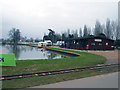
Photos of NN3 9SY


Area Information
Living in NN3 9SY means being part of a tightly packed residential cluster in England, where 1,643 residents occupy just 1,551 square metres. This high population density creates a compact, community-focused environment, with daily life shaped by proximity to amenities and neighbours. The area is characterised by its mature demographic, with a median age of 47 and most residents aged between 30 and 64. This suggests a stable, established community with a strong presence of families and professionals. Safety is a key feature: the area has a low crime risk, scoring 68 out of 100, and no flood or environmental constraints. Residents benefit from easy access to Northampton Railway Station and nearby bus interchanges, ensuring connectivity to the city and beyond. The presence of supermarkets like Tesco Northampton and Co-op Bellinge adds to the convenience of everyday life, while the absence of protected natural areas means no restrictions on development. NN3 9SY is a practical choice for those seeking a safe, well-connected small area with a clear sense of community.
- Area Type
- Postcode
- Area Size
- 1551 m²
- Population
- 1643
- Population Density
- 7717 people/km²
The property market in NN3 9SY is defined by a 44% home ownership rate, suggesting that nearly half of residents are renters. The accommodation type is predominantly houses, which may indicate a focus on family homes rather than flats or apartments. This composition implies a limited housing stock, as the area is small and tightly packed. For buyers, this means competition is likely to be strong, with few options available within NN3 9SY itself. The presence of houses may appeal to those seeking larger properties, though the high population density suggests space is at a premium. Prospective buyers should consider nearby areas for more options, as the immediate surroundings may offer greater flexibility. The market’s character is shaped by its compact size and established community, making it a niche choice for those prioritising safety, connectivity, and proximity to amenities over expansive living space.
House Prices in NN3 9SY
Showing 5 properties
| Address | Type | Beds | Baths | Last Sale Price | Last Sale Date | |
|---|---|---|---|---|---|---|
| 2 Bestwell Court, Northampton, NN3 9SY | Terraced | 3 | 1 | £112,000 | Nov 2013 | |
| 1 Bestwell Court, Northampton, NN3 9SY | house | 3 | 2 | £97,000 | Nov 2004 | |
| 5 Bestwell Court, Northampton, NN3 9SY | house | - | - | £81,000 | Jun 2003 | |
| 3 Bestwell Court, Northampton, NN3 9SY | house | - | - | - | - | |
| 4 Bestwell Court, Northampton, NN3 9SY | house | - | - | - | - |
Energy Efficiency in NN3 9SY
Residents of NN3 9SY enjoy a range of local amenities within easy reach. The area is served by five retail outlets, including Lidl Lings, Co-op Bellinge, and Tesco Northampton, ensuring everyday shopping needs are met without long journeys. These stores provide a mix of convenience and choice, from fresh groceries to household essentials. Transport links are equally accessible, with two bus interchanges and a railway station connecting to Northampton and beyond, making it simple to travel for work, leisure, or socialising. While the area lacks large parks or recreational spaces, the compact layout means residents can access nearby green areas or community hubs without significant travel. The presence of these amenities fosters a self-contained lifestyle, where daily life is shaped by the rhythm of local shops, public transport, and the close-knit nature of the community.
Amenities
Schools
| Rank | School | Type | Entry gender | Ages |
|---|
Explore more schools in this area
Go to Schools tabDemographics
The community in NN3 9SY is predominantly composed of adults aged 30 to 64, with a median age of 47. This suggests a settled population, likely including professionals and families. Home ownership rates stand at 44%, indicating that nearly half of residents rent, which may reflect the area’s smaller size and limited housing stock. The accommodation type is primarily houses, which aligns with the presence of a mature, family-oriented demographic. The predominant ethnic group is White, though specific data on diversity is not provided. The population density of 1,059,462 people per square kilometre is exceptionally high, which may contribute to a close-knit, interdependent community. However, this density also means limited space for expansion, potentially affecting housing availability. For residents, this translates to a compact, well-serviced environment where daily needs are met by nearby amenities, though the high density could impact privacy or green space access.
Household Size
Accommodation Type
Tenure
Ethnic Group
Religion
Household Composition
Age
Household Deprivation
NS-SEC
Explore more demographic insights in this area
Go to Demographics tabPlanning
Planning Constraints
- Flood RiskPremium
- Ramsar Wetland SitesPremium
- Area of Outstanding Natural BeautyPremium
- Protected Nature ReservePremium
- Protected WoodlandPremium