Area Overview for NN3 8UX
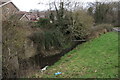
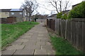
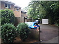
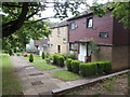
Photos of NN3 8UX


Area Information
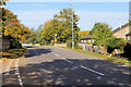
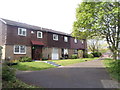
Living in NN3 8UX means inhabiting a tightly knit residential cluster in England’s countryside, where 1700 people are spread across just 1.5 hectares. This compact area, with a population density of 110,000 people per square kilometre, reflects a small, closely connected community. Daily life here is defined by proximity to essential services and a mix of local amenities. The area’s size means residents are likely to know their neighbours, with a focus on practical living rather than sprawling development. While the postcode covers a limited geographical footprint, it is strategically positioned near key transport hubs and retail centres, making it a convenient base for those balancing rural tranquillity with urban accessibility. The absence of major planning constraints or environmental restrictions suggests a straightforward approach to development, though the area’s density raises questions about space and privacy. For those seeking a compact, functional living environment without the isolation of remote locations, NN3 8UX offers a blend of practicality and community.
- Area Type
- Postcode
- Area Size
- 1.5 hectares
- Population
- 1700
- Population Density
- 2455 people/km²
The property market in NN3 8UX is characterised by a 43% home ownership rate, with houses being the primary accommodation type. This suggests a market skewed towards rental properties, as the majority of residents do not own their homes. The small area size and high population density indicate a limited housing stock, which may lead to competition for available properties. Given the focus on houses rather than flats or apartments, the area likely appeals to those prioritising space and privacy over high-density living. For buyers, this means a smaller pool of properties, potentially driving up prices or reducing availability. The absence of major planning constraints or environmental restrictions may make the area more attractive for investment, though the compact size means any development would need to be carefully managed. Prospective buyers should consider the balance between property scarcity and the area’s proximity to amenities.
House Prices in NN3 8UX
Showing 55 properties
| Address | Type | Beds | Baths | Last Sale Price | Last Sale Date | |
|---|---|---|---|---|---|---|
| 33 North Holme Court, Northampton, NN3 8UX | Terraced | 3 | - | £167,500 | Sep 2019 | |
| 9 North Holme Court, Northampton, NN3 8UX | Terraced | 4 | 2 | £134,000 | Jul 2019 | |
| 21 North Holme Court, Northampton, NN3 8UX | house | - | - | £158,500 | Sep 2018 | |
| 8 North Holme Court, Northampton, NN3 8UX | house | - | - | £140,000 | Sep 2018 | |
| 28 North Holme Court, Northampton, NN3 8UX | Terraced | 1 | 1 | £144,000 | Aug 2018 | |
| 52 North Holme Court, Northampton, NN3 8UX | Terraced | 3 | 1 | £130,000 | May 2018 | |
| 39 North Holme Court, Northampton, NN3 8UX | house | - | - | £165,000 | Apr 2018 | |
| 5 North Holme Court, Northampton, NN3 8UX | house | 5 | 1 | £169,500 | May 2017 | |
| 50 North Holme Court, Northampton, NN3 8UX | Terraced | 3 | 1 | £126,000 | Jul 2016 | |
| 20 North Holme Court, Northampton, NN3 8UX | Flat | - | - | £68,500 | May 2016 |
Energy Efficiency in NN3 8UX
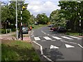
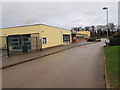
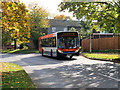
The lifestyle in NN3 8UX is shaped by its proximity to retail and transport hubs. Within practical reach are notable venues such as Tesco Spinny, Co-op Bushland, and Tesco Northampton, offering a range of shopping and dining options. These retail centres provide convenience for daily errands, though the area itself lacks independent shops or local cafés. For transport, the University Bus Interchange and Northampton Bus Interchange provide access to broader regional networks, while Northampton Railway Station connects to further destinations. The absence of parks or leisure facilities within the postcode means residents must travel to nearby areas for recreation. Despite this, the area’s compact size and strategic location make it a functional base for those prioritising accessibility over on-site amenities. The mix of retail and transport options supports a practical, outward-facing lifestyle.
Amenities
Schools
The nearest school to NN3 8UX is Thorplands Primary School, which serves the local community with a good Ofsted rating. This school is the only educational institution explicitly listed in the data, indicating that families relying on secondary education may need to look beyond the immediate area. The presence of a primary school with a positive rating is a significant draw for parents, offering a reliable foundation for early education. However, the lack of secondary schools or further education facilities within the postcode suggests that residents will need to travel to nearby towns for older children’s schooling. For those prioritising a school within walking distance, Thorplands Primary School provides a solid option, but the absence of additional institutions may limit choices for growing families.
| Rank | School | Type | Entry gender | Ages |
|---|
Explore more schools in this area
Go to Schools tabDemographics
The community in NN3 8UX is predominantly composed of adults aged 30–64, with a median age of 47. This suggests a stable, mature population, likely with established careers and families. Home ownership rates here are 43%, which is lower than the national average, indicating a mix of renters and homeowners. The accommodation type is primarily houses, which, combined with the high population density, implies a compact, possibly multi-generational living arrangement. The predominant ethnic group is White, reflecting a homogenous demographic profile. While the data does not specify deprivation levels, the age and ownership statistics suggest a community that is neither overwhelmingly young nor transient. This stability may contribute to a sense of continuity in local services and social networks. However, the low proportion of owner-occupied homes could mean greater turnover, affecting long-term community cohesion.
Household Size
Accommodation Type
Tenure
Ethnic Group
Religion
Household Composition
Age
Household Deprivation
NS-SEC
Explore more demographic insights in this area
Go to Demographics tabPlanning
Planning Constraints
- Flood RiskPremium
- Ramsar Wetland SitesPremium
- Area of Outstanding Natural BeautyPremium
- Protected Nature ReservePremium
- Protected WoodlandPremium