Area Overview for NN3 8AB
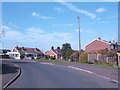
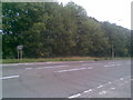
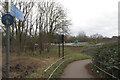
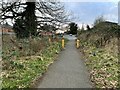
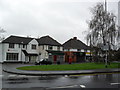
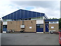
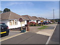
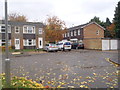
Photos of NN3 8AB


Area Information
Living in NN3 8AB means being part of a tightly knit residential cluster in England, where 1,700 people reside across just 1.8 hectares. The area’s compact size creates a sense of intimacy, though its high population density of 92,173 people per square kilometre reflects a focus on housing efficiency. Daily life here is shaped by proximity to essential services, including retail outlets, public transport hubs, and a primary school with a good Ofsted rating. The median age of 47 suggests a community of established adults, many in the 30–64 age range, who may be drawn to the area’s practicality and accessibility. With broadband scores of 100, digital connectivity is exceptional, supporting remote work or online activities. While the area lacks expansive green spaces, its strategic location near Northampton’s transport networks and retail centres offers convenience. For those seeking a compact, functional living environment with minimal commute times to nearby urban amenities, NN3 8AB provides a straightforward, no-frills option.
- Area Type
- Postcode
- Area Size
- 1.8 hectares
- Population
- 1700
- Population Density
- 2455 people/km²
The property market in NN3 8AB is defined by a 43% home ownership rate, with houses making up the majority of accommodation types. This suggests a market skewed towards owner-occupation, though the relatively low ownership percentage implies a significant rental segment. The area’s small size—just 1.8 hectares—means housing stock is limited, likely consisting of modest, single-family homes. Buyers should consider the proximity to nearby retail and transport hubs, which may enhance property value. However, the compact nature of the area could limit scope for expansion or development. For those seeking a straightforward, no-frills home in a functional location, NN3 8AB offers a niche opportunity, though its small footprint may not appeal to those prioritising space or privacy.
House Prices in NN3 8AB
Showing 50 properties
| Address | Type | Beds | Baths | Last Sale Price | Last Sale Date | |
|---|---|---|---|---|---|---|
| 66 North Holme Court, Northampton, NN3 8AB | Terraced | 2 | 1 | £124,500 | Sep 2020 | |
| 72 North Holme Court, Northampton, NN3 8AB | Terraced | 3 | 1 | £122,500 | May 2018 | |
| 103 North Holme Court, Northampton, NN3 8AB | Flat | 2 | 1 | £83,000 | Mar 2016 | |
| 85 North Holme Court, Northampton, NN3 8AB | Terraced | 3 | - | £134,000 | Nov 2015 | |
| 68 North Holme Court, Northampton, NN3 8AB | house | - | - | £110,000 | Apr 2015 | |
| 57 North Holme Court, Northampton, NN3 8AB | Terraced | 4 | - | £120,000 | Mar 2015 | |
| 100 North Holme Court, Northampton, NN3 8AB | house | - | - | £87,000 | Apr 2010 | |
| 61 North Holme Court, Northampton, NN3 8AB | house | - | - | £99,995 | Nov 2007 | |
| 62 North Holme Court, Northampton, NN3 8AB | Terraced | 3 | 1 | £66,000 | Oct 2006 | |
| 64 North Holme Court, Northampton, NN3 8AB | house | - | - | £88,500 | Sep 2006 |
Energy Efficiency in NN3 8AB
Daily life in NN3 8AB is shaped by its proximity to retail and transport hubs. Nearby shops include Tesco Spinny, Co-op Bushland, and Tesco Northampton, offering essential goods and services. The area’s two bus interchanges and Northampton Railway Station provide easy access to urban amenities, though leisure options are limited to what is immediately available. The absence of named parks or recreational facilities suggests a focus on practicality over leisure. For residents, the lifestyle is defined by convenience: shops, transport, and schools are within reach, but the area’s small size means broader experiences require travel. The mix of retail and transport infrastructure supports a functional, efficient lifestyle, ideal for those prioritising accessibility over expansive amenities.
Amenities
Schools
The nearest school to NN3 8AB is Thorplands Primary School, which holds a good Ofsted rating. This institution serves the local community, offering primary education for children in the area. While no secondary schools are listed, the presence of a well-rated primary school is a key draw for families. The single school type suggests a reliance on external secondary education options, potentially requiring travel to nearby towns. For parents prioritising strong early education, Thorplands Primary’s rating provides reassurance, though the lack of local secondary schools may necessitate planning for longer commutes. The school’s proximity to residential areas underscores its role as a central community asset.
| Rank | School | Type | Entry gender | Ages |
|---|
Explore more schools in this area
Go to Schools tabDemographics
The community in NN3 8AB is predominantly composed of adults aged 30–64, with a median age of 47. Home ownership sits at 43%, indicating a mix of owner-occupied properties and rental units. The area is characterised by houses rather than flats or apartments, reflecting a traditional housing stock. The predominant ethnic group is White, though no specific data on diversity or deprivation levels is provided. The high population density of 92,173 people per square kilometre suggests a compact, possibly high-traffic residential environment. This density may influence local infrastructure demands, though the area’s small size means resources are concentrated. For those considering NN3 8AB, the demographic profile suggests a mature, stable community with a focus on practical living over expansive amenities.
Household Size
Accommodation Type
Tenure
Ethnic Group
Religion
Household Composition
Age
Household Deprivation
NS-SEC
Explore more demographic insights in this area
Go to Demographics tabPlanning
Planning Constraints
- Flood RiskPremium
- Ramsar Wetland SitesPremium
- Area of Outstanding Natural BeautyPremium
- Protected Nature ReservePremium
- Protected WoodlandPremium