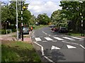
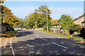
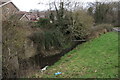
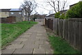
Area Overview for NN3 8AE
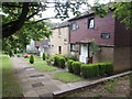
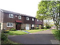
Photos of NN3 8AE


Area Information
NN3 8AE is a small, tightly knit residential area in England, covering just 1.1 hectares and home to around 1700 people. Its compact size means it feels intimate, with a population density of 159,477 people per square kilometre, suggesting a mix of closely spaced homes and shared spaces. The area is characterised by its focus on housing, with most properties being individual homes rather than flats. Daily life here is likely shaped by proximity to local amenities, including nearby schools, retail outlets, and transport hubs. The median age of 47 indicates a community skewed towards adults in their 30s to 60s, which may influence the pace of life and local services. While the area lacks natural constraints like protected woodlands or AONB designations, its safety profile includes a medium crime risk, requiring standard precautions. For those seeking a quiet, residential environment with practical access to essentials, NN3 8AE offers a balance of space and convenience within a compact footprint.
- Area Type
- Postcode
- Area Size
- 1.1 hectares
- Population
- 1700
- Population Density
- 2455 people/km²
The property market in NN3 8AE is dominated by houses, with 43% of homes owned by residents. This suggests a mix of owner-occupied properties and a smaller proportion of rental units, though the exact split between buy-to-let and private rentals is not specified. The compact size of the area—just 1.1 hectares—means the housing stock is limited, potentially leading to higher competition for available properties. Given the prevalence of houses, the market may cater more to families seeking space than to younger buyers or those prioritising flats. Buyers should consider the area’s small footprint when assessing long-term viability, as growth is constrained by its physical boundaries. The lack of planning constraints like protected woodlands or AONB designations may make it more adaptable for development, though this is not explicitly confirmed by the data.
House Prices in NN3 8AE
Showing 36 properties
| Address | Type | Beds | Baths | Last Sale Price | Last Sale Date | |
|---|---|---|---|---|---|---|
| 57 Great Holme Court, Northampton, NN3 8AE | house | - | - | £140,000 | Oct 2019 | |
| 61 Great Holme Court, Northampton, NN3 8AE | house | - | - | £150,000 | Apr 2019 | |
| 53 Great Holme Court, Northampton, NN3 8AE | Terraced | 3 | - | £133,500 | May 2018 | |
| 58 Great Holme Court, Northampton, NN3 8AE | Terraced | 3 | - | £138,000 | May 2017 | |
| 76 Great Holme Court, Northampton, NN3 8AE | Terraced | 4 | 2 | £136,000 | Oct 2016 | |
| 54 Great Holme Court, Northampton, NN3 8AE | Terraced | 3 | - | £135,000 | Aug 2016 | |
| 68 Great Holme Court, Northampton, NN3 8AE | Terraced | 3 | - | £120,000 | Apr 2015 | |
| 63 Great Holme Court, Northampton, NN3 8AE | Flat | - | - | £91,000 | Dec 2006 | |
| 55 Great Holme Court, Northampton, NN3 8AE | Flat | - | - | £99,000 | Nov 2005 | |
| 56 Great Holme Court, Northampton, NN3 8AE | house | - | - | £92,000 | Nov 2005 |
Energy Efficiency in NN3 8AE
Residents of NN3 8AE have access to a range of nearby amenities, including five retail outlets such as Co-op Bushland, Tesco Spinny, and Tesco Northampton. These shops provide everyday essentials, though the specific types of stores are not detailed. The area’s transport links to Northampton Bus Interchange and University Bus Interchange suggest access to broader leisure and dining options beyond the immediate vicinity. While the data does not mention parks or recreational spaces, the absence of protected natural areas may indicate more open land for local use. The compact nature of the area means amenities are likely within walking or short driving distance, contributing to a convenient lifestyle. However, the lack of specific details on dining or leisure venues leaves room for further exploration of the local character.
Amenities
Schools
The nearest school to NN3 8AE is Thorplands Primary School, which serves the local community with primary education. The school holds a 'good' Ofsted rating, indicating a satisfactory standard of teaching and facilities. As a primary school, it caters to younger children, but the data does not mention secondary education options nearby. This means families with children may need to look beyond the immediate area for secondary schooling. The presence of a well-rated primary school is a key draw for families, though the absence of secondary schools could influence decisions about long-term residency. Parents should consider the proximity of other educational institutions when evaluating the area’s suitability for their needs.
| Rank | School | Type | Entry gender | Ages |
|---|
Explore more schools in this area
Go to Schools tabDemographics
The community in NN3 8AE is predominantly composed of adults aged 30–64, making up the most common age range. With a median age of 47, the area reflects a mature demographic, which may influence local amenities and social dynamics. Home ownership stands at 43%, suggesting a mix of owner-occupied properties and rental units. The accommodation type is primarily houses, which aligns with the area’s residential character. The predominant ethnic group is White, though specific data on diversity or deprivation levels is not provided. This demographic profile indicates a stable, established community, likely with a focus on family-oriented living. The absence of detailed diversity statistics means broader cultural or social nuances remain unexplored, but the data suggests a homogeneous population in terms of ethnicity.
Household Size
Accommodation Type
Tenure
Ethnic Group
Religion
Household Composition
Age
Household Deprivation
NS-SEC
Explore more demographic insights in this area
Go to Demographics tabPlanning
Planning Constraints
- Flood RiskPremium
- Ramsar Wetland SitesPremium
- Area of Outstanding Natural BeautyPremium
- Protected Nature ReservePremium
- Protected WoodlandPremium