Area Overview for NN3 8UU
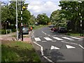
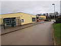
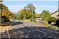
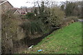
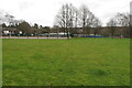
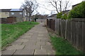
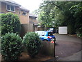
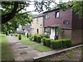
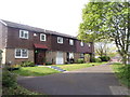
Photos of NN3 8UU


Area Information
NN3 8UU is a compact residential postcode area in England, covering 9,952 square metres and home to 1,913 residents. Its high population density—192,217 people per square kilometre—reflects a tightly knit community, though the area remains small enough to feel intimate. The postcode encompasses a cluster of homes, predominantly houses, which gives it a distinct character compared to larger urban zones. Daily life here is shaped by proximity to key services, including retail hubs like Tesco Northampton and Co-op Bushland, as well as transport links such as Northampton Railway Station. The area’s compact size means residents can access amenities within short distances, though the high density may influence the pace of life. With a median age of 47 and a population skewed toward adults aged 30–64, the community is mature, stable, and likely focused on long-term living. For buyers, this area offers a blend of practicality and accessibility, though its small footprint means choices are limited to a specific cluster of properties.
- Area Type
- Postcode
- Area Size
- 9952 m²
- Population
- 1913
- Population Density
- 6532 people/km²
The property market in NN3 8UU is characterised by a 45% home ownership rate, indicating that nearly half of the area’s properties are rented. This suggests a rental market that coexists with owner-occupied homes, though the exact balance between the two is not specified. The accommodation type is predominantly houses, which is typical for smaller residential clusters where larger properties dominate. Given the area’s size—just 9,952 square metres—there is limited scope for expansion, meaning the housing stock is likely fixed and static. For buyers, this presents both opportunities and constraints: properties are available but scarce, and the small footprint means the immediate surroundings may offer few alternatives. The presence of houses rather than flats or apartments may appeal to those seeking more space, but the high population density could mean proximity to neighbours is close. Prospective buyers should consider the area’s compact nature when evaluating long-term suitability.
House Prices in NN3 8UU
Showing 26 properties
| Address | Type | Beds | Baths | Last Sale Price | Last Sale Date | |
|---|---|---|---|---|---|---|
| 12 Greatfield Court, Northampton, NN3 8UU | Flat | - | - | £85,000 | Dec 2019 | |
| 14 Greatfield Court, Northampton, NN3 8UU | Terraced | 3 | 1 | £165,000 | Nov 2019 | |
| 2 Greatfield Court, Northampton, NN3 8UU | Terraced | 2 | 1 | £125,000 | Aug 2016 | |
| 5 Greatfield Court, Northampton, NN3 8UU | house | - | - | £124,995 | Jul 2016 | |
| 26 Greatfield Court, Northampton, NN3 8UU | Terraced | - | - | £130,500 | Oct 2007 | |
| 17 Greatfield Court, Northampton, NN3 8UU | Flat | - | - | £75,000 | Dec 2006 | |
| 6 Greatfield Court, Northampton, NN3 8UU | house | 2 | - | £88,000 | Sep 2006 | |
| 22 Greatfield Court, Northampton, NN3 8UU | house | - | - | £100,000 | Jun 2006 | |
| 23 Greatfield Court, Northampton, NN3 8UU | Terraced | - | - | £93,000 | Aug 2005 | |
| 8 Greatfield Court, Northampton, NN3 8UU | house | - | - | £94,000 | May 2004 |
Energy Efficiency in NN3 8UU
Living in NN3 8UU offers access to a range of nearby amenities within practical reach. Retail options include major supermarkets such as Tesco Northampton, Co-op Bushland, and Lidl Lings, ensuring residents can shop for essentials without long commutes. The area’s transport links, including University Bus Interchange and Northampton Bus Interchange, provide easy access to broader networks, while Northampton Railway Station connects to regional destinations. Though the area is small, the presence of these amenities contributes to a convenient lifestyle. The retail and transport hubs suggest a community that values accessibility, with services clustered to serve both daily needs and commuting requirements. While the area lacks extensive parks or leisure facilities, the proximity to Northampton—home to larger recreational spaces—may offset this. The compact nature of NN3 8UU means residents can enjoy a blend of local convenience and broader connectivity.
Amenities
Schools
| Rank | School | Type | Entry gender | Ages |
|---|
Explore more schools in this area
Go to Schools tabDemographics
The population of NN3 8UU is 1,913, with a median age of 47. Over half the residents fall into the 30–64 age range, suggesting a community of established adults, many of whom may be in their prime working years. Home ownership rates stand at 45%, meaning nearly half of properties are rented, indicating a mix of owner-occupied and rental housing. The area is predominantly composed of houses, not flats or apartments, which aligns with the typical housing stock in smaller residential clusters. The predominant ethnic group is White, reflecting the broader demographic patterns of the region. With a population density of 192,217 people per square kilometre, the area is intensely populated, which may influence local infrastructure and community dynamics. While no specific deprivation data is provided, the high density and mature age profile suggest a population that is relatively stable but may face challenges related to space and resource allocation.
Household Size
Accommodation Type
Tenure
Ethnic Group
Religion
Household Composition
Age
Household Deprivation
NS-SEC
Explore more demographic insights in this area
Go to Demographics tabPlanning
Planning Constraints
- Flood RiskPremium
- Ramsar Wetland SitesPremium
- Area of Outstanding Natural BeautyPremium
- Protected Nature ReservePremium
- Protected WoodlandPremium