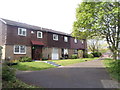
Area Overview for NN3 8UT
Photos of NN3 8UT


Area Information
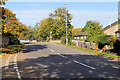
NN3 8UT is a compact residential postcode in England, covering just 2.3 hectares yet home to 1913 residents. Its high population density of 84,000 people per square kilometre reflects a tightly knit community, where proximity to amenities and transport links defines daily life. Situated near Northampton’s bus interchanges and railway station, the area offers practical connectivity for commuters and shoppers. The postcode’s small size means residents share a close-knit environment, with local shops like Tesco Northampton and Lidl Lings within reach. Despite its density, the area avoids environmental constraints such as protected woodlands or AONB designations, allowing for straightforward development and living. For those prioritising convenience, NN3 8UT balances urban accessibility with the quietude of a residential cluster, making it appealing to those seeking a mix of practicality and community.
- Area Type
- Postcode
- Area Size
- 2.3 hectares
- Population
- 1913
- Population Density
- 6532 people/km²
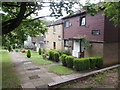
NN3 8UT’s property market is characterised by a 45% home ownership rate, meaning nearly half of residents rent. The accommodation type is predominantly houses, which contrasts with areas where flats dominate. This suggests a market skewed towards owner-occupied homes, though the relatively low home ownership rate may reflect a rental market in certain parts of the postcode. Given the area’s small size and high density, the housing stock is limited, making it a niche market for buyers seeking proximity to Northampton’s transport hubs and retail centres. The presence of nearby amenities like the University Bus Interchange and Northampton Railway Station adds value, particularly for commuters. However, buyers should consider the area’s compact nature, which may limit expansion or new developments.
House Prices in NN3 8UT
Showing 64 properties
| Address | Type | Beds | Baths | Last Sale Price | Last Sale Date | |
|---|---|---|---|---|---|---|
| 18 Sidebrook Court, Northampton, NN3 8UT | Terraced | 3 | - | £155,000 | Jan 2020 | |
| 60 Sidebrook Court, Northampton, NN3 8UT | Semi-detached | 3 | 1 | £150,000 | May 2019 | |
| 26 Sidebrook Court, Northampton, NN3 8UT | house | - | - | £132,500 | Dec 2017 | |
| 34 Sidebrook Court, Northampton, NN3 8UT | Terraced | 3 | 1 | £163,000 | Jul 2017 | |
| 54 Sidebrook Court, Northampton, NN3 8UT | house | 3 | 1 | £123,000 | May 2017 | |
| 59 Sidebrook Court, Northampton, NN3 8UT | house | - | - | £141,000 | Jan 2017 | |
| 7 Sidebrook Court, Northampton, NN3 8UT | house | - | - | £128,000 | Jun 2016 | |
| 21 Sidebrook Court, Northampton, NN3 8UT | house | - | - | £125,000 | May 2016 | |
| 2 Sidebrook Court, Northampton, NN3 8UT | Terraced | 3 | - | £117,500 | Mar 2016 | |
| 12 Sidebrook Court, Northampton, NN3 8UT | Terraced | 3 | 1 | £130,000 | Mar 2016 |
Energy Efficiency in NN3 8UT
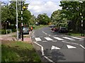
Daily life in NN3 8UT is shaped by its proximity to retail and transport hubs. Residents have access to shops like Tesco Northampton, Lidl Lings, and Co-op Bushland, offering convenience for grocery runs. The University Bus Interchange and Northampton Railway Station provide direct links to nearby towns and universities, supporting both commuters and students. While the area lacks large parks or leisure facilities, its compact design ensures amenities are within walking or short-vehicle distance. The presence of multiple bus routes and a railway station adds to the area’s practicality, making it ideal for those prioritising accessibility. The mix of retail and transport options creates a functional lifestyle, though residents may need to venture slightly further for more specialised services.
Amenities
Schools
| Rank | School | Type | Entry gender | Ages |
|---|
Explore more schools in this area
Go to Schools tabDemographics
The median age in NN3 8UT is 47, with the majority of residents aged 30–64. This suggests a mature, established community, likely centred around families and professionals in their prime working years. Home ownership stands at 45%, indicating a mixed market where nearly half of residents rent. The predominant accommodation type is houses, reflecting a preference for standalone properties over flats. The predominant ethnic group is White, though no data on diversity beyond this is provided. The high population density, combined with a median age skewed towards adults, implies a stable, long-term resident base. For buyers, this demographic profile suggests a neighbourhood with mature infrastructure and a focus on practical living, though the lower home ownership rate may indicate a rental-driven market in parts of the area.
Household Size
Accommodation Type
Tenure
Ethnic Group
Religion
Household Composition
Age
Household Deprivation
NS-SEC
Explore more demographic insights in this area
Go to Demographics tabPlanning
Planning Constraints
- Flood RiskPremium
- Ramsar Wetland SitesPremium
- Area of Outstanding Natural BeautyPremium
- Protected Nature ReservePremium
- Protected WoodlandPremium