Area Overview for NN3 8AU
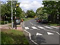
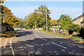
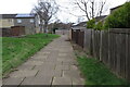
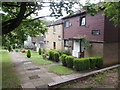
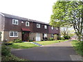
Photos of NN3 8AU


Area Information
Living in NN3 8AU offers a compact, densely populated residential experience within a small cluster of just 1.4 hectares. With 1,913 residents spread across a high population density of 136,900 people per square kilometre, this area is characterised by its tight-knit community and proximity to essential services. The postcode is strategically located near Northampton Railway Station and major bus interchanges, making it easy to access nearby towns and cities. Daily life here revolves around local shops such as Tesco Northampton and Lidl Lings, while the area’s housing stock is predominantly composed of homes, reflecting a stable, mature demographic. The median age of 47 suggests a community of established residents, many of whom are in their prime working years. While the area is small, its connectivity to transport hubs and retail centres ensures convenience for both practical needs and leisure. For those seeking a balance between urban accessibility and residential tranquillity, NN3 8AU provides a focused, functional living environment.
- Area Type
- Postcode
- Area Size
- 1.4 hectares
- Population
- 1913
- Population Density
- 6532 people/km²
The property market in NN3 8AU is defined by a 45% home ownership rate, with the majority of accommodation being houses. This suggests a focus on owner-occupied properties, though the relatively low home ownership figure may indicate a significant rental market within the area. Given the small size of the postcode—just 1.4 hectares—housing stock is limited, and buyers should consider the immediate surrounding areas for more options. The prevalence of houses may appeal to families or those seeking more space, but the compact nature of NN3 8AU means competition for properties could be fierce. For prospective buyers, the area’s proximity to Northampton Railway Station and bus interchanges adds value, particularly for those prioritising transport links. However, the small size of the postcode means that property availability is constrained, requiring a targeted search beyond NN3 8AU itself.
House Prices in NN3 8AU
Showing 44 properties
| Address | Type | Beds | Baths | Last Sale Price | Last Sale Date | |
|---|---|---|---|---|---|---|
| 12 Lower Meadow Court, Northampton, NN3 8AU | house | - | - | £218,000 | Apr 2023 | |
| 11 Lower Meadow Court, Northampton, NN3 8AU | Terraced | 4 | 1 | £179,995 | Jan 2022 | |
| 23 Lower Meadow Court, Northampton, NN3 8AU | house | - | - | £180,000 | Jun 2021 | |
| 28 Lower Meadow Court, Northampton, NN3 8AU | Flat | - | - | £70,000 | Jun 2021 | |
| 17 Lower Meadow Court, Northampton, NN3 8AU | Terraced | 2 | - | £137,000 | May 2018 | |
| 19 Lower Meadow Court, Northampton, NN3 8AU | Terraced | 2 | 1 | £130,000 | Jan 2018 | |
| 43 Lower Meadow Court, Northampton, NN3 8AU | house | - | - | £104,000 | Jun 2017 | |
| 10 Lower Meadow Court, Northampton, NN3 8AU | house | 3 | 1 | £127,500 | Feb 2017 | |
| 15 Lower Meadow Court, Northampton, NN3 8AU | house | - | - | £127,000 | Aug 2007 | |
| 8 Lower Meadow Court, Northampton, NN3 8AU | house | - | - | £98,500 | Sep 2006 |
Energy Efficiency in NN3 8AU
The lifestyle in NN3 8AU is shaped by its proximity to essential amenities. Local shops such as Tesco Northampton, Lidl Lings, and Co-op Bushland provide everyday convenience, while the nearby Northampton Bus Interchange and University Bus Interchange offer reliable transport to surrounding areas. The Northampton Railway Station is a key asset, enabling swift travel to nearby cities and employment centres. Though the area is small, its access to retail, transport, and connectivity ensures residents can meet practical needs without lengthy commutes. The presence of multiple bus routes and a railway station adds to the area’s practicality, making it suitable for those who value accessibility. While green spaces or leisure facilities are not explicitly mentioned, the compact layout and proximity to urban hubs suggest a lifestyle focused on efficiency and ease of movement.
Amenities
Schools
| Rank | School | Type | Entry gender | Ages |
|---|
Explore more schools in this area
Go to Schools tabDemographics
The community in NN3 8AU is predominantly composed of adults aged 30–64, with a median age of 47. This indicates a mature, stable population, likely with strong ties to employment and family life. Home ownership stands at 45%, suggesting a mix of owner-occupied and rental properties, though the exact proportion of renters is not specified. The predominant accommodation type is houses, which may reflect a preference for larger living spaces in this compact area. Ethnically, the population is overwhelmingly White, with no data provided on other groups. The high population density of 136,900 people per square kilometre implies a closely packed residential environment, which may influence local services and social dynamics. While the data does not include deprivation metrics, the presence of essential amenities like supermarkets and transport links suggests a baseline level of accessibility for daily needs.
Household Size
Accommodation Type
Tenure
Ethnic Group
Religion
Household Composition
Age
Household Deprivation
NS-SEC
Explore more demographic insights in this area
Go to Demographics tabPlanning
Planning Constraints
- Flood RiskPremium
- Ramsar Wetland SitesPremium
- Area of Outstanding Natural BeautyPremium
- Protected Nature ReservePremium
- Protected WoodlandPremium