Area Overview for NN3 8TS
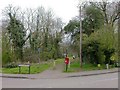
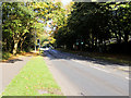
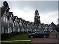
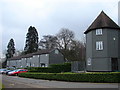
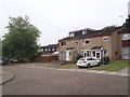
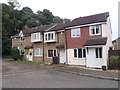
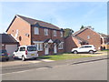
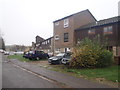
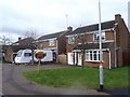
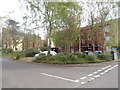
Photos of NN3 8TS


Area Information
NN3 8TS is a compact residential postcode in England, covering 3,084 square metres and home to 1,598 residents. Its high population density—518,178 people per square kilometre—reflects a tightly knit community, where proximity to amenities and services is a defining feature. The area’s small size means residents are likely within walking or short driving distance of key facilities. While it is not a sprawling suburb, its strategic location near Northampton’s infrastructure, including railway stations and bus interchanges, positions it as a practical choice for commuters. The demographic profile suggests a mature population, with a median age of 47 and a majority of residents aged 30–64. This hints at a community of established professionals and families, potentially seeking stability and convenience. The area’s appeal lies in its balance of accessibility and compactness, though its limited size may mean fewer green spaces or expansive vistas. For those prioritising ease of movement and proximity to retail and transport hubs, NN3 8TS offers a focused, functional living environment.
- Area Type
- Postcode
- Area Size
- 3084 m²
- Population
- 1598
- Population Density
- 4940 people/km²
The property market in NN3 8TS is characterised by a 43% home ownership rate, meaning the majority of residents rent their homes. This suggests the area functions more as a rental market than a buyer’s market, potentially influenced by its compact size and proximity to Northampton’s amenities. The accommodation type is predominantly houses, which contrasts with high-density urban areas where flats dominate. This may appeal to buyers seeking more space or a traditional housing format, though the small area size limits the availability of properties. For those considering purchase, the low number of homes—coupled with the high population density—could mean competition for available listings. The area’s proximity to transport links and retail hubs may offset its limited housing stock, making it attractive to those prioritising convenience over expansive living space.
House Prices in NN3 8TS
Showing 17 properties
| Address | Type | Beds | Baths | Last Sale Price | Last Sale Date | |
|---|---|---|---|---|---|---|
| 6 Bradmoor Court, Northampton, NN3 8TS | Terraced | 2 | - | £130,000 | Mar 2020 | |
| 15 Bradmoor Court, Northampton, NN3 8TS | Terraced | 2 | 1 | £126,000 | Jul 2018 | |
| 4 Bradmoor Court, Northampton, NN3 8TS | Semi-detached | 1 | 1 | £115,000 | Oct 2017 | |
| 18 Bradmoor Court, Northampton, NN3 8TS | house | - | - | £117,000 | Oct 2017 | |
| 5 Bradmoor Court, Northampton, NN3 8TS | house | - | - | £139,995 | Apr 2017 | |
| 10 Bradmoor Court, Northampton, NN3 8TS | Semi-detached | 2 | 1 | £125,000 | Oct 2015 | |
| 12 Bradmoor Court, Northampton, NN3 8TS | Terraced | 2 | 1 | £123,000 | May 2015 | |
| 14 Bradmoor Court, Northampton, NN3 8TS | Terraced | 2 | 1 | £112,500 | May 2015 | |
| 9 Bradmoor Court, Northampton, NN3 8TS | house | - | - | £124,500 | Oct 2007 | |
| 3 Bradmoor Court, Northampton, NN3 8TS | house | 1 | 1 | £81,000 | Feb 2006 |
Energy Efficiency in NN3 8TS
Living in NN3 8TS provides access to essential retail and transport hubs within close reach. Nearby shops include Co-op Northampton, Tesco Northampton, and Lidl Lings, offering a range of grocery and household needs. The University Bus Interchange and Northampton Bus Interchange provide reliable connections to local and regional destinations, while Northampton Railway Station facilitates travel to larger cities. Though the area is small, its proximity to these amenities ensures convenience for daily errands and socialising. The presence of multiple retail options and transport links suggests a practical, efficient lifestyle, ideal for those prioritising accessibility over expansive leisure spaces. While the data does not mention parks or recreational areas, the area’s compactness likely means residents are near Northampton’s broader green spaces or community facilities.
Amenities
Schools
| Rank | School | Type | Entry gender | Ages |
|---|
Explore more schools in this area
Go to Schools tabDemographics
The population of NN3 8TS is predominantly adults aged 30–64, with a median age of 47. This suggests a community of middle-aged individuals, likely settled in careers and family life. Home ownership stands at 43%, indicating that nearly half of residents rent their homes, which may reflect the area’s role as a rental market within Northampton’s broader housing landscape. The accommodation type is primarily houses, rather than flats or apartments, which aligns with a suburban or semi-rural character. The predominant ethnic group is White, though the data does not specify further diversity metrics. With a population density of 518,178 per square kilometre, the area is highly compact, which can foster a close-knit community but may also limit private space. This density, combined with the age profile, suggests a stable, possibly family-oriented environment where social ties are likely strong.
Household Size
Accommodation Type
Tenure
Ethnic Group
Religion
Household Composition
Age
Household Deprivation
NS-SEC
Explore more demographic insights in this area
Go to Demographics tabPlanning
Planning Constraints
- Flood RiskPremium
- Ramsar Wetland SitesPremium
- Area of Outstanding Natural BeautyPremium
- Protected Nature ReservePremium
- Protected WoodlandPremium