Area Overview for NN3 8TP
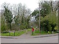
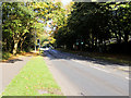
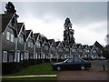
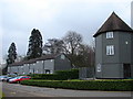
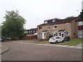
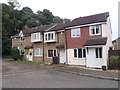
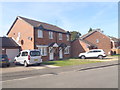
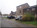
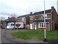
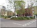
Photos of NN3 8TP


Area Information
NN3 8TP is a small, tightly packed residential postcode in England, covering just 5.6 hectares. With a population of 1,598 people, it is one of the most densely populated areas in the country, at 28,639 people per square kilometre. This compact cluster of homes is characterised by its proximity to essential services and transport links, making it a practical choice for those prioritising convenience. The area’s proximity to Northampton’s urban core means residents have easy access to retail, education, and employment opportunities. Daily life here is shaped by the mix of local amenities and the community’s demographic profile, which skews towards middle-aged adults. While the area lacks natural landscapes or protected sites, its strategic location near major transport hubs and retail centres compensates. For buyers, NN3 8TP offers a blend of compact living and accessibility, though the high population density may influence property availability and pricing. Understanding the area’s unique balance of space and connectivity is key to assessing its suitability for long-term residency.
- Area Type
- Postcode
- Area Size
- 5.6 hectares
- Population
- 1598
- Population Density
- 4940 people/km²
The property market in NN3 8TP is defined by a 43% home ownership rate, indicating that nearly half of properties are rented. This mix of owner-occupied and rental homes suggests a dynamic market, with potential for both long-term investment and short-term letting. The area’s housing stock is dominated by houses, which contrasts with the higher prevalence of flats or apartments in more urban settings. This may appeal to buyers seeking standalone properties with private outdoor space, though the compact size of the postcode means competition for available homes is likely fierce. Given the high population density, property prices may reflect the area’s limited space and strong connectivity to Northampton’s amenities. Buyers should consider the small size of the area when exploring nearby options, as the immediate surroundings may offer similar characteristics. The predominance of houses also implies that the market may cater more to families or individuals prioritising privacy over proximity to city centres.
House Prices in NN3 8TP
Showing 58 properties
| Address | Type | Beds | Baths | Last Sale Price | Last Sale Date | |
|---|---|---|---|---|---|---|
| 49 Wysall Road, Northampton, NN3 8TP | Semi-detached | 2 | 1 | £195,000 | Jul 2025 | |
| 65 Wysall Road, Northampton, NN3 8TP | Detached | 3 | 1 | £250,000 | Jul 2024 | |
| 11 Wysall Road, Northampton, NN3 8TP | house | - | - | £260,000 | Jul 2024 | |
| 75 Wysall Road, Northampton, NN3 8TP | house | 3 | 2 | £260,000 | Aug 2023 | |
| 29 Wysall Road, Northampton, NN3 8TP | Semi-detached | 3 | 1 | £256,000 | May 2023 | |
| 15 Wysall Road, Northampton, NN3 8TP | Detached | 3 | 1 | £280,000 | Aug 2022 | |
| 24 Wysall Road, Northampton, NN3 8TP | Bungalow | - | - | £229,995 | Sep 2021 | |
| 57 Wysall Road, Northampton, NN3 8TP | house | - | - | £240,000 | Aug 2021 | |
| 35 Wysall Road, Northampton, NN3 8TP | house | - | - | £220,000 | Mar 2021 | |
| 7 Wysall Road, Northampton, NN3 8TP | Semi-detached | 2 | 1 | £170,000 | Mar 2021 |
Energy Efficiency in NN3 8TP
Living in NN3 8TP provides access to a range of essential amenities within close proximity. Retail options include major chains such as Co-op Northampton, Tesco Northampton, and Lidl Lings, ensuring residents have convenient access to grocery shopping and daily essentials. The area’s transport links, including the University Bus Interchange and Northampton Bus Interchange, connect residents to broader leisure and cultural opportunities in Northampton. While specific parks or recreational spaces are not listed, the proximity to the city suggests that larger green spaces and facilities are within easy reach. The character of daily life here is shaped by the balance between local convenience and urban accessibility, making it suitable for those who value practicality without sacrificing connectivity to a wider network of services.
Amenities
Schools
| Rank | School | Type | Entry gender | Ages |
|---|
Explore more schools in this area
Go to Schools tabDemographics
The community in NN3 8TP is predominantly composed of adults aged 30–64, with a median age of 47. This suggests a mature, established population, likely with strong ties to local employment and services. Home ownership stands at 43%, indicating a mix of owner-occupied properties and rental homes. The area is largely composed of houses, reflecting a preference for standalone living rather than flats or apartments. The predominant ethnic group is White, with no specific data provided on other demographics. The population density of 28,639 people per square kilometre implies a tightly packed residential environment, which may influence social dynamics and local infrastructure pressures. While no deprivation data is explicitly stated, the high density and moderate crime risk suggest that residents may experience challenges related to space and safety, though these are balanced by proximity to amenities and transport.
Household Size
Accommodation Type
Tenure
Ethnic Group
Religion
Household Composition
Age
Household Deprivation
NS-SEC
Explore more demographic insights in this area
Go to Demographics tabPlanning
Planning Constraints
- Flood RiskPremium
- Ramsar Wetland SitesPremium
- Area of Outstanding Natural BeautyPremium
- Protected Nature ReservePremium
- Protected WoodlandPremium