Area Overview for NN3 8BE
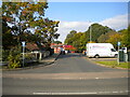
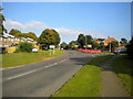
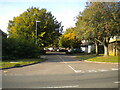
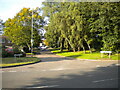
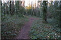
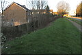
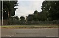
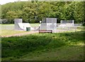
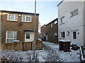
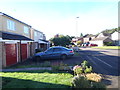
Photos of NN3 8BE


Area Information
Living in NN3 8BE means inhabiting a compact, densely populated residential cluster in England. The area spans just 9.8 hectares, yet it houses 1,644 people, translating to a population density of 16,711 per square kilometre. This makes NN3 8BE a tightly knit community, ideal for those seeking proximity to amenities without the sprawl of larger towns. The area’s small size means residents are likely to know their neighbours, fostering a sense of local cohesion. With a median age of 47, the demographic skews towards adults, suggesting a stable, family-oriented environment. Daily life here is shaped by proximity to essential services, including retail hubs like Co-op Northampton and Lidl Lings, as well as transport links such as Northampton Railway Station. The low crime risk score of 80 further underscores its appeal as a safe, secure place to live. While the area lacks natural landscapes like AONB or Ramsar sites, its practicality and accessibility make it a pragmatic choice for those prioritising convenience over scenic surroundings.
- Area Type
- Postcode
- Area Size
- 9.8 hectares
- Population
- 1644
- Population Density
- 4262 people/km²
The property market in NN3 8BE is characterised by a 61% home ownership rate, suggesting a balance between owner-occupied properties and rental stock. The accommodation type is primarily houses, which is unusual for a small area but may reflect the presence of larger, family-friendly homes. Given the area’s limited size (9.8 hectares), the housing stock is likely constrained, potentially driving competition among buyers. The high population density also implies that properties are in demand, though the lack of protected natural sites or planning constraints may allow for development flexibility. For buyers, this means a focus on existing homes rather than new builds. The predominance of houses may appeal to families, but the small area’s proximity to transport links like Northampton Railway Station and bus interchanges could also attract commuters. However, the limited size of NN3 8BE means the immediate surroundings are critical for additional housing options.
House Prices in NN3 8BE
Showing 1 properties
| Address | Type | Beds | Baths | Last Sale Price | Last Sale Date | |
|---|---|---|---|---|---|---|
| The Bungalow, Lings Wood, Lings Way, Northampton, NN3 8BE | Bungalow | - | - | - | - |
Energy Efficiency in NN3 8BE
Life in NN3 8BE is shaped by its proximity to essential amenities, including retail outlets such as Co-op Northampton, Tesco Northampton, and Lidl Lings. These stores provide a range of everyday goods, reducing the need for long trips to larger shopping centres. The area’s transport links, including Northampton Railway Station and two bus interchanges, offer flexibility for commuting or leisure travel. While the data does not mention parks or recreational spaces, the compact layout suggests that local green spaces may be limited, potentially requiring residents to seek nearby nature reserves or public parks. The presence of multiple retail options and transport hubs contributes to a practical, convenience-focused lifestyle. However, the absence of detailed information on leisure facilities means that residents may need to look beyond NN3 8BE for cultural or recreational activities.
Amenities
Schools
The nearest school to NN3 8BE is Lings Primary School, which serves the area’s primary education needs. The school is rated “good” by Ofsted, indicating a satisfactory standard of teaching and facilities. As the only named school in the data, it suggests that families with young children may need to look beyond NN3 8BE for secondary education options. The presence of a primary school within practical reach is a significant advantage, reducing the need for long commutes. However, the absence of secondary schools in the immediate vicinity could be a consideration for parents planning for their children’s long-term education. The school’s rating reflects a baseline of quality, but additional details about its curriculum or extracurricular offerings are not provided. For families prioritising proximity to schools, Lings Primary School’s “good” rating offers reassurance, though further research into secondary options would be necessary.
| Rank | School | Type | Entry gender | Ages |
|---|
Explore more schools in this area
Go to Schools tabDemographics
The community in NN3 8BE is predominantly composed of adults aged 30–64, with a median age of 47. This suggests a mature, established population, likely with strong ties to local institutions and employment. Home ownership sits at 61%, indicating a mix of owner-occupied properties and rental units. The accommodation type is largely houses, which aligns with the area’s compact layout and suggests a focus on family homes. The predominant ethnic group is White, reflecting a homogenous demographic profile. With 16,711 people per square kilometre, the area is densely populated, which can influence social dynamics and the availability of shared resources. While the data does not specify deprivation levels, the high home ownership and low crime risk imply a stable, middle-income environment. This profile may appeal to those seeking a settled, low-maintenance lifestyle with access to nearby amenities.
Household Size
Accommodation Type
Tenure
Ethnic Group
Religion
Household Composition
Age
Household Deprivation
NS-SEC
Explore more demographic insights in this area
Go to Demographics tabPlanning
Planning Constraints
- Flood RiskPremium
- Ramsar Wetland SitesPremium
- Area of Outstanding Natural BeautyPremium
- Protected Nature ReservePremium
- Protected WoodlandPremium