Area Overview for NN3 8XJ
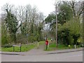
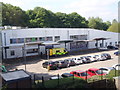
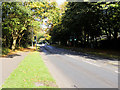
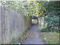
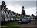
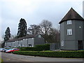
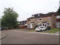
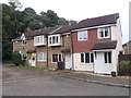
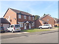
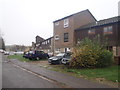
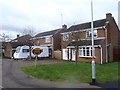
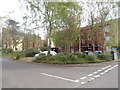
Photos of NN3 8XJ
Area Information
Living in NN3 8XJ means inhabiting a compact, residential cluster in England with a population of 1981 people spread across just 3 hectares. This makes it one of the most densely populated areas in the country, with 65,619 people per square kilometre. The area is defined by its small-scale nature, where daily life is shaped by proximity to amenities and a focus on local services. Residents benefit from nearby retail options such as Co-op Northampton and Lidl Lings, as well as transport links including Northampton Bus Interchange and Northampton Railway Station. The community is predominantly composed of adults aged 30–64, with a median age of 47, suggesting a settled, mature demographic. While the area lacks natural or protected landscapes, its accessibility to urban infrastructure and educational facilities like Greenfields School and Sports College positions it as a practical choice for families seeking convenience over expansive scenery.
- Area Type
- Postcode
- Area Size
- 3.0 hectares
- Population
- 1981
- Population Density
- 4951 people/km²
The property market in NN3 8XJ is shaped by its small size and high density, with 47% of homes owned by residents and the remainder likely occupied by renters. The area is predominantly composed of houses, which contrasts with the higher proportion of flats found in more urban settings. This suggests a mix of family homes and single-unit properties, though the limited area size means the housing stock is constrained. Buyers considering NN3 8XJ should note that the small footprint may restrict availability, particularly for larger properties. The compact nature of the area also means proximity to amenities is a key advantage, though the high population density could impact living space per person. For those prioritising ownership, the 47% home ownership rate indicates a stable market, but competition for available properties may be keen given the area’s practical location and access to transport.
House Prices in NN3 8XJ
Showing 24 properties
| Address | Type | Beds | Baths | Last Sale Price | Last Sale Date | |
|---|---|---|---|---|---|---|
| 2 Goldcrest Court, Northampton, NN3 8XJ | Bungalow | - | - | - | - | |
| 1 Goldcrest Court, Northampton, NN3 8XJ | Bungalow | - | - | - | - | |
| 6 Goldcrest Court, Northampton, NN3 8XJ | Bungalow | - | - | - | - | |
| 14 Goldcrest Court, Northampton, NN3 8XJ | Bungalow | - | - | - | - | |
| 8 Goldcrest Court, Northampton, NN3 8XJ | Bungalow | - | - | - | - | |
| 23 Goldcrest Court, Northampton, NN3 8XJ | Bungalow | - | - | - | - | |
| 9 Goldcrest Court, Northampton, NN3 8XJ | Bungalow | - | - | - | - | |
| 19 Goldcrest Court, Northampton, NN3 8XJ | Bungalow | - | - | - | - | |
| 3 Goldcrest Court, Northampton, NN3 8XJ | Bungalow | - | - | - | - | |
| 4 Goldcrest Court, Northampton, NN3 8XJ | Bungalow | - | - | - | - |
Energy Efficiency in NN3 8XJ
The lifestyle in NN3 8XJ is defined by its proximity to essential amenities, including retail outlets like Co-op Northampton, Tesco Northampton, and Lidl Lings. These stores provide everyday shopping convenience, reducing the need for long commutes. The area also benefits from transport hubs such as Northampton Bus Interchange and University Bus Interchange, which connect residents to wider networks. While there are no parks or leisure facilities listed in the data, the compact layout ensures that services are within practical reach. The presence of two special schools further underscores the community’s focus on education and support services. For residents, this means a lifestyle centred on accessibility and practicality, with limited space but strong local connectivity. The high population density may create a sense of community, though it also necessitates efficient use of space and shared resources.
Amenities
Schools
Residents of NN3 8XJ have access to two special schools: Greenfields School and Sports College, and Greenfields Specialist School for Communication. Both institutions cater to students with specific educational needs, offering tailored support and resources. The presence of two special schools in the area suggests a focus on inclusive education and services for children with communication or other learning requirements. For families seeking such provisions, this cluster of schools provides proximity and variety. However, the absence of mainstream primary or secondary schools in the data means parents may need to look further afield for broader educational options. The schools’ types highlight the area’s role in supporting specialist education, though it may not be ideal for families requiring a wider range of academic institutions.
| Rank | School | Type | Entry gender | Ages |
|---|
Explore more schools in this area
Go to Schools tabDemographics
The community in NN3 8XJ is characterised by a median age of 47, with the majority of residents falling within the 30–64 age range. Home ownership accounts for 47% of households, indicating a mix of owner-occupied properties and rental units. The area is predominantly composed of houses rather than flats, reflecting a traditional housing stock. The predominant ethnic group is White, with no specific data provided on other demographics. The high population density of 65,619 people per square kilometre suggests a compact, closely knit community where services and amenities are concentrated. This density may influence the pace of life, with limited open space but strong local connectivity. For quality of life, the absence of protected natural areas or planning constraints may offer flexibility for development, though the medium crime risk score of 52 indicates standard security measures are advisable.
Household Size
Accommodation Type
Tenure
Ethnic Group
Religion
Household Composition
Age
Household Deprivation
NS-SEC
Explore more demographic insights in this area
Go to Demographics tabPlanning
Planning Constraints
- Flood RiskPremium
- Ramsar Wetland SitesPremium
- Area of Outstanding Natural BeautyPremium
- Protected Nature ReservePremium
- Protected WoodlandPremium