Area Overview for NN3 8TA
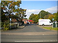
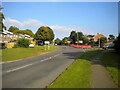
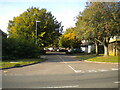
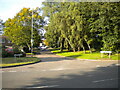
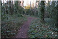
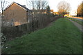
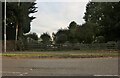
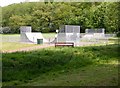
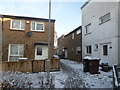
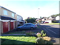
Photos of NN3 8TA


Area Information
Living in NN3 8TA offers a compact, densely populated residential experience within a small cluster of 7.2 hectares. With 1,604 residents spread across a high population density of 22,413 people per square kilometre, this area fosters a tightly knit community. The median age of 47 suggests a mature demographic, with most residents falling between 30 and 64 years old. This makes NN3 8TA a stable, family-oriented neighbourhood where homes are predominantly owner-occupied. The area’s proximity to key amenities like retail hubs, transport links, and schools ensures convenience without the need for long commutes. While it is a small postcode, its strategic location near Northampton’s infrastructure provides access to city amenities while retaining a quieter, residential character. For those seeking a balance between urban connectivity and a close-knit environment, NN3 8TA offers a distinct blend of practicality and community focus.
- Area Type
- Postcode
- Area Size
- 7.2 hectares
- Population
- 1604
- Population Density
- 6303 people/km²
The property market in NN3 8TA is characterised by a 51% home ownership rate, with houses forming the majority of the housing stock. This suggests a market skewed towards owner-occupied properties rather than rentals, though the small area size means the overall stock is limited. The compact nature of the postcode implies that properties are likely to be in close proximity to amenities and transport links, which could be a draw for buyers prioritising convenience. However, the limited number of homes also means competition for available properties. Given the area’s proximity to Northampton’s infrastructure, buyers may find that the surrounding regions offer more housing options, though NN3 8TA itself remains a focused, tightly packed residential cluster.
House Prices in NN3 8TA
Showing 31 properties
| Address | Type | Beds | Baths | Last Sale Price | Last Sale Date | |
|---|---|---|---|---|---|---|
| 27 Lingswood Park, Northampton, NN3 8TA | Detached | 4 | 2 | £425,000 | Oct 2025 | |
| 35 Lingswood Park, Northampton, NN3 8TA | Retail | 4 | 1 | £321,500 | Dec 2022 | |
| 4 Lingswood Park, Northampton, NN3 8TA | house | 3 | 2 | £329,000 | Sep 2022 | |
| 24 Lingswood Park, Northampton, NN3 8TA | Detached | 5 | 2 | £306,000 | Jun 2021 | |
| 12 Lingswood Park, Northampton, NN3 8TA | house | - | - | £360,000 | Apr 2021 | |
| 6 Lingswood Park, Northampton, NN3 8TA | house | - | - | £285,000 | Mar 2021 | |
| 30 Lingswood Park, Northampton, NN3 8TA | Detached | 4 | - | £300,000 | Jan 2020 | |
| 3 Lingswood Park, Northampton, NN3 8TA | Detached | 3 | - | £249,000 | Dec 2019 | |
| 10 Lingswood Park, Northampton, NN3 8TA | Detached | 4 | 2 | £235,000 | Oct 2015 | |
| 36 Lingswood Park, Northampton, NN3 8TA | house | - | - | £215,000 | Oct 2015 |
Energy Efficiency in NN3 8TA
Residents of NN3 8TA have access to a range of nearby amenities, including five retail outlets such as Tesco Northampton, Co-op Northampton, and Lidl Lings, ensuring everyday shopping needs are met. The area’s transport links, including the University Bus Interchange and Northampton Bus Interchange, provide easy access to city centres and beyond. While specific parks or leisure facilities are not listed in the data, the proximity to Northampton’s infrastructure suggests a variety of recreational options within reach. The compact nature of the area means that amenities are closely clustered, reducing the need for long journeys. This creates a convenient, self-contained lifestyle where daily essentials and transport are readily accessible.
Amenities
Schools
The nearest school to NN3 8TA is St Peter’s Independent School, a fee-paying institution that caters to students seeking private education. While no Ofsted rating is provided, independent schools like St Peter’s typically offer smaller class sizes and specialised curricula. The presence of this school indicates that the area may attract families prioritising private education, though it is not a state-funded option. For families requiring state schools, the data does not list any public institutions nearby, suggesting that residents may need to look beyond NN3 8TA for comprehensive schooling options. This could influence decisions about where to live, depending on a household’s educational preferences and budget.
| Rank | School | Type | Entry gender | Ages |
|---|
Explore more schools in this area
Go to Schools tabDemographics
The community in NN3 8TA is predominantly composed of adults aged 30 to 64, with a median age of 47. This suggests a mature, established population, likely with strong ties to local institutions and employment. Home ownership stands at 51%, with houses being the primary type of accommodation. The predominant ethnic group is White, reflecting a homogenous demographic profile. The high population density of 22,413 people per square kilometre indicates a compact, closely packed residential area, which can influence daily life through shared spaces and community interaction. While specific data on deprivation is absent, the high home ownership rate and stable age range suggest a relatively secure, middle-income environment. However, the lack of diversity in ethnic composition may limit cultural variety, which could be a consideration for some residents.
Household Size
Accommodation Type
Tenure
Ethnic Group
Religion
Household Composition
Age
Household Deprivation
NS-SEC
Explore more demographic insights in this area
Go to Demographics tabPlanning
Planning Constraints
- Flood RiskPremium
- Ramsar Wetland SitesPremium
- Area of Outstanding Natural BeautyPremium
- Protected Nature ReservePremium
- Protected WoodlandPremium