Area Overview for NN3 8HW
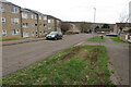
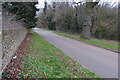
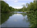
Photos of NN3 8HW


Area Information
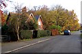
NN3 8HW is a compact residential cluster in England, covering just 1.1 hectares and home to 1,801 people. Its high population density—170,475 people per square kilometre—reflects a tightly knit community, where living spaces are closely spaced. The area’s character is defined by its proximity to essential services, with five retail outlets within practical reach, including Tesco Northampton and Lidl Lings. This makes daily life convenient, with shops, transport hubs, and a railway station all within easy access. The median age of 47 suggests a mature demographic, with adults aged 30–64 forming the largest group. While the area has low flood risk and no protected natural sites, residents should be aware of a medium crime risk. Broadband is excellent, with a score of 99, and mobile coverage is good, supporting both remote work and everyday connectivity. For those seeking a small, accessible community with strong retail and transport links, NN3 8HW offers a blend of practicality and proximity to Northampton’s infrastructure.
- Area Type
- Postcode
- Area Size
- 1.1 hectares
- Population
- 1801
- Population Density
- 4161 people/km²
The property market in NN3 8HW is characterised by a low home ownership rate of 34%, suggesting that the area is more rental-focused than owner-occupied. The accommodation type is predominantly houses, which may indicate a mix of semi-detached or terraced properties given the small area’s constraints. With only 1.1 hectares of land, the housing stock is limited, making the area a niche market for buyers seeking specific properties. The high population density implies that properties are likely to be closely spaced, potentially offering less privacy than larger suburban areas. For buyers, this means competition for available homes and a need to consider proximity to amenities. The rental market is likely active, driven by the area’s accessibility to transport and retail. However, the small size of NN3 8HW means that any property search must be precise, focusing on the immediate surroundings for viable options.
House Prices in NN3 8HW
Showing 41 properties
| Address | Type | Beds | Baths | Last Sale Price | Last Sale Date | |
|---|---|---|---|---|---|---|
| 9 Mounts Court, Northampton, NN3 8HW | house | 3 | 1 | £157,500 | Apr 2020 | |
| 7 Mounts Court, Northampton, NN3 8HW | Detached | 4 | - | £177,500 | May 2017 | |
| 26 Mounts Court, Northampton, NN3 8HW | Terraced | 3 | - | £146,000 | Mar 2017 | |
| 4 Mounts Court, Northampton, NN3 8HW | Terraced | 3 | - | £138,000 | Dec 2016 | |
| 30 Mounts Court, Northampton, NN3 8HW | Flat | - | - | £72,000 | Nov 2016 | |
| 8 Mounts Court, Northampton, NN3 8HW | house | - | - | £129,995 | Mar 2016 | |
| 17 Mounts Court, Northampton, NN3 8HW | Terraced | 3 | 1 | £110,000 | Nov 2015 | |
| 22 Mounts Court, Northampton, NN3 8HW | house | - | - | £102,000 | Jul 2008 | |
| 6 Mounts Court, Northampton, NN3 8HW | Semi-detached | - | - | £97,500 | Oct 2005 | |
| 3 Mounts Court, Northampton, NN3 8HW | house | - | - | £91,000 | Oct 2004 |
Energy Efficiency in NN3 8HW
Living in NN3 8HW offers access to a range of amenities within practical reach. Retail options include Tesco Northampton, Lidl Lings, and Co-op Bushland, ensuring essentials are readily available. The area’s transport network is robust, with two major bus interchanges and a railway station providing connections to Northampton and beyond. While the small size of the postcode limits local parks or leisure facilities, the proximity to Northampton’s broader infrastructure compensates. The character of daily life is shaped by convenience—shops, transport, and work opportunities are all within easy access. For residents, this means a practical, efficient lifestyle with minimal need for long commutes. The presence of multiple retail outlets also suggests a community that prioritises accessibility, making NN3 8HW a viable choice for those seeking a compact, service-rich environment.
Amenities
Schools
| Rank | School | Type | Entry gender | Ages |
|---|
Explore more schools in this area
Go to Schools tabDemographics
The community in NN3 8HW is predominantly composed of adults aged 30–64, with a median age of 47. This suggests a stable, established population, likely with long-term ties to the area. Home ownership rates are relatively low at 34%, indicating that a majority of residents rent their homes. The accommodation type is primarily houses, which contrasts with areas where flats or apartments dominate. The predominant ethnic group is White, though no data is provided on other groups. The high population density—170,475 people per square kilometre—raises questions about living conditions, though the area’s small size means resources are shared among a tightly packed community. For residents, this density may influence access to green spaces or privacy, though the area’s proximity to amenities offsets some of these constraints. The demographic profile reflects a mature, settled population with a focus on practical living over luxury.
Household Size
Accommodation Type
Tenure
Ethnic Group
Religion
Household Composition
Age
Household Deprivation
NS-SEC
Explore more demographic insights in this area
Go to Demographics tabPlanning
Planning Constraints
- Flood RiskPremium
- Ramsar Wetland SitesPremium
- Area of Outstanding Natural BeautyPremium
- Protected Nature ReservePremium
- Protected WoodlandPremium