Area Overview for NN3 8HF
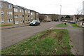
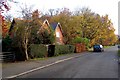
Photos of NN3 8HF


Area Information
NN3 8HF is a compact residential postcode in England, covering just 5,905 square metres and home to 1,801 residents. Its high population density of 305,011 people per square kilometre reflects a tightly knit community, though the area’s small size means it is more of a cluster than a sprawling neighbourhood. Daily life here is shaped by proximity to essential services, with five retail outlets within practical reach, including Tesco Northampton and Lidl Lings. The area’s character is defined by its mix of older housing stock and practical amenities, catering to a population skewed towards adults aged 30–64. While the postcode lacks natural or protected landscapes, its strategic location near transport hubs like Northampton Railway Station and two bus interchanges ensures connectivity to surrounding regions. For those seeking a quiet, functional living environment with access to retail and transport, NN3 8HF offers a straightforward, no-frills alternative to larger urban centres.
- Area Type
- Postcode
- Area Size
- 5905 m²
- Population
- 1801
- Population Density
- 4161 people/km²
The property market in NN3 8HF is characterised by a low home ownership rate of 34%, suggesting that the area is largely a rental market rather than one dominated by owner-occupiers. The accommodation type is primarily houses, but the small area size and high population density imply that these are likely modest or semi-detached properties. With only 1,801 residents spread across 5,905 square metres, the housing stock is limited, and the immediate surroundings may offer little in the way of new developments or alternative options. Buyers seeking to purchase in NN3 8HF may face competition from renters, particularly given the area’s practical appeal for those prioritising proximity to transport and retail. The lack of protected or natural landscapes also means the area’s property values are unlikely to be inflated by environmental factors, keeping it accessible but potentially lacking in premium features.
House Prices in NN3 8HF
Showing 27 properties
| Address | Type | Beds | Baths | Last Sale Price | Last Sale Date | |
|---|---|---|---|---|---|---|
| 1 Fullerburn Court, Northampton, NN3 8HF | Terraced | 3 | 1 | £151,500 | Apr 2020 | |
| 2 Fullerburn Court, Northampton, NN3 8HF | Terraced | 3 | 1 | £135,000 | Jun 2019 | |
| 21 Fullerburn Court, Northampton, NN3 8HF | Terraced | 3 | 2 | £153,500 | Jan 2019 | |
| 25 Fullerburn Court, Northampton, NN3 8HF | house | 3 | - | £94,500 | Sep 2012 | |
| 3 Fullerburn Court, Northampton, NN3 8HF | house | - | - | £115,000 | Aug 2006 | |
| 4 Fullerburn Court, Northampton, NN3 8HF | house | - | - | £89,000 | Dec 2004 | |
| 5 Fullerburn Court, Northampton, NN3 8HF | Terraced | - | - | £112,000 | Dec 2004 | |
| 20 Fullerburn Court, Northampton, NN3 8HF | house | - | - | £50,000 | Jan 2003 | |
| 6 Fullerburn Court, Northampton, NN3 8HF | house | - | - | £34,000 | Nov 1998 | |
| 15 Fullerburn Court, Northampton, NN3 8HF | Flat | - | - | - | - |
Energy Efficiency in NN3 8HF
Living in NN3 8HF offers access to essential retail and transport hubs within short distances. The area’s five retail outlets include major names like Tesco Northampton and Lidl Lings, alongside Co-op Bushland, providing everyday shopping convenience. Public transport is well-served by two bus interchanges and Northampton Railway Station, facilitating travel to nearby employment centres or leisure destinations. While there are no named parks or recreational facilities in the data, the proximity to Northampton — a city with cultural and commercial amenities — suggests residents can access broader lifestyle options. The compact nature of the area means daily errands and travel are efficient, though the lack of specific green spaces or leisure venues may require residents to venture further for recreation. The retail and transport links make NN3 8HF practical for those prioritising accessibility over expansive amenities.
Amenities
Schools
| Rank | School | Type | Entry gender | Ages |
|---|
Explore more schools in this area
Go to Schools tabDemographics
The population of NN3 8HF is predominantly adults aged 30–64, with a median age of 47. This suggests a mature, stable community with a focus on long-term residency rather than transient populations. Home ownership rates are low at 34%, indicating that the majority of residents rent their homes. The area’s accommodation is primarily composed of houses, though the high population density implies these properties are likely smaller or multi-occupancy units. The predominant ethnic group is White, with no data provided on other demographics. The high density and age profile suggest a community that may prioritise practicality over luxury, with limited scope for large families or young professionals. The absence of specific data on deprivation or income levels means quality of life factors remain unquantified, though the low home ownership rate may reflect affordability challenges or a rental-focused market.
Household Size
Accommodation Type
Tenure
Ethnic Group
Religion
Household Composition
Age
Household Deprivation
NS-SEC
Explore more demographic insights in this area
Go to Demographics tabPlanning
Planning Constraints
- Flood RiskPremium
- Ramsar Wetland SitesPremium
- Area of Outstanding Natural BeautyPremium
- Protected Nature ReservePremium
- Protected WoodlandPremium