Area Overview for NN3 8HP
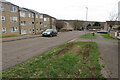
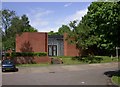
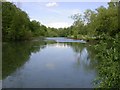
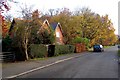
Photos of NN3 8HP

Area Information
NN3 8HP is a compact residential postcode in England, covering just 5,328 square metres and home to 1,801 people. Its high population density of 338,054 people per square kilometre reflects a tightly knit community, though the area’s small size means it is best suited for those prioritising proximity to local amenities over expansive space. The postcode forms a small cluster of homes, predominantly houses, with a median age of 47 and a majority of residents aged 30–64. This suggests a mature, established population, likely drawn to the area for its practicality and accessibility. Daily life here is shaped by its proximity to retail, transport, and educational hubs, with shops like Tesco Northampton and Lidl Lings within reach. While the area lacks sprawling green spaces, its compact nature ensures residents can access essential services quickly. For buyers, NN3 8HP offers a straightforward, no-frills living environment, though its limited size means it is more of a stepping stone than a long-term home for growing families.
- Area Type
- Postcode
- Area Size
- 5328 m²
- Population
- 1801
- Population Density
- 4161 people/km²
NN3 8HP is a small, house-dominated area with a home ownership rate of 34%, indicating a mix of owner-occupied and rental properties. The limited area size means the housing stock is constrained, with little scope for new developments. The prevalence of houses over flats suggests a traditional, family-friendly character, though the low ownership rate may reflect a transient population or reliance on private rentals. For buyers, this small cluster of homes is unlikely to offer a wide selection, and those seeking a long-term property may need to look beyond the immediate postcode. The area’s proximity to transport hubs like Northampton Railway Station and bus interchanges could make it attractive to commuters, but its compact nature means it is more of a satellite location than a standalone community.
House Prices in NN3 8HP
Showing 11 properties
| Address | Type | Beds | Baths | Last Sale Price | Last Sale Date | |
|---|---|---|---|---|---|---|
| 9 Parva Court, Northampton, NN3 8HP | Terraced | 3 | - | £135,000 | Jun 2017 | |
| 8 Parva Court, Northampton, NN3 8HP | Terraced | - | - | £108,000 | Oct 2015 | |
| 1 Parva Court, Northampton, NN3 8HP | Terraced | 3 | 1 | £112,000 | Sep 2015 | |
| 5 Parva Court, Northampton, NN3 8HP | Semi-detached | - | - | £112,000 | Sep 2007 | |
| 3 Parva Court, Northampton, NN3 8HP | Terraced | - | - | £48,500 | Dec 2000 | |
| 4 Parva Court, Northampton, NN3 8HP | house | - | - | £46,500 | Aug 2000 | |
| 2 Parva Court, Northampton, NN3 8HP | Terraced | - | - | - | - | |
| 6 Parva Court, Northampton, NN3 8HP | house | 3 | 1 | - | - | |
| 11 Parva Court, Northampton, NN3 8HP | house | - | - | - | - | |
| 10 Parva Court, Northampton, NN3 8HP | house | - | - | - | - |
Energy Efficiency in NN3 8HP
Living in NN3 8HP offers practical access to essential amenities. Retail options include major supermarkets like Tesco Northampton, Lidl Lings, and Co-op Bushland, ensuring daily shopping needs are met within a short distance. The area’s transport links are robust, with two bus interchanges and a railway station providing connections to Northampton and beyond. While there is no mention of parks or leisure facilities in the data, the presence of retail and transport hubs suggests a functional, convenience-focused lifestyle. The compact nature of the postcode means residents can access these amenities without long commutes, though the lack of detailed information on recreational spaces means it is unclear how much green space or cultural offerings are available. For those prioritising practicality over luxury, NN3 8HP delivers a straightforward, service-rich environment.
Amenities
Schools
| Rank | School | Type | Entry gender | Ages |
|---|
Explore more schools in this area
Go to Schools tabDemographics
The population of NN3 8HP skews towards adults aged 30–64, with a median age of 47. This indicates a community of established professionals and families, though the 34% home ownership rate suggests a significant proportion of residents rent their homes. The area is predominantly composed of houses, reflecting a traditional housing stock rather than flats or apartments. The predominant ethnic group is White, though no specific data on diversity or deprivation is provided. The high population density of 338,054 people per square kilometre implies a compact, possibly urbanised setting, though the absence of detailed socioeconomic data means it is unclear how this density affects quality of life. For buyers, the demographic profile suggests a stable, low-turnover market, with demand likely driven by proximity to transport links and retail rather than demographic shifts.
Household Size
Accommodation Type
Tenure
Ethnic Group
Religion
Household Composition
Age
Household Deprivation
NS-SEC
Explore more demographic insights in this area
Go to Demographics tabPlanning
Planning Constraints
- Flood RiskPremium
- Ramsar Wetland SitesPremium
- Area of Outstanding Natural BeautyPremium
- Protected Nature ReservePremium
- Protected WoodlandPremium