Area Overview for NN3 8EH
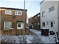
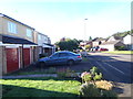
Photos of NN3 8EH


Area Information
NN3 8EH is a compact residential postcode in England, covering just 1.3 hectares and home to 1,604 residents. Its high population density of 121,818 people per square kilometre reflects a tightly knit community, though the area’s small size means it is best suited for those prioritising proximity to Northampton’s urban amenities. The postcode lies within a cluster of homes, predominantly owner-occupied, with a median age of 47 and a strong presence of adults aged 30–64. Living here offers easy access to Northampton’s transport hubs, retail centres, and educational institutions, including St Peter’s Independent School. The area’s digital connectivity is exceptional, with a broadband score of 100, ensuring seamless internet access for remote work or entertainment. However, its limited size means residents may seek nearby districts for additional space or amenities. For those valuing convenience over expansive living, NN3 8EH provides a compact, well-connected base.
- Area Type
- Postcode
- Area Size
- 1.3 hectares
- Population
- 1604
- Population Density
- 6303 people/km²
The property market in NN3 8EH is characterised by a 51% home ownership rate, suggesting a mix of owner-occupied homes and rental properties. With houses as the primary accommodation type, the area caters to families and individuals seeking traditional housing. Given its small size of 1.3 hectares, the housing stock is limited, making it a competitive market for buyers. The high population density may indicate a scarcity of new developments, meaning prospective buyers may need to consider nearby areas for more options. The predominance of houses suggests a focus on private, standalone living rather than apartments or flats. For those seeking a stable investment, the area’s proximity to Northampton’s transport and retail hubs could be a draw, though its constrained size may limit long-term growth potential.
House Prices in NN3 8EH
Showing 45 properties
| Address | Type | Beds | Baths | Last Sale Price | Last Sale Date | |
|---|---|---|---|---|---|---|
| 3 Maidencastle, Northampton, NN3 8EH | Flat | 1 | 1 | £125,000 | Feb 2023 | |
| 2 Maidencastle, Northampton, NN3 8EH | Flat | 1 | - | £100,000 | Sep 2021 | |
| 18 Maidencastle, Northampton, NN3 8EH | house | - | - | £195,000 | Aug 2021 | |
| 39 Maidencastle, Northampton, NN3 8EH | house | - | - | £170,000 | Mar 2021 | |
| 38 Maidencastle, Northampton, NN3 8EH | Terraced | 3 | - | £146,000 | Jul 2019 | |
| 7 Maidencastle, Northampton, NN3 8EH | Terraced | 3 | - | £148,500 | Apr 2018 | |
| 11 Maidencastle, Northampton, NN3 8EH | Terraced | 3 | 1 | £154,000 | Sep 2017 | |
| 30 Maidencastle, Northampton, NN3 8EH | house | - | - | £120,000 | Sep 2017 | |
| 9 Maidencastle, Northampton, NN3 8EH | Terraced | 3 | - | £144,000 | Jun 2017 | |
| 20 Maidencastle, Northampton, NN3 8EH | Terraced | 3 | 1 | £139,000 | Nov 2016 |
Energy Efficiency in NN3 8EH
Living in NN3 8EH grants access to nearby retail options, including Co-op Northampton, Co-op Bellinge, and Tesco Northampton, ensuring everyday shopping needs are met. The area’s proximity to Northampton Bus Interchange and University Bus Interchange facilitates easy travel to the city centre, where additional amenities, parks, and leisure facilities are available. While the postcode itself is a small cluster, its location within Northampton’s transport network means residents can quickly reach cultural venues, dining spots, and recreational areas. The presence of multiple retail outlets and transport links suggests a lifestyle focused on convenience and accessibility, though the area’s compact nature may limit on-site green spaces or leisure facilities.
Amenities
Schools
The nearest school to NN3 8EH is St Peter’s Independent School, an independent institution with no Ofsted rating provided in the data. As the sole listed school, it is the primary educational option for families in the area. The absence of state schools or other independent institutions suggests a limited choice for parents seeking diverse educational pathways. For those prioritising independent education, St Peter’s may offer specialised resources or curricula, though its standalone status means families must consider commuting to other districts for alternative schooling. The school’s presence could attract households valuing private education, but it also highlights the area’s reliance on a single institution for primary and secondary education.
| Rank | School | Type | Entry gender | Ages |
|---|
Explore more schools in this area
Go to Schools tabDemographics
The population of NN3 8EH is predominantly adults aged 30–64, with a median age of 47. This suggests a community of established professionals and families, likely drawn by the area’s proximity to Northampton’s infrastructure. Home ownership stands at 51%, indicating a balance between owner-occupied properties and rental units. The accommodation type is primarily houses, which aligns with the area’s residential character. The predominant ethnic group is White, reflecting a homogenous demographic profile. The high population density of 121,818 people per square kilometre implies a compact, possibly multi-generational living environment. While this density supports a vibrant local network, it also means limited space for expansion or new developments. For residents, this translates to a tightly woven community where social interactions and shared resources are common.
Household Size
Accommodation Type
Tenure
Ethnic Group
Religion
Household Composition
Age
Household Deprivation
NS-SEC
Explore more demographic insights in this area
Go to Demographics tabPlanning
Planning Constraints
- Flood RiskPremium
- Ramsar Wetland SitesPremium
- Area of Outstanding Natural BeautyPremium
- Protected Nature ReservePremium
- Protected WoodlandPremium