Area Overview for NN3 9BL
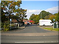
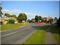
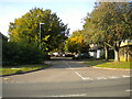
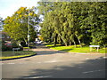
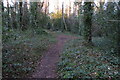
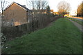
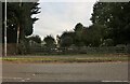
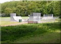
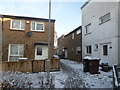
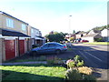
Photos of NN3 9BL


Area Information
NN3 9BL is a small, tightly packed residential cluster in England, covering just 1.9 hectares and home to 2,102 people. Its high population density of 111,284 people per square kilometre reflects a compact, community-focused layout. This area is defined by its proximity to essential services and transport links, making it practical for daily life. The demographics suggest a mature population, with a median age of 47 and a strong presence of adults aged 30–64. Home ownership is high at 84%, with houses predominating over flats, indicating a stable, long-term resident base. The area’s low flood risk and below-average crime rates, scoring 83 out of 100 for safety, contribute to a sense of security. While there are no protected natural sites or wetlands nearby, the lack of planning constraints may simplify development. For those seeking a densely populated yet safe environment with easy access to retail and transport, NN3 9BL offers a blend of practicality and proximity.
- Area Type
- Postcode
- Area Size
- 1.9 hectares
- Population
- 2102
- Population Density
- 3325 people/km²
The property market in NN3 9BL is characterised by high home ownership, with 84% of residents living in their own homes. This suggests a market skewed towards owner-occupation rather than rental properties, which may indicate a stable, long-term resident base. The accommodation type is predominantly houses, which are likely to be family homes given the median age of 47 and the prevalence of adults in the 30–64 age range. The small area size of 1.9 hectares means the housing stock is limited, which could make the market competitive for buyers. However, the absence of planning constraints such as protected woodlands or AONB designations may simplify development or renovation. For buyers, this implies a focus on existing properties rather than new builds, with potential for value retention in a low-risk, densely populated environment.
House Prices in NN3 9BL
No properties found in this postcode.
Energy Efficiency in NN3 9BL
Living in NN3 9BL offers access to essential retail and transport hubs within practical reach. Nearby shops include Co-op Bellinge, Co-op Northampton, and Tesco Northampton, providing everyday convenience for groceries and household needs. The University Bus Interchange and Northampton Bus Interchange ensure regular public transport options, while Northampton Railway Station connects residents to broader networks. Though the area is small, these amenities contribute to a functional lifestyle, reducing the need for long commutes. The proximity to retail and transport hubs supports a practical, community-oriented rhythm of daily life. While there are no named parks or leisure facilities in the data, the area’s density and service accessibility suggest a focus on efficiency over expansive recreational spaces.
Amenities
Schools
| Rank | School | Type | Entry gender | Ages |
|---|
Explore more schools in this area
Go to Schools tabDemographics
The community in NN3 9BL is predominantly composed of adults aged 30–64, with a median age of 47. This suggests a mature, established population, likely with long-term ties to the area. Home ownership is exceptionally high at 84%, reflecting a stable housing market where most residents live in their own homes rather than renting. The accommodation type is primarily houses, which aligns with the area’s small size and residential character. The predominant ethnic group is White, though no specific data on diversity or deprivation is provided. The high population density of 111,284 people per square kilometre means the area is intensely populated, which can influence the pace of life and availability of shared amenities. For those prioritising a settled, low-mobility community with strong property ownership, NN3 9BL’s demographics present a clear profile.
Household Size
Accommodation Type
Tenure
Ethnic Group
Religion
Household Composition
Age
Household Deprivation
NS-SEC
Explore more demographic insights in this area
Go to Demographics tabPlanning
Planning Constraints
- Flood RiskPremium
- Ramsar Wetland SitesPremium
- Area of Outstanding Natural BeautyPremium
- Protected Nature ReservePremium
- Protected WoodlandPremium
- Crime RiskPremium