Area Overview for NN3 8EL
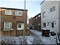
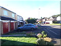
Photos of NN3 8EL


Area Information
NN3 8EL is a compact residential cluster in England, covering just 2.4 hectares and home to 1604 residents. Its high population density of 67,864 people per square kilometre suggests a tightly knit community, though the area’s small size means it is likely to feel intimate rather than sprawling. The postcode is characterised by a predominance of houses, reflecting a stable, family-oriented demographic. With a median age of 47, the area is primarily populated by adults aged 30–64, indicating a mature, established community. Daily life here is likely shaped by proximity to essential services, including retail outlets like Co-op Northampton and Tesco, as well as transport hubs such as Northampton Railway Station. The area’s compact nature means residents are within easy reach of both local amenities and broader connectivity, making it a practical choice for those prioritising convenience. However, the small size also means the housing stock is limited, so buyers should consider the immediate surroundings for more options.
- Area Type
- Postcode
- Area Size
- 2.4 hectares
- Population
- 1604
- Population Density
- 6303 people/km²
The property market in NN3 8EL is defined by a 51% home ownership rate, with houses being the primary accommodation type. This suggests a market skewed towards owner-occupied homes rather than rental properties, though the small area size means the housing stock is limited. Given the high population density, properties are likely to be closely spaced, and buyers may need to look beyond the immediate postcode for more options. The presence of houses rather than flats indicates a focus on family homes, which could appeal to those seeking space and privacy. However, the small area’s compact nature means competition for properties may be fierce, and buyers should consider nearby areas for a broader selection.
House Prices in NN3 8EL
Showing 70 properties
| Address | Type | Beds | Baths | Last Sale Price | Last Sale Date | |
|---|---|---|---|---|---|---|
| 108 Maidencastle, Northampton, NN3 8EL | Terraced | 3 | 1 | £145,000 | Jun 2025 | |
| 122 Maidencastle, Northampton, NN3 8EL | house | - | - | £200,000 | Feb 2022 | |
| 145 Maidencastle, Northampton, NN3 8EL | Flat | - | - | £95,000 | May 2021 | |
| 165 Maidencastle, Northampton, NN3 8EL | Terraced | 3 | - | £172,500 | Aug 2020 | |
| 120 Maidencastle, Northampton, NN3 8EL | house | - | - | £142,000 | Apr 2020 | |
| 124 Maidencastle, Northampton, NN3 8EL | Terraced | 3 | - | £158,000 | Sep 2019 | |
| 153 Maidencastle, Northampton, NN3 8EL | house | - | - | £159,000 | Sep 2019 | |
| 139 Maidencastle, Northampton, NN3 8EL | house | - | - | £148,000 | Jan 2018 | |
| 126 Maidencastle, Northampton, NN3 8EL | house | - | - | £125,000 | Jul 2017 | |
| 136 Maidencastle, Northampton, NN3 8EL | Terraced | 3 | - | £160,000 | Feb 2017 |
Energy Efficiency in NN3 8EL
Residents of NN3 8EL have access to a range of nearby amenities, including retail options such as Co-op Northampton, Co-op Bellinge, and Tesco Northampton, ensuring everyday shopping needs are met. The area’s proximity to Northampton Bus Interchange and Northampton Railway Station enhances connectivity, making it simple to reach the city centre or further destinations. While parks and leisure facilities are not explicitly listed in the data, the area’s compact design suggests a balance between residential living and accessibility to urban amenities. The presence of multiple retail outlets and transport hubs contributes to a practical, convenient lifestyle, though those seeking green spaces may need to explore nearby areas.
Amenities
Schools
The nearest school to NN3 8EL is St Peter’s Independent School, a private institution. While no Ofsted rating is provided, the presence of an independent school suggests the area may attract families seeking alternative educational options. However, the data does not list any state schools or other educational institutions nearby. This lack of variety in school types could be a consideration for families prioritising public education. Those relying on local state schools may need to look further afield, though the proximity to Northampton’s transport links could ease access to broader schooling options.
| Rank | School | Type | Entry gender | Ages |
|---|
Explore more schools in this area
Go to Schools tabDemographics
The population of NN3 8EL is predominantly adults aged 30–64, with a median age of 47. This suggests a community of middle-aged residents, many of whom may be in their peak working years or nearing retirement. Home ownership is at 51%, slightly below the national average, but the area is primarily composed of houses rather than flats or apartments. The predominant ethnic group is White, though no specific data on diversity or deprivation is provided. The age profile indicates a stable, long-term resident base, which may contribute to a sense of continuity in the local area. With no mention of social housing or rental properties, it is likely that the housing market here is more focused on owner-occupied properties, reflecting a demographic that values private residence.
Household Size
Accommodation Type
Tenure
Ethnic Group
Religion
Household Composition
Age
Household Deprivation
NS-SEC
Explore more demographic insights in this area
Go to Demographics tabPlanning
Planning Constraints
- Flood RiskPremium
- Ramsar Wetland SitesPremium
- Area of Outstanding Natural BeautyPremium
- Protected Nature ReservePremium
- Protected WoodlandPremium