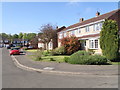
Area Overview for NN3 7SQ
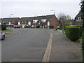
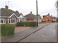
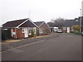
Photos of NN3 7SQ
Area Information
NN3 7SQ is a small residential cluster in England, covering 18.5 hectares and home to 2,141 residents. Its compact size means it is a tightly knit area, with a population density of 306 people per square kilometre. The median age of 47 suggests a community skewed towards middle-aged adults, with the majority of residents falling between 30 and 64 years old. This demographic profile indicates a stable, established population, likely with strong ties to local institutions and long-term residency. Daily life here is shaped by proximity to essential services, including retail, transport hubs, and educational facilities. The area’s small footprint means residents are likely within walking or short driving distance of amenities, fostering a sense of convenience. With 65% of homes owned outright, the area leans towards owner-occupation rather than rental, reflecting a community focused on long-term stability. While it lacks large-scale infrastructure, its compact nature ensures a manageable, low-traffic environment. For those seeking a quiet, established neighbourhood with practical access to services, NN3 7SQ offers a straightforward, no-frills living experience.
- Area Type
- Postcode
- Area Size
- 18.5 hectares
- Population
- 2141
- Population Density
- 306 people/km²
NN3 7SQ is an owner-occupied area, with 65% of homes owned by residents rather than rented. This suggests a market focused on long-term investment rather than short-term tenancy, which can stabilise property values. The accommodation type is predominantly houses, which is unusual for areas with high population density but aligns with the demographic profile of middle-aged adults. This housing stock may appeal to those seeking family homes or larger properties, though the area’s small size means the overall housing supply is limited. Buyers should consider that the market is likely competitive, with fewer properties available compared to larger towns. The proximity to transport hubs and schools may enhance the area’s appeal, but the compact nature of NN3 7SQ means potential buyers must evaluate whether the size and layout of individual homes meet their needs.
House Prices in NN3 7SQ
Showing 2 properties
| Address | Type | Beds | Baths | Last Sale Price | Last Sale Date | |
|---|---|---|---|---|---|---|
| The Nest, Boughton Road, Moulton, NN3 7SQ | Detached | 5 | 3 | £725,000 | Dec 2008 | |
| Avant Homes Ltd, Salisbury Landscapes Ltd, Boughton Road, Moulton, NN3 7SQ | warehouse | - | - | - | - |
Energy Efficiency in NN3 7SQ
The lifestyle in NN3 7SQ is defined by its proximity to essential retail and transport services. Local shops such as Co-op Moulton, Tesco Spinny, and Aldi Overstone provide everyday necessities, reducing the need for long trips to larger centres. The area’s transport links, including two bus interchanges and a railway station, offer easy access to Northampton and surrounding areas, supporting both commuting and leisure travel. While there are no specific parks or leisure facilities listed, the compact nature of the area ensures residents are likely within short distances of recreational spaces. The presence of multiple schools and a mix of retail options contributes to a convenient, self-contained lifestyle. For those prioritising practicality over sprawling amenities, NN3 7SQ offers a straightforward, accessible environment.
Amenities
Schools
Residents of NN3 7SQ have access to a range of educational institutions, including Moulton Primary School, which holds a ‘good’ Ofsted rating. This school serves younger children, while Moulton School and Science College caters to older students, operating as both a primary and academy school. A sixth-form college, Moulton College, provides further education options for older pupils. The mix of school types ensures coverage from early childhood through to post-16 education, reducing the need for long commutes. The presence of two primary schools with a ‘good’ rating suggests a reliable foundation for local education, though no secondary schools are explicitly listed. Families should consider the proximity of these institutions to their homes, as the area’s small size means travel times are likely minimal.
| Rank | School | Type | Entry gender | Ages |
|---|
Explore more schools in this area
Go to Schools tabDemographics
The population of NN3 7SQ is predominantly adults aged 30–64, with a median age of 47. This suggests a mature, settled community with fewer young families or retirees compared to other areas. Home ownership is high at 65%, indicating a preference for long-term residency over renting. The accommodation type is primarily houses, which aligns with the demographic’s likely need for family-sized properties. The predominant ethnic group is White, though no specific diversity statistics are provided. The area’s population density of 306 people per square kilometre is moderate, balancing residential space with community interaction. While no deprivation data is available, the high home ownership and stable age profile suggest a relatively secure quality of life. The absence of significant demographic diversity or younger populations may mean fewer childcare needs or cultural amenities, but the area’s compact size ensures services are accessible.
Household Size
Accommodation Type
Tenure
Ethnic Group
Religion
Household Composition
Age
Household Deprivation
NS-SEC
Explore more demographic insights in this area
Go to Demographics tabPlanning
Planning Constraints
- Flood RiskPremium
- Ramsar Wetland SitesPremium
- Area of Outstanding Natural BeautyPremium
- Protected Nature ReservePremium
- Protected WoodlandPremium