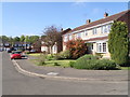
Area Overview for NN3 7LD
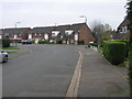
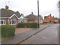
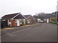
Photos of NN3 7LD
Area Information
Living in NN3 7LD offers a compact, well-defined residential experience in a small cluster of homes spread across 9 hectares. With a population of 1,812 people, this area is densely populated at 1,581 people per square kilometre, reflecting a tight-knit community. The demographic profile suggests a mature population, with a median age of 47 and the majority of residents aged 30–64. This makes NN3 7LD a place where families and established individuals coexist, often in owner-occupied homes. The area’s proximity to Northampton’s transport hubs and retail centres, combined with its low crime risk, positions it as a practical choice for those prioritising safety and convenience. Daily life here is shaped by the availability of nearby amenities, from supermarkets to public transport, while the absence of major environmental constraints ensures a straightforward living environment. For buyers, the area’s small size and focused layout mean that proximity to essential services is a key feature, though the limited housing stock may require careful consideration of location and timing when entering the market.
- Area Type
- Postcode
- Area Size
- 9.0 hectares
- Population
- 1812
- Population Density
- 1581 people/km²
The property market in NN3 7LD is characterised by high home ownership (83%) and a focus on houses rather than flats or other forms of accommodation. This suggests a market where long-term residency is common, with fewer rental properties available. The small area size of 9 hectares means the housing stock is limited, likely comprising a mix of older and newer homes. Buyers should consider that the proximity to Northampton’s transport networks and retail amenities may make this area appealing for those seeking a balance between urban accessibility and residential tranquillity. However, the limited number of properties could mean competition for available homes, particularly in desirable locations. For those prioritising family-friendly living, the presence of nearby schools and low crime risk may further enhance the area’s appeal. Potential buyers should also note that the compact nature of NN3 7LD means that property values may be influenced more by proximity to key services than by broader regional trends.
House Prices in NN3 7LD
Showing 59 properties
| Address | Type | Beds | Baths | Last Sale Price | Last Sale Date | |
|---|---|---|---|---|---|---|
| 14 Cottingham Drive, Northampton, NN3 7LD | Detached | 3 | 1 | £286,000 | Oct 2025 | |
| 29 Cottingham Drive, Northampton, NN3 7LD | Terraced | 3 | 1 | £212,850 | Mar 2025 | |
| 4 Cottingham Drive, Northampton, NN3 7LD | Detached | 3 | 1 | £275,000 | May 2024 | |
| 9 Cottingham Drive, Northampton, NN3 7LD | Terraced | 3 | 1 | £250,000 | Oct 2023 | |
| 26 Cottingham Drive, Northampton, NN3 7LD | Detached | 3 | 1 | £325,000 | Aug 2023 | |
| 23 Cottingham Drive, Northampton, NN3 7LD | Terraced | 2 | 1 | £210,000 | Apr 2023 | |
| 12 Cottingham Drive, Northampton, NN3 7LD | Detached | 3 | 1 | £310,000 | Feb 2023 | |
| 65 Cottingham Drive, Northampton, NN3 7LD | house | - | - | £335,000 | Mar 2021 | |
| 16 Cottingham Drive, Northampton, NN3 7LD | Semi-detached | 3 | 1 | £210,000 | May 2020 | |
| 44 Cottingham Drive, Northampton, NN3 7LD | Semi-detached | 2 | 1 | £212,000 | Apr 2020 |
Energy Efficiency in NN3 7LD
The lifestyle in NN3 7LD is shaped by its proximity to retail and transport hubs. Within practical reach are five retail outlets, including Co-op Moulton, Tesco Spinny, and Aldi Overstone, ensuring everyday shopping needs are met. The presence of two bus interchanges and a railway station enhances mobility, allowing residents to access Northampton’s cultural and commercial centres. While parks and leisure facilities are not explicitly listed, the area’s low environmental risk assessments suggest it is free from constraints that might limit recreational spaces. The convenience of nearby amenities, combined with the absence of major planning restrictions, creates a functional living environment. However, the limited number of venues means that residents may need to travel further for specialist services, such as larger supermarkets or entertainment options.
Amenities
Schools
The nearest school to NN3 7LD is Northampton School, an academy. While no Ofsted rating is provided, the presence of a single academy suggests a focus on structured, potentially high-achieving education. Families in the area may benefit from the school’s proximity, though the lack of additional schools—such as primary or specialist institutions—means parents may need to consider commuting for other educational stages. The absence of data on school performance or diversity in educational options is notable, but the availability of at least one academy provides a baseline for families seeking a structured learning environment. Given the area’s adult demographic skew, it is possible that many residents have children attending schools further afield, though the existing school serves as a key local resource.
| Rank | School | Type | Entry gender | Ages |
|---|
Explore more schools in this area
Go to Schools tabDemographics
The community in NN3 7LD is predominantly composed of adults aged 30–64, with a median age of 47. This suggests a population that is largely settled, with many residents likely in their peak working years or nearing retirement. Home ownership is high, at 83%, indicating a stable housing market where most properties are owned rather than rented. The accommodation type is primarily houses, which aligns with the area’s residential character. The predominant ethnic group is White, though specific data on diversity or minority representation is not provided. The population density of 1,581 people per square kilometre highlights a closely packed community, which may influence the social dynamics and availability of shared spaces. While no explicit data on deprivation levels is included, the high home ownership and low crime risk suggest a relatively affluent or stable environment. However, the absence of detailed socioeconomic breakdowns means the full picture of quality of life remains partially opaque.
Household Size
Accommodation Type
Tenure
Ethnic Group
Religion
Household Composition
Age
Household Deprivation
NS-SEC
Explore more demographic insights in this area
Go to Demographics tabPlanning
Planning Constraints
- Flood RiskPremium
- Ramsar Wetland SitesPremium
- Area of Outstanding Natural BeautyPremium
- Protected Nature ReservePremium
- Protected WoodlandPremium