Area Overview for NN3 7LG
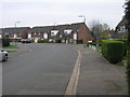
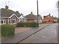
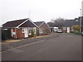
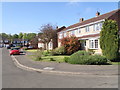
Photos of NN3 7LG
Area Information
NN3 7LG is a compact residential postcode area in England, covering just 2.3 hectares and home to 1,877 residents. Its high population density of 82,498 people per square kilometre reflects a tightly knit community, though the area’s small size means it is best suited for those prioritising proximity to essential services over expansive living space. The neighbourhood is characterised by a mature demographic, with a median age of 47 and a majority of residents aged 30–64. This suggests a stable, established community with a focus on homeownership, which accounts for 77% of properties. The area’s limited footprint means daily life is centred around nearby amenities, including retail outlets, transport hubs, and a special school. While it lacks large green spaces or natural features, its accessibility to Northampton’s infrastructure—such as the railway station and bus interchanges—makes it appealing for commuters. For buyers, NN3 7LG offers a blend of practicality and convenience, though its size means the housing stock is limited to a small cluster of homes.
- Area Type
- Postcode
- Area Size
- 2.3 hectares
- Population
- 1877
- Population Density
- 2064 people/km²
The property market in NN3 7LG is dominated by owner-occupied homes, with 77% of properties in private hands. The accommodation type is predominantly houses, which is unusual for a small postcode area but suggests a focus on family-friendly or semi-detached housing. Given the area’s limited size—just 2.3 hectares—there is little scope for new developments, meaning the housing stock is likely to remain static. This makes the market highly competitive for buyers, with limited options for both first-time buyers and those seeking to expand their property portfolios. The high home ownership rate indicates a stable market, with little pressure from rental demand. However, the small footprint of the area means buyers must consider proximity to nearby amenities, such as Northampton’s transport links and retail hubs, as the immediate surroundings are the primary source of additional options.
House Prices in NN3 7LG
Showing 51 properties
| Address | Type | Beds | Baths | Last Sale Price | Last Sale Date | |
|---|---|---|---|---|---|---|
| Hawkstone, 60 Cottingham Drive, Northampton, NN3 7LG | Terraced | 3 | 1 | £272,500 | Jun 2025 | |
| 106 Cottingham Drive, Northampton, NN3 7LG | Terraced | 3 | 2 | £245,000 | May 2025 | |
| 101 Cottingham Drive, Northampton, NN3 7LG | house | - | - | £318,000 | Apr 2025 | |
| 94 Cottingham Drive, Northampton, NN3 7LG | Terraced | 3 | 1 | £220,000 | Jul 2024 | |
| 96 Cottingham Drive, Northampton, NN3 7LG | house | 3 | 1 | £293,000 | Jul 2024 | |
| 87 Cottingham Drive, Northampton, NN3 7LG | house | 3 | 1 | £275,000 | Jun 2022 | |
| 103 Cottingham Drive, Northampton, NN3 7LG | Semi-detached | 3 | - | £227,500 | Jan 2022 | |
| 91 Cottingham Drive, Northampton, NN3 7LG | Terraced | 3 | - | £220,000 | Oct 2021 | |
| 72 Cottingham Drive, Northampton, NN3 7LG | house | - | - | £235,000 | Jun 2021 | |
| 88 Cottingham Drive, Northampton, NN3 7LG | Terraced | 3 | - | £228,000 | Oct 2020 |
Energy Efficiency in NN3 7LG
The lifestyle in NN3 7LG is shaped by its proximity to essential amenities within practical reach. Retail options include Co-op Moulton, Tesco Spinny, and Aldi Overstone, offering a range of shopping needs. The area’s transport links, including Northampton Bus Interchange and the railway station, provide access to broader networks for commuting and travel. While the data does not mention parks or leisure facilities, the presence of multiple retail and transport hubs suggests a practical, service-oriented lifestyle. The compact nature of the area means residents rely on nearby towns for more extensive amenities, but the immediate vicinity offers sufficient convenience for daily needs.
Amenities
Schools
The nearest school to NN3 7LG is On Track Education, a special school with a good Ofsted rating. This suggests the area is well served for families with children requiring specialist education, though no mainstream schools are listed in the data. The presence of a special school indicates a focus on inclusivity and support for students with specific needs, but it does not provide information on primary or secondary education options. For families requiring a broader range of schooling, proximity to Northampton’s larger educational institutions would be critical. The lack of additional schools in the immediate vicinity means buyers should investigate further to ensure access to comprehensive educational facilities.
| Rank | School | Type | Entry gender | Ages |
|---|
Explore more schools in this area
Go to Schools tabDemographics
The population of NN3 7LG is predominantly adults aged 30–64, with a median age of 47. This indicates a community of middle-aged residents, likely focused on long-term stability rather than transient lifestyles. Homeownership is high at 77%, suggesting most residents are either long-term residents or have purchased properties in the area. The accommodation type is primarily houses, which aligns with the area’s compact size and the prevalence of owner-occupied homes. The predominant ethnic group is White, though no data on diversity or deprivation levels is provided. The high home ownership rate and mature age profile suggest a low turnover of residents, contributing to a sense of continuity. However, the lack of specific data on income levels or deprivation means the area’s economic profile remains unclear. For prospective buyers, the demographic profile implies a quiet, settled neighbourhood with limited pressure from rental demand or speculative investment.
Household Size
Accommodation Type
Tenure
Ethnic Group
Religion
Household Composition
Age
Household Deprivation
NS-SEC
Explore more demographic insights in this area
Go to Demographics tabPlanning
Planning Constraints
- Flood RiskPremium
- Ramsar Wetland SitesPremium
- Area of Outstanding Natural BeautyPremium
- Protected Nature ReservePremium
- Protected WoodlandPremium