Area Overview for NN3 7TU
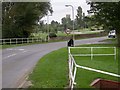
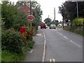
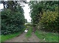
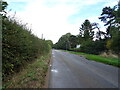
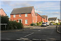
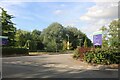
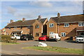
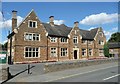
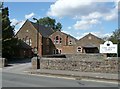
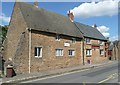
Photos of NN3 7TU


Area Information
Living in NN3 7TU means being part of a tightly knit residential cluster in England, covering 9.2 hectares and home to 2141 people. The area has a population density of 306 people per square kilometre, creating a compact, community-oriented environment. With a median age of 47, the area is predominantly populated by adults aged 30-64, many of whom are homeowners. This suggests a stable, established community where most properties are owner-occupied. The small size of the postcode means residents share a close proximity to local amenities, schools, and transport links. While the area lacks natural conservation designations like AONB or Ramsar sites, its low flood risk and below-average crime rates make it a practical choice for families seeking safety and convenience. NN3 7TU is not a sprawling suburb but a focused, functional postcode where daily life is shaped by nearby retail, transport hubs, and educational institutions. Its appeal lies in its balance of practicality and accessibility, making it suitable for those prioritising security and proximity to essential services.
- Area Type
- Postcode
- Area Size
- 9.2 hectares
- Population
- 2141
- Population Density
- 306 people/km²
The property market in NN3 7TU is characterised by a high rate of home ownership (65%) and a predominance of houses. This suggests a residential area where most properties are owner-occupied, rather than rented out. The focus on houses rather than flats or apartments indicates a preference for traditional family homes, which may appeal to buyers seeking spacious, long-term living options. Given the small size of the postcode (9.2 hectares), the housing stock is limited, meaning buyers may need to consider nearby areas for a broader selection. The presence of multiple schools and transport links within reach also adds to the area’s desirability for families. However, the small size of NN3 7TU means property availability is constrained, and prices may reflect the demand for secure, established homes in a low-risk environment. Buyers should be aware that the market is likely to cater more to existing residents than new arrivals.
House Prices in NN3 7TU
Showing 14 properties
| Address | Type | Beds | Baths | Last Sale Price | Last Sale Date | |
|---|---|---|---|---|---|---|
| 2 Greensleeves Close, Moulton, NN3 7TU | Retail | 5 | 3 | £690,000 | May 2022 | |
| 10 Greensleeves Close, Moulton, NN3 7TU | house | - | - | £549,995 | Apr 2019 | |
| 8 Greensleeves Close, Moulton, NN3 7TU | Detached | 5 | 3 | £589,995 | Apr 2019 | |
| 14 Greensleeves Close, Moulton, NN3 7TU | house | - | - | £599,995 | Feb 2019 | |
| 12 Greensleeves Close, Moulton, NN3 7TU | house | - | - | £549,995 | Jan 2019 | |
| 6 Greensleeves Close, Moulton, NN3 7TU | house | - | - | £474,995 | Nov 2018 | |
| 4 Greensleeves Close, Moulton, NN3 7TU | house | - | - | £479,995 | Oct 2018 | |
| 1 Greensleeves Close, Moulton, NN3 7TU | house | - | - | £158,444 | Mar 2018 | |
| 3 Greensleeves Close, Moulton, NN3 7TU | house | - | - | - | - | |
| 7 Greensleeves Close, Moulton, NN3 7TU | house | - | - | - | - |
Energy Efficiency in NN3 7TU
Daily life in NN3 7TU is shaped by its proximity to essential amenities, including retail, transport, and leisure options. The area’s retail offerings include Co-op Moulton, Aldi Overstone, and Tesco Spinny, providing access to groceries and everyday essentials. These shops are within practical reach, reducing the need for long journeys to larger centres. Transport links are equally convenient, with Northampton Railway Station and two bus interchanges offering connections to nearby cities and universities. While the area lacks major parks or leisure facilities, its compact size ensures residents can access nearby attractions in Northampton. The presence of multiple schools and transport hubs contributes to a functional, community-focused lifestyle, where convenience and accessibility are prioritised over sprawling recreational spaces.
Amenities
Schools
Residents of NN3 7TU have access to a range of educational institutions, including primary and sixth-form schools. Moulton Primary School, rated ‘good’ by Ofsted, provides early education for younger children, while Moulton School and Science College, also rated ‘good’, offers secondary education. Moulton College, a sixth-form institution, supports older students preparing for higher education or vocational training. The presence of both primary and secondary schools in the area ensures a seamless educational pathway for families. For those needing further education, the proximity to Northampton Railway Station and bus interchanges facilitates access to larger academic institutions. The variety of school types reflects the area’s role in supporting both local and regional educational needs, making it a practical choice for families prioritising schooling options.
| Rank | School | Type | Entry gender | Ages |
|---|
Explore more schools in this area
Go to Schools tabDemographics
The community in NN3 7TU is defined by its age profile and home ownership patterns. With a median age of 47, the area is dominated by adults aged 30-64, reflecting a mature population with established careers and families. Home ownership stands at 65%, indicating a strong presence of long-term residents. The predominant accommodation type is houses, which aligns with the area’s residential character. The predominant ethnic group is White, though no specific data on diversity or deprivation is provided. This demographic structure suggests a stable, middle-aged population with a focus on family living. The absence of data on deprivation means the area’s quality of life cannot be fully assessed in that regard, but the low crime risk and flood safety scores imply a generally secure environment. For buyers, this profile suggests a community where property values may hold steady, and local services cater to a consistent, non-transient population.
Household Size
Accommodation Type
Tenure
Ethnic Group
Religion
Household Composition
Age
Household Deprivation
NS-SEC
Explore more demographic insights in this area
Go to Demographics tabPlanning
Planning Constraints
- Flood RiskPremium
- Ramsar Wetland SitesPremium
- Area of Outstanding Natural BeautyPremium
- Protected Nature ReservePremium
- Protected WoodlandPremium