Area Overview for NN3 7LB
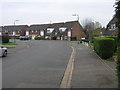
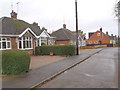
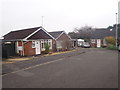
Photos of NN3 7LB
Area Information
NN3 7LB is a small, densely populated residential cluster in England, covering just 1.3 hectares and home to 1,877 residents. With a population density of 143,143 people per square kilometre, this area is compact but functional, offering a mix of daily conveniences. The community is predominantly composed of adults aged 30–64, with a median age of 47, suggesting a mature, stable population. Most residents own their homes, reflecting a strong sense of local attachment. Daily life here is shaped by proximity to essential services, including retail outlets like Tesco Spinny and Co-op Moulton, as well as transport hubs such as Northampton Railway Station. While the area’s size is limited, its strategic location near Northampton provides access to broader urban amenities. The presence of a special school with a good Ofsted rating, On Track Education, underscores the area’s focus on family needs. For those seeking a tight-knit, low-maintenance lifestyle with easy access to transport and retail, NN3 7LB offers a pragmatic, community-driven environment.
- Area Type
- Postcode
- Area Size
- 1.3 hectares
- Population
- 1877
- Population Density
- 2064 people/km²
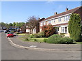
NN3 7LB is primarily an owner-occupied area, with 77% of residents living in homes they own. The accommodation type is predominantly houses, which is unusual for a small postcode area but suggests a focus on family-friendly housing. This composition indicates a market where property buyers are likely to be long-term residents or families seeking stability. The limited size of the area—just 1.3 hectares—means the housing stock is constrained, potentially leading to competition among buyers. For those considering the area, the high home ownership rate implies a lack of rental properties, which could be a consideration for investors or those seeking tenancy options. The presence of nearby transport links, including Northampton Railway Station, may also influence property values, as accessibility to urban centres is a key factor for buyers. However, the small scale of the area means that immediate surroundings, rather than the postcode itself, may hold more variety in housing types.
House Prices in NN3 7LB
Showing 28 properties
| Address | Type | Beds | Baths | Last Sale Price | Last Sale Date | |
|---|---|---|---|---|---|---|
| 27 Hallam Close, Northampton, NN3 7LB | Terraced | 4 | 1 | £210,000 | Jun 2023 | |
| 26 Hallam Close, Northampton, NN3 7LB | Semi-detached | 3 | - | £180,000 | Feb 2020 | |
| 3 Hallam Close, Northampton, NN3 7LB | Terraced | 4 | 1 | £198,000 | Aug 2019 | |
| 15 Hallam Close, Northampton, NN3 7LB | Terraced | 2 | 1 | £160,000 | May 2019 | |
| 19 Hallam Close, Northampton, NN3 7LB | Terraced | 2 | 1 | £175,000 | May 2019 | |
| 11 Hallam Close, Northampton, NN3 7LB | Terraced | 3 | 1 | £183,500 | Nov 2017 | |
| 14 Hallam Close, Northampton, NN3 7LB | Terraced | 2 | - | £158,000 | Sep 2017 | |
| 25 Hallam Close, Northampton, NN3 7LB | Terraced | 4 | - | £124,995 | May 2012 | |
| 6 Hallam Close, Northampton, NN3 7LB | house | - | - | £124,995 | Mar 2012 | |
| 16 Hallam Close, Northampton, NN3 7LB | Terraced | 2 | 1 | £98,000 | Feb 2010 |
Energy Efficiency in NN3 7LB
Living in NN3 7LB offers access to a range of essential amenities within close proximity. Retail options include major chains such as Tesco Spinny, Co-op Moulton, and Aldi Overstone, ensuring everyday shopping needs are met. The area’s transport links, including Northampton Bus Interchange and the University Bus Interchange, provide easy access to broader retail and leisure opportunities in Northampton. While the postcode itself lacks parks or recreational spaces, the surrounding area likely offers green spaces for relaxation. The presence of a railway station and multiple bus routes enhances mobility, allowing residents to explore dining, cultural events, and other facilities in nearby towns. The compact nature of the area means that daily life is centred around these immediate amenities, creating a convenient but limited lifestyle. For those prioritising accessibility over expansive leisure options, NN3 7LB delivers practical convenience.
Amenities
Schools
The nearest school to NN3 7LB is On Track Education, a special school with a good Ofsted rating. This institution caters to students with specific educational needs, providing tailored support and resources. While the area lacks other schools, the presence of a well-rated special school suggests that families with children requiring specialist education may find the area suitable. However, the absence of primary or secondary schools within the postcode means that residents must rely on nearby institutions in Northampton or surrounding areas for broader educational needs. This dynamic could be a consideration for families prioritising a comprehensive school network. The good Ofsted rating for On Track Education indicates a commitment to quality, but prospective buyers should factor in the need for additional schooling options when evaluating the area’s suitability for their household.
| Rank | School | Type | Entry gender | Ages |
|---|
Explore more schools in this area
Go to Schools tabDemographics
The population of NN3 7LB skews towards adults aged 30–64, with a median age of 47, indicating a mature demographic. Home ownership is high, at 77%, with most properties being houses rather than flats. The predominant ethnic group is White, reflecting the area’s homogeneity. With 1,877 residents in a 1.3-hectare space, the population density is exceptionally high—143,143 people per square kilometre—suggesting tightly packed living conditions. This density may impact personal space but also fosters a close-knit community. The absence of specific deprivation data means quality of life factors like access to services and safety must be inferred from available metrics. For instance, the low crime risk score of 67/100 suggests a relatively secure environment. However, the high density and limited green spaces may influence lifestyle choices, with residents relying heavily on nearby amenities for leisure and social interaction.
Household Size
Accommodation Type
Tenure
Ethnic Group
Religion
Household Composition
Age
Household Deprivation
NS-SEC
Explore more demographic insights in this area
Go to Demographics tabPlanning
Planning Constraints
- Flood RiskPremium
- Ramsar Wetland SitesPremium
- Area of Outstanding Natural BeautyPremium
- Protected Nature ReservePremium
- Protected WoodlandPremium