Area Overview for NN3 7DB
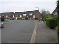
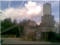
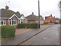
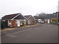
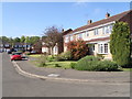
Photos of NN3 7DB
Area Information
NN3 7DB is a small, densely populated residential cluster in England, covering just 1.6 hectares. With 1,877 residents, it is a compact area characterised by a high population density of 114,405 people per square kilometre. This suggests a tightly knit community, though the area’s size means it is likely to feel intimate rather than sprawling. The postcode is home to a predominantly mature population, with a median age of 47 and most residents falling within the 30–64 age range. This demographic profile indicates a stable, established neighbourhood, likely with long-term residents. The area’s housing stock is largely composed of owner-occupied properties, with 77% of homes owned by their occupants. This mix of small-scale residential living and proximity to nearby amenities such as schools, retail, and transport hubs makes NN3 7DB a practical choice for those prioritising convenience and a settled lifestyle.
- Area Type
- Postcode
- Area Size
- 1.6 hectares
- Population
- 1877
- Population Density
- 2064 people/km²
The property market in NN3 7DB is dominated by owner-occupied homes, with 77% of properties owned by their occupants. This suggests a stable, long-term resident base rather than a transient rental market. The accommodation type is primarily houses, which is unusual for a small postcode area but may reflect the local housing stock’s character. Given the area’s compact size, the housing stock is likely limited, making it a niche market for buyers seeking specific properties. The high home ownership rate implies that properties may be held for longer periods, potentially offering security for buyers. However, the small area size means that buyers should consider proximity to nearby amenities and transport links as key factors when evaluating the area’s appeal.
House Prices in NN3 7DB
Showing 43 properties
| Address | Type | Beds | Baths | Last Sale Price | Last Sale Date | |
|---|---|---|---|---|---|---|
| 8 Oundle Drive, Northampton, NN3 7DB | Detached | 3 | 1 | £250,000 | Jun 2025 | |
| 32 Oundle Drive, Northampton, NN3 7DB | Semi-detached | 3 | 1 | £236,500 | Mar 2025 | |
| 3 Oundle Drive, Northampton, NN3 7DB | Detached | 3 | 2 | £325,000 | Jan 2025 | |
| 62 Oundle Drive, Northampton, NN3 7DB | Semi-detached | 2 | 1 | £224,000 | Aug 2024 | |
| 30 Oundle Drive, Northampton, NN3 7DB | Terraced | 3 | 1 | £222,500 | Aug 2024 | |
| 5 Oundle Drive, Northampton, NN3 7DB | Semi-detached | 4 | 1 | £303,000 | Dec 2023 | |
| 54 Oundle Drive, Northampton, NN3 7DB | Bungalow | 2 | 1 | £275,000 | Dec 2022 | |
| 27 Oundle Drive, Northampton, NN3 7DB | Semi-detached | 2 | - | £182,500 | May 2021 | |
| 52 Oundle Drive, Northampton, NN3 7DB | Bungalow | 2 | - | £208,000 | Nov 2019 | |
| 60 Oundle Drive, Northampton, NN3 7DB | Semi-detached | 2 | - | £197,500 | May 2019 |
Energy Efficiency in NN3 7DB
The lifestyle in NN3 7DB is supported by nearby amenities that cater to daily needs. Retail options include Tesco Spinny, Co-op Moulton, and Aldi Overstone, providing a range of shopping choices within practical reach. These stores likely offer convenience for residents, reducing the need for long trips. The area’s proximity to Northampton Bus Interchange and the University Bus Interchange enhances mobility, connecting residents to broader networks of services, leisure, and employment. While the data does not specify parks or leisure facilities, the presence of multiple retail and transport hubs suggests a functional, community-focused environment where daily errands and social activities are easily accessible.
Amenities
Schools
The nearest school to NN3 7DB is On Track Education, a special school with a good Ofsted rating. This indicates that the area is well served for families with children requiring specialist educational support. However, no other schools are listed in the data, which may mean that families without specific needs might need to look further afield for mainstream education options. The presence of a special school suggests that the community includes households with children who benefit from tailored learning environments. For buyers prioritising schools, it is important to consider whether this single option meets their needs or whether additional research into nearby districts is required.
| Rank | School | Type | Entry gender | Ages |
|---|
Explore more schools in this area
Go to Schools tabDemographics
The community in NN3 7DB is predominantly composed of adults aged 30–64, with a median age of 47. This suggests a mature, stable population with likely long-term ties to the area. Home ownership is high, at 77%, indicating a strong presence of owner-occupied properties rather than rental housing. The accommodation type is primarily houses, which aligns with the area’s compact, residential character. The predominant ethnic group is White, though no specific data on diversity or deprivation is provided. The high population density of 114,405 people per square kilometre reflects the area’s small size and concentrated living, which may influence the sense of community and access to shared resources. For buyers, this density could mean limited space for expansion but also proximity to essential services.
Household Size
Accommodation Type
Tenure
Ethnic Group
Religion
Household Composition
Age
Household Deprivation
NS-SEC
Explore more demographic insights in this area
Go to Demographics tabPlanning
Planning Constraints
- Flood RiskPremium
- Ramsar Wetland SitesPremium
- Area of Outstanding Natural BeautyPremium
- Protected Nature ReservePremium
- Protected WoodlandPremium