Area Overview for NN29 7TN
Photos of NN29 7TN


Area Information
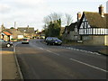
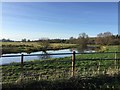
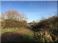
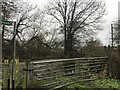
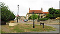
Living in NN29 7TN means being part of a compact, residential community in north-east England. The area covers just 4.4 hectares, housing 1,792 people at a density of 166 per square kilometre. This small cluster of homes is characterised by a quiet, settled atmosphere, with most residents being adults aged 30–64. Daily life here is defined by proximity to essential services, including two primary schools and a railway station in Wellingborough. The area’s low population density suggests a mix of family homes and single-occupancy properties, though the exact distribution isn’t specified. Proximity to Wellingborough, a nearby market town, likely provides access to broader amenities. With no major environmental constraints like protected woodlands or wetlands, the area is free from planning restrictions that could complicate property development or renovation. For those seeking a low-maintenance, stable environment, NN29 7TN offers a straightforward, uncluttered lifestyle.
- Area Type
- Postcode
- Area Size
- 4.4 hectares
- Population
- 1792
- Population Density
- 166 people/km²
NN29 7TN is a predominantly owner-occupied area, with 84% of residents living in homes they own. The accommodation type is exclusively houses, which is unusual for a small postcode area but suggests a focus on single-family dwellings rather than flats or shared housing. This makes the area appealing to buyers seeking stability and long-term investment, as owner-occupation rates often correlate with lower turnover. The small size of the area—just 4.4 hectares—means property stock is limited, which could drive competition among buyers. However, the absence of planning constraints like protected woodlands or wetlands may make it easier to renovate or extend homes. For those prioritising family-friendly living, the presence of two primary schools within reach adds value. The market here is likely niche, catering to those who prefer a quiet, low-density environment without the complexities of urban living.
House Prices in NN29 7TN
Showing 2 properties
| Address | Type | Beds | Baths | Last Sale Price | Last Sale Date | |
|---|---|---|---|---|---|---|
| 53-55 Lower Street, Great Doddington, NN29 7TN | house | - | - | £799,995 | Jan 2022 | |
| 59 Lower Street, Great Doddington, NN29 7TN | Detached | - | - | - | - |
Energy Efficiency in NN29 7TN
The lifestyle in NN29 7TN is shaped by its proximity to retail and transport hubs. Within practical reach are five retail outlets, including Sainsburys Wellingborough, Morrisons Daily, and Budgens Berrymoor, offering everyday shopping needs. The Wellingborough Railway Station provides access to nearby towns and cities, enhancing connectivity for commuters or those needing to travel further. While the area itself has limited amenities, its location near Wellingborough likely offers additional options for dining, leisure, and services. The small size of the area means community interactions are likely to be more personal, with residents relying on nearby towns for broader facilities. The absence of major parks or leisure facilities within the postcode suggests that outdoor activities may require travel, but the low population density and lack of environmental constraints could support local walks or cycling.
Amenities
Schools
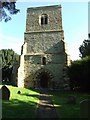
Residents of NN29 7TN have access to two primary schools: Great Doddington Primary and Wilby Church of England Primary School. Both institutions hold a satisfactory Ofsted rating, indicating they meet standard educational benchmarks but may not excel in areas like pupil outcomes or leadership. The presence of two primary schools within practical reach is a significant advantage for families, reducing the need for long commutes to education. The mix of state and church-affiliated schools offers some choice in educational philosophy, though no secondary schools are listed in the data. For parents prioritising convenience and basic educational standards, these schools provide a reliable foundation. However, the lack of secondary education options nearby may necessitate travel to Wellingborough or other nearby towns.
| Rank | School | Type | Entry gender | Ages |
|---|
Explore more schools in this area
Go to Schools tabDemographics
The community in NN29 7TN is predominantly composed of adults aged 30–64, with a median age of 47. This suggests a mature, established population, likely with strong family ties and long-term residency. Home ownership is high at 84%, indicating a stable housing market where most residents live in their own homes. The accommodation type is primarily houses, reflecting a suburban or semi-rural setting. The predominant ethnic group is White, though no specific diversity metrics are provided. The low population density of 166 people per square kilometre implies a spread-out, less crowded environment. With no data on deprivation levels, it’s unclear how economic factors might influence quality of life, but the high home ownership rate and absence of environmental constraints suggest a relatively self-sufficient, low-risk community.
Household Size
Accommodation Type
Tenure
Ethnic Group
Religion
Household Composition
Age
Household Deprivation
NS-SEC
Explore more demographic insights in this area
Go to Demographics tabPlanning
Planning Constraints
- Flood RiskPremium
- Ramsar Wetland SitesPremium
- Area of Outstanding Natural BeautyPremium
- Protected Nature ReservePremium
- Protected WoodlandPremium