Area Overview for NN29 7TL
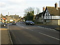
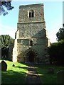
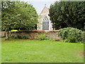
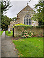
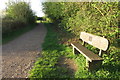
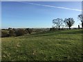
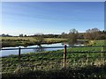
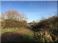
Photos of NN29 7TL
Area Information
Living in NN29 7TL offers a quiet, residential experience within a small cluster of homes. The area covers 18.4 hectares, housing 1,792 residents at a density of 166 people per square kilometre. This compact postcode is characterised by a stable, mature community, with most residents aged 30–64 years. The landscape is low-risk for flooding, with a safety score of 84, and no protected natural sites, making it a straightforward place to live. Daily life here is defined by proximity to essential services, including nearby shops, a railway station, and two primary schools. The area’s low crime rate and reliable broadband connectivity (100/100) support both remote work and family needs. While it lacks large-scale amenities, its small size fosters a close-knit environment. For those prioritising safety, practicality, and a slower pace of life, NN29 7TL provides a straightforward, no-frills option in a well-connected part of England.
- Area Type
- Postcode
- Area Size
- 18.4 hectares
- Population
- 1792
- Population Density
- 166 people/km²
NN29 7TL is primarily an owner-occupied area, with 84% of homes owned by residents rather than rented. The accommodation type is predominantly houses, not flats, which is unusual for a small postcode area. This suggests a housing stock tailored to families or individuals seeking more space, rather than urban renters. The high home ownership rate indicates a stable market with limited turnover, which can be advantageous for buyers seeking long-term value. However, the small size of the area means the property options are limited, and buyers may need to look beyond NN29 7TL for a broader selection. The absence of rental properties also means the area is less suited to those requiring flexibility in housing arrangements. For those prioritising ownership and space, this area offers a straightforward, low-risk investment.
House Prices in NN29 7TL
Showing 21 properties
| Address | Type | Beds | Baths | Last Sale Price | Last Sale Date | |
|---|---|---|---|---|---|---|
| 9 Lower Street, Great Doddington, NN29 7TL | Semi-detached | - | - | £350,000 | Mar 2021 | |
| 1-3 Lower Street, Great Doddington, NN29 7TL | Cottage | 3 | 2 | £280,000 | Oct 2018 | |
| 36 Lower Street, Great Doddington, NN29 7TL | Detached | 3 | 2 | £370,000 | Jun 2017 | |
| 31 Lower Street, Great Doddington, NN29 7TL | Detached | 3 | 1 | £336,000 | Aug 2016 | |
| 19 Lower Street, Great Doddington, NN29 7TL | Detached | 4 | 1 | £525,000 | Jun 2015 | |
| 24 Lower Street, Great Doddington, NN29 7TL | house | 3 | 2 | £190,000 | Mar 2010 | |
| 17 Lower Street, Great Doddington, NN29 7TL | house | - | - | £300,000 | Jan 2010 | |
| 39 Lower Street, Great Doddington, NN29 7TL | Detached | - | - | £155,000 | Jan 2007 | |
| 27 Lower Street, Great Doddington, NN29 7TL | Detached | - | - | £249,995 | Oct 2003 | |
| 7 Lower Street, Great Doddington, NN29 7TL | Land | - | - | £430,000 | May 2003 |
Energy Efficiency in NN29 7TL
The lifestyle in NN29 7TL is defined by practicality and proximity. Nearby amenities include five retail outlets, such as Budgens Berrymoor, Morrisons Daily, and Sainsburys Wellingborough, offering everyday shopping needs. The Wellingborough Railway Station provides access to regional travel, though the area lacks large-scale leisure or dining venues. Residents can expect a straightforward, no-frills existence, with essential services within reach but no extravagant amenities. The absence of parks or cultural hubs means the area is ideal for those prioritising convenience over luxury. For those who value a quiet, functional lifestyle with easy access to retail and rail, NN29 7TL delivers a simple, efficient daily experience.
Amenities
Schools
Residents of NN29 7TL have access to two primary schools: Great Doddington Primary and Wilby Church of England Primary School. Both institutions hold an Ofsted rating of satisfactory, indicating they meet basic standards but may not excel in specialist areas. The presence of two primary schools within practical reach ensures families have options for their children’s early education. However, the absence of secondary schools or further education facilities means students may need to travel to nearby towns for higher education. The mix of school types—both state and church-affiliated—provides some diversity in educational approaches, though the overall offering is limited by the area’s small size. For families prioritising proximity to schools, this area offers convenience, but broader educational opportunities lie beyond its boundaries.
| Rank | School | Type | Entry gender | Ages |
|---|
Explore more schools in this area
Go to Schools tabDemographics
The population of NN29 7TL is 1,792, with a median age of 47, reflecting a community dominated by adults aged 30–64 years. Home ownership is high, at 84%, indicating a stable, long-term resident base. The area is predominantly occupied by White residents, with no data provided on other ethnic groups. Most properties are houses, not flats, suggesting a family-oriented housing stock. The age profile and ownership rates imply a mature, settled population with limited turnover. The absence of specific data on deprivation or diversity means the area’s social dynamics are not fully detailed, but the figures suggest a cohesive, middle-aged community with strong ties to their homes. This demographic profile aligns with a neighbourhood that prioritises stability over transient living, offering a predictable, low-maintenance lifestyle.
Household Size
Accommodation Type
Tenure
Ethnic Group
Religion
Household Composition
Age
Household Deprivation
NS-SEC
Explore more demographic insights in this area
Go to Demographics tabPlanning
Planning Constraints
- Flood RiskPremium
- Ramsar Wetland SitesPremium
- Area of Outstanding Natural BeautyPremium
- Protected Nature ReservePremium
- Protected WoodlandPremium