Area Overview for NN29 7TJ
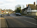
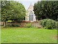
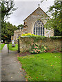
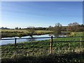
Photos of NN29 7TJ


Area Information
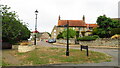
NN29 7TJ is a small residential postcode area in England, spanning 1959 square metres and home to 1792 people. With a population density of 166 people per square kilometre, it reflects a compact, low-density living environment. The area is characterised by a mix of traditional housing, with a strong emphasis on owner-occupied homes. Daily life here is shaped by its quiet, residential nature, offering a balance between suburban comfort and proximity to essential services. The community is anchored by local amenities such as retail stores and a railway station, while nearby schools provide educational options for families. The area’s low flood risk and crime score of 84/100 suggest a safe, stable environment. For those seeking a place with a distinct, manageable scale, NN29 7TJ offers a snapshot of English rural living, where the pace of life is measured and the sense of community is tangible.
- Area Type
- Postcode
- Area Size
- 1959 m²
- Population
- 1792
- Population Density
- 166 people/km²
The property market in NN29 7TJ is dominated by owner-occupied homes, with 84% of properties owned by residents. This suggests a stable, long-term housing stock rather than a rental-heavy market. The area’s accommodation type is primarily houses, which is typical for smaller, rural postcode areas. Given the low population density and compact size of the area, the housing stock is likely to be limited in scale, with fewer high-density developments. For buyers, this means a focus on individual properties rather than apartments or shared spaces. The high home ownership rate also indicates a community with a strong local attachment, which can influence property values and desirability. Those seeking a traditional, family-oriented home in a low-risk environment may find NN29 7TJ appealing.
House Prices in NN29 7TJ
Showing 6 properties
| Address | Type | Beds | Baths | Last Sale Price | Last Sale Date | |
|---|---|---|---|---|---|---|
| 2 Chapel Lane, Great Doddington, NN29 7TJ | Semi-detached | 3 | 1 | £260,000 | May 2017 | |
| 3 Chapel Lane, Great Doddington, NN29 7TJ | Semi-detached | - | - | £175,000 | May 2016 | |
| 6 Chapel Lane, Great Doddington, NN29 7TJ | house | 2 | - | £285,000 | May 2015 | |
| 4 Chapel Lane, Great Doddington, NN29 7TJ | house | 2 | - | £153,000 | Nov 2011 | |
| Solo Hair Design, Hair Dressing Room, 2 Chapel Lane, Great Doddington, NN29 7TJ | shop | - | - | - | - | |
| 5 Chapel Lane, Great Doddington, NN29 7TJ | Detached | 1 | 1 | - | - |
Energy Efficiency in NN29 7TJ
The lifestyle in NN29 7TJ is shaped by its proximity to retail and transport hubs. Nearby amenities include five retail outlets, such as Budgens Berrymoor, Morrisons Daily, and Sainsburys Wellingborough, providing essential shopping options. These stores cater to daily needs, from groceries to household items, reducing the need for long commutes. The Wellingborough Railway Station adds convenience, linking residents to regional services and employment centres. While the area lacks large parks or leisure facilities, its small size means amenities are closely grouped, fostering a sense of walkability. The combination of retail access and transport links supports a practical, low-stress lifestyle, ideal for those prioritising convenience over expansive recreational spaces.
Amenities
Schools
Residents of NN29 7TJ have access to two primary schools: Great Doddington Primary and Wilby Church of England Primary School. Both institutions hold a satisfactory Ofsted rating, reflecting a baseline standard of education. The presence of two primary schools within reach suggests a focus on local schooling, which is often a priority for families. The mix of school types—state and church-affiliated—provides options for parents with different preferences. While no secondary schools are listed, the proximity to these primary schools may indicate a broader network of educational facilities nearby. For families, the availability of these schools is a practical consideration, though the ratings suggest there may be room for improvement in educational outcomes.
| Rank | School | Type | Entry gender | Ages |
|---|
Explore more schools in this area
Go to Schools tabDemographics
The population of NN29 7TJ has a median age of 47, with the majority of residents falling within the 30-64 age range. This suggests a community skewed towards adults, likely including families and professionals. Home ownership is high, at 84%, with houses being the predominant accommodation type. The area’s demographic profile indicates a stable, mature population, with little evidence of younger or transient demographics. The predominant ethnic group is White, though specific data on diversity or deprivation is not provided. The age distribution and ownership rates imply a settled, long-term resident base. For those considering relocation, this profile may align with buyers seeking a low-maintenance, family-friendly environment with minimal turnover.
Household Size
Accommodation Type
Tenure
Ethnic Group
Religion
Household Composition
Age
Household Deprivation
NS-SEC
Explore more demographic insights in this area
Go to Demographics tabPlanning
Planning Constraints
- Flood RiskPremium
- Ramsar Wetland SitesPremium
- Area of Outstanding Natural BeautyPremium
- Protected Nature ReservePremium
- Protected WoodlandPremium