Area Overview for NN29 7TG
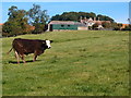
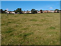
Photos of NN29 7TG


Area Information
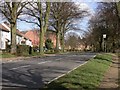
Living in NN29 7TG means being part of a small, tightly knit residential cluster in England. The area spans 7,895 square metres, housing 1,792 residents at a density of 166 people per square kilometre. This compact postcode is characterised by a quiet, suburban feel, with homes primarily occupied by owners rather than renters. The community is centred around local amenities, including a railway station and nearby shops, making daily life convenient. While the area is small, it offers a balance of residential tranquillity and practical access to services. The absence of major planning constraints, such as protected woodlands or natural beauty areas, means development is unlikely to disrupt the existing character. For those seeking a peaceful yet connected environment, NN29 7TG provides a stable base with low crime rates and reliable digital infrastructure. Its proximity to Wellingborough and surrounding areas ensures easy access to larger towns without sacrificing the charm of a smaller neighbourhood.
- Area Type
- Postcode
- Area Size
- 7895 m²
- Population
- 1792
- Population Density
- 166 people/km²
The property market in NN29 7TG is dominated by owner-occupied homes, with 84% of residences owned by their occupants. This high home ownership rate suggests a stable, long-term community with limited rental activity. The accommodation type is primarily houses, indicating a focus on family homes rather than apartments or terraced properties. Given the area’s small size, the housing stock is likely limited, making it a niche market for buyers seeking a quiet, suburban environment. The absence of planning constraints such as protected woodlands or areas of outstanding natural beauty means development restrictions are minimal, though the small size of the postcode may limit property availability. For buyers, this means a focus on existing homes rather than new builds, with potential for investment in a stable, low-risk area. The proximity to Wellingborough and nearby amenities also adds value, offering a balance of local convenience and regional connectivity.
House Prices in NN29 7TG
Showing 16 properties
| Address | Type | Beds | Baths | Last Sale Price | Last Sale Date | |
|---|---|---|---|---|---|---|
| 4 St Nicholas Road, Great Doddington, NN29 7TG | house | - | - | £240,000 | Sep 2020 | |
| 3 St Nicholas Road, Great Doddington, NN29 7TG | Semi-detached | 3 | 1 | £222,500 | May 2020 | |
| 11 St Nicholas Road, Great Doddington, NN29 7TG | Semi-detached | 3 | 1 | £255,000 | Aug 2019 | |
| 8 St Nicholas Road, Great Doddington, NN29 7TG | Semi-detached | 3 | 1 | £217,000 | Jan 2019 | |
| 1 St Nicholas Road, Great Doddington, NN29 7TG | house | - | - | £165,000 | Jul 2015 | |
| 13 St Nicholas Road, Great Doddington, NN29 7TG | house | 3 | - | £180,000 | Aug 2012 | |
| 9 St Nicholas Road, Great Doddington, NN29 7TG | Semi-detached | - | - | £80,000 | Feb 2001 | |
| 2 St Nicholas Road, Great Doddington, NN29 7TG | Semi-detached | - | - | - | - | |
| 7 St Nicholas Road, Great Doddington, NN29 7TG | house | - | - | - | - | |
| 10 St Nicholas Road, Great Doddington, NN29 7TG | Semi-detached | - | - | - | - |
Energy Efficiency in NN29 7TG
The lifestyle in NN29 7TG is shaped by its proximity to retail and transport hubs. Within practical reach are five retail outlets, including Budgens Berrymoor, Morrisons Daily, and Sainsburys Wellingborough, offering everyday shopping convenience. The Wellingborough Railway Station provides access to regional services, enhancing connectivity for commuters and visitors. While the area lacks detailed information on parks or leisure facilities, the presence of multiple shops and a railway station suggests a practical, community-focused lifestyle. Residents can enjoy the benefits of local amenities without needing to travel far, making daily errands and social activities manageable. The combination of retail options and transport links ensures a balance between suburban tranquillity and urban accessibility, catering to both independent living and regional engagement.
Amenities
Schools
Residents of NN29 7TG have access to two primary schools within practical reach: Great Doddington Primary and Wilby Church of England Primary School. Both institutions hold an Ofsted rating of ‘satisfactory’, indicating they meet acceptable standards of education. The presence of two primary schools provides families with options, though the data does not include secondary schools. This makes the area particularly suited for families with younger children, as the primary education is readily available. However, parents seeking secondary schooling may need to consider commuting to nearby towns. The ‘satisfactory’ rating suggests that while the schools are functional, there may be scope for improvement in areas such as teaching quality or facilities. For those prioritising proximity to schools, NN29 7TG offers a reliable, if modest, educational foundation.
| Rank | School | Type | Entry gender | Ages |
|---|
Explore more schools in this area
Go to Schools tabDemographics
The population of NN29 7TG is 1,792, with a median age of 47 and the majority of residents falling within the 30-64 age range. This suggests a community skewed towards middle-aged adults, likely including families and professionals. Home ownership is high, at 84%, indicating a strong presence of long-term residents. The accommodation type is predominantly houses, reflecting a residential area focused on family homes rather than flats or apartments. The predominant ethnic group is White, aligning with broader regional trends. While the data does not specify deprivation levels, the high home ownership and stable age profile imply a relatively affluent, settled population. The absence of detailed diversity metrics means the community’s cultural makeup remains less defined, but the area’s safety and infrastructure suggest it is appealing to a broad demographic seeking stability.
Household Size
Accommodation Type
Tenure
Ethnic Group
Religion
Household Composition
Age
Household Deprivation
NS-SEC
Explore more demographic insights in this area
Go to Demographics tabPlanning
Planning Constraints
- Flood RiskPremium
- Ramsar Wetland SitesPremium
- Area of Outstanding Natural BeautyPremium
- Protected Nature ReservePremium
- Protected WoodlandPremium