Area Overview for NN29 7NL
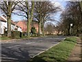
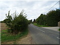
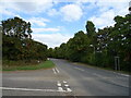
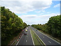
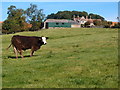
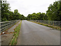
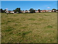
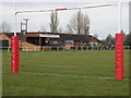
Photos of NN29 7NL

Area Information
Living in NN29 7NL means inhabiting a small, tightly knit residential cluster in England. The area spans 6,874 square metres and is home to 1,792 people, translating to a population density of 166 people per square kilometre. This is a quiet, low-density neighbourhood where daily life is shaped by proximity to local amenities and a strong sense of community. The area’s compact size means residents can access nearby shops, schools, and transport links within short distances. With no major infrastructure or industrial activity nearby, NN29 7NL offers a peaceful, residential environment. Its small footprint and manageable population make it ideal for those seeking a slower pace of life, though it lacks the vibrancy of larger towns. The presence of a railway station at Wellingborough and nearby retail outlets like Sainsburys and Morrisons ensures practical connectivity for daily needs. For buyers, this area represents a niche opportunity to own a home in a setting that prioritises tranquillity over urban convenience.
- Area Type
- Postcode
- Area Size
- 6874 m²
- Population
- 1792
- Population Density
- 166 people/km²
The property market in NN29 7NL is defined by high home ownership and a focus on residential houses. With 84% of properties owned by residents, this is not a rental-heavy area, suggesting a community of long-term occupants. The accommodation type is exclusively houses, which contrasts with areas where flats or apartments dominate. This housing stock appeals to buyers seeking traditional, spacious homes rather than modern, high-density living. Given the area’s small size and limited development, property availability is constrained, making it a niche market. Buyers should consider that the surrounding area may offer similar options, but NN29 7NL itself is unlikely to expand significantly. The emphasis on owner-occupation also implies a conservative, stable market with fewer speculative investments.
House Prices in NN29 7NL
Showing 19 properties
| Address | Type | Beds | Baths | Last Sale Price | Last Sale Date | |
|---|---|---|---|---|---|---|
| 1 Frost Court, Great Doddington, NN29 7NL | Semi-detached | 4 | 4 | £315,000 | Jun 2024 | |
| 11 Frost Court, Great Doddington, NN29 7NL | Semi-detached | 4 | 2 | £298,000 | Feb 2021 | |
| 6 Frost Court, Great Doddington, NN29 7NL | Semi-detached | 3 | - | £235,000 | Jul 2020 | |
| 7 Frost Court, Great Doddington, NN29 7NL | house | - | - | £210,000 | Oct 2019 | |
| 10 Frost Court, Great Doddington, NN29 7NL | Detached | 4 | 4 | £360,000 | May 2019 | |
| 16 Frost Court, Great Doddington, NN29 7NL | Semi-detached | 4 | 2 | £245,000 | Nov 2018 | |
| 20 Frost Court, Great Doddington, NN29 7NL | Terraced | 5 | 2 | £252,000 | Sep 2017 | |
| 8 Frost Court, Great Doddington, NN29 7NL | Semi-detached | 3 | 1 | £185,000 | Mar 2017 | |
| 4 Frost Court, Great Doddington, NN29 7NL | Semi-detached | 4 | 2 | £267,500 | Jun 2015 | |
| 19 Frost Court, Great Doddington, NN29 7NL | Semi-detached | 3 | - | £222,000 | Jan 2015 |
Energy Efficiency in NN29 7NL
The lifestyle in NN29 7NL is shaped by its proximity to practical amenities. Nearby retail options include Budgens Berrymoor, Sainsburys Wellingborough, and Morrisons Daily, providing access to groceries, household goods, and everyday essentials. The Wellingborough Railway Station offers a direct link to regional transport networks, enhancing mobility for commuters. While the area lacks large leisure facilities or parks, its small size ensures that daily errands and social interactions can be managed without long journeys. The absence of major entertainment hubs means the lifestyle here is more subdued, appealing to those who prioritise convenience and quiet over urban vibrancy. Residents benefit from a balance of essential services and a low-density environment that minimises congestion.
Amenities
Schools
Residents of NN29 7NL have access to two primary schools: Great Doddington Primary and Wilby Church of England Primary School. Both institutions hold an Ofsted rating of satisfactory, indicating they meet acceptable standards of education but may not excel in all areas. The presence of two primary schools within reach is a practical advantage for families with young children, reducing the need for long commutes. However, the data does not mention secondary schools or other educational facilities, so parents may need to look further afield for comprehensive schooling. The mix of school types—both state and church-affiliated—offers some choice, though the limited number of schools reflects the area’s small size and modest population.
| Rank | School | Type | Entry gender | Ages |
|---|
Explore more schools in this area
Go to Schools tabDemographics
The community in NN29 7NL is predominantly composed of adults aged 30–64, with a median age of 47. This suggests a mature, stable population, likely with established careers and families. Home ownership is exceptionally high at 84%, indicating a strong preference for long-term residency over renting. The area is characterised by houses rather than flats, reflecting a traditional, family-oriented housing stock. The predominant ethnic group is White, though no specific data on diversity or deprivation levels is provided. The age profile and home ownership rates imply a community focused on stability and continuity. With no evidence of significant generational turnover, NN29 7NL appears to cater to those seeking a settled, low-maintenance lifestyle rather than a dynamic, evolving neighbourhood.
Household Size
Accommodation Type
Tenure
Ethnic Group
Religion
Household Composition
Age
Household Deprivation
NS-SEC
Explore more demographic insights in this area
Go to Demographics tabPlanning
Planning Constraints
- Flood RiskPremium
- Ramsar Wetland SitesPremium
- Area of Outstanding Natural BeautyPremium
- Protected Nature ReservePremium
- Protected WoodlandPremium