Area Overview for NN29 7TF
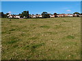
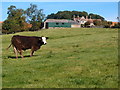
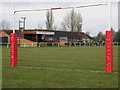
Photos of NN29 7TF

Area Information
Living in NN29 7TF means being part of a tightly knit residential cluster in north-western England. This area covers 9.9 hectares, housing 1,792 people at a density of 166 per square kilometre. Its compact size fosters a quiet, community-oriented atmosphere, with homes predominantly owner-occupied and focused on family living. The area’s proximity to Wellingborough offers access to larger amenities without the congestion of urban centres. Daily life here is characterised by a balance between rural tranquillity and practical connectivity, with nearby schools, shops, and rail links within practical reach. The demographic profile—skewed towards adults aged 30-64—suggests a mature, stable population, many of whom have lived in the area for years. While the postcode lacks natural or protected landscapes, its low flood risk and safety scores make it an appealing choice for those prioritising security and reliability. For buyers seeking a small, manageable area with clear boundaries and a distinct local identity, NN29 7TF offers a straightforward proposition.
- Area Type
- Postcode
- Area Size
- 9.9 hectares
- Population
- 1792
- Population Density
- 166 people/km²
The property market in NN29 7TF is dominated by owner-occupied homes, with 84% of properties in private hands. This high home ownership rate suggests a stable market with limited rental activity, making it less attractive for investors seeking short-term returns. The accommodation type is exclusively houses, which is unusual for a small postcode area but aligns with the low population density of 166 per square kilometre. This configuration implies a focus on single-family living, potentially limiting options for buyers seeking flats or shared housing. The small size of the area—just 9.9 hectares—means the housing stock is finite, so buyers should consider nearby suburbs for more choice. For those prioritising privacy and a traditional home environment, NN29 7TF offers a straightforward, low-risk proposition, though its limited scale may restrict long-term growth potential.
House Prices in NN29 7TF
Showing 63 properties
| Address | Type | Beds | Baths | Last Sale Price | Last Sale Date | |
|---|---|---|---|---|---|---|
| 34 John Gray Road, Great Doddington, NN29 7TF | Semi-detached | 3 | 1 | £290,000 | Jan 2025 | |
| 64 John Gray Road, Great Doddington, NN29 7TF | Semi-detached | 4 | 2 | £295,000 | Sep 2023 | |
| 57 John Gray Road, Great Doddington, NN29 7TF | Semi-detached | 2 | 1 | £276,000 | Sep 2023 | |
| 56 John Gray Road, Great Doddington, NN29 7TF | Semi-detached | 3 | 1 | £280,000 | Jul 2023 | |
| 11 John Gray Road, Great Doddington, NN29 7TF | Semi-detached | 3 | 2 | £262,500 | Oct 2022 | |
| 22 John Gray Road, Great Doddington, NN29 7TF | Retail | 3 | 1 | £285,000 | Jul 2022 | |
| 49 John Gray Road, Great Doddington, NN29 7TF | Detached | 3 | 1 | £265,000 | Jan 2021 | |
| 17 John Gray Road, Great Doddington, NN29 7TF | house | 3 | 1 | £235,000 | May 2020 | |
| 47 John Gray Road, Great Doddington, NN29 7TF | Semi-detached | 3 | 1 | £200,000 | Feb 2020 | |
| 35 John Gray Road, Great Doddington, NN29 7TF | Bungalow | - | - | £113,000 | Sep 2018 |
Energy Efficiency in NN29 7TF
The lifestyle in NN29 7TF is shaped by its proximity to retail and transport hubs. Five notable retail outlets are within reach, including Budgens Berrymoor, Sainsburys Wellingborough, and Morrisons Daily, providing convenient access to groceries and everyday essentials. The Wellingborough Railway Station adds practicality, enabling easy travel to nearby towns and cities. While the area lacks dedicated parks or leisure facilities, the nearby retail options and rail link contribute to a functional daily life. The compact size of the postcode means amenities are concentrated, reducing the need for long journeys. For residents, this translates to a lifestyle that balances convenience with a low-key, community-focused environment. The absence of sprawling commercial zones keeps the area uncluttered, though those seeking extensive leisure options may need to venture further afield.
Amenities
Schools
Residents of NN29 7TF have access to two primary schools within practical reach: Great Doddington Primary and Wilby Church of England Primary School. Both institutions hold a satisfactory Ofsted rating, indicating they meet baseline standards but may lack outstanding features. The presence of two primary schools serves the local community well, reducing the need for long commutes to education. However, the absence of secondary schools in the immediate area means families must look beyond NN29 7TF for secondary education. This could be a consideration for those planning for older children’s schooling. The school mix reflects a focus on early education, which is typical for smaller residential clusters. For buyers prioritising proximity to schools, the availability of primary options is a clear advantage, though secondary schooling remains a logistical factor to address.
| Rank | School | Type | Entry gender | Ages |
|---|
Explore more schools in this area
Go to Schools tabDemographics
The community in NN29 7TF is predominantly composed of adults aged 30-64, with a median age of 47. This suggests a mature population, likely with established careers and family ties. Home ownership is high, at 84%, indicating a stable, long-term resident base rather than a transient rental market. The accommodation type is primarily houses, which aligns with the area’s low density and suburban character. The predominant ethnic group is White, reflecting a homogenous demographic profile. While no specific data on deprivation is provided, the high home ownership and age distribution imply a relatively affluent, settled community. The absence of significant diversity metrics means the area’s social fabric is largely uniform, which may appeal to those seeking a familiar, low-entropy environment. For prospective buyers, this demographic structure suggests a neighbourhood where property values are likely to remain steady, with little pressure from rapid demographic shifts.
Household Size
Accommodation Type
Tenure
Ethnic Group
Religion
Household Composition
Age
Household Deprivation
NS-SEC
Explore more demographic insights in this area
Go to Demographics tabPlanning
Planning Constraints
- Flood RiskPremium
- Ramsar Wetland SitesPremium
- Area of Outstanding Natural BeautyPremium
- Protected Nature ReservePremium
- Protected WoodlandPremium