Area Overview for NN29 7PW
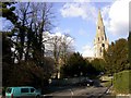
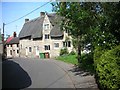
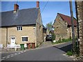
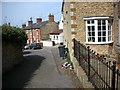
Photos of NN29 7PW


Area Information
NN29 7PW is a small, tightly knit residential cluster in England, covering just 1.7 hectares and home to 1,641 residents. Its compact size means it is not a sprawling suburb but a focused community with a population density of 609 people per square kilometre. This area is defined by its quiet, mature character, with a median age of 47 and a majority of residents aged between 30 and 64. The high home ownership rate—86%—suggests a stable, long-term population, with most properties being houses rather than flats. Living here offers proximity to essential services, including a railway station and multiple retail outlets, while the low crime risk and absence of environmental constraints make it a practical choice for families. The area’s small footprint means it is not a commuter hub, but its connectivity to Wellingborough and nearby amenities ensures residents are never far from shops, schools, and transport links. For those seeking a low-maintenance, family-friendly environment with minimal planning restrictions, NN29 7PW presents a straightforward, no-frills option.
- Area Type
- Postcode
- Area Size
- 1.7 hectares
- Population
- 1641
- Population Density
- 609 people/km²
The property market in NN29 7PW is dominated by owner-occupied homes, with 86% of residents living in properties they own. This high home ownership rate indicates a stable, long-term community with little reliance on the rental market. The accommodation type is primarily houses, which is unusual for a small postcode area but suggests a focus on family homes and single-unit properties. Given the area’s compact size, the housing stock is likely limited, meaning buyers may need to consider nearby postcodes for more options. The lack of flats or apartments implies a market that caters to those seeking private, low-density living. For buyers, this means a focus on individual properties with potential for long-term value, though the small size of the area may limit availability. The absence of planning constraints such as protected areas or AONB designations also makes it easier to develop or purchase properties without regulatory hurdles.
House Prices in NN29 7PW
Showing 42 properties
| Address | Type | Beds | Baths | Last Sale Price | Last Sale Date | |
|---|---|---|---|---|---|---|
| 12 Priory Road, Wollaston, NN29 7PW | Semi-detached | 4 | 2 | £299,995 | Nov 2024 | |
| 24 Priory Road, Wollaston, NN29 7PW | Bungalow | 3 | 1 | £270,000 | Nov 2024 | |
| 14 Priory Road, Wollaston, NN29 7PW | Semi-detached | 3 | 1 | £240,000 | Sep 2024 | |
| 29 Priory Road, Wollaston, NN29 7PW | house | - | - | £222,000 | Mar 2021 | |
| 41 Priory Road, Wollaston, NN29 7PW | Semi-detached | 4 | 1 | £245,000 | Dec 2019 | |
| 11 Priory Road, Wollaston, NN29 7PW | Semi-detached | 2 | 1 | £210,000 | Nov 2019 | |
| 1 Priory Road, Wollaston, NN29 7PW | Bungalow | 3 | 1 | £330,000 | Apr 2019 | |
| 45 Priory Road, Wollaston, NN29 7PW | house | - | - | £225,000 | Dec 2015 | |
| 25 Priory Road, Wollaston, NN29 7PW | Semi-detached | 3 | 1 | £147,000 | Aug 2013 | |
| 20 Priory Road, Wollaston, NN29 7PW | Semi-detached | 3 | 1 | £149,995 | Mar 2013 |
Energy Efficiency in NN29 7PW
Living in NN29 7PW offers access to a range of practical amenities within walking or short driving distance. The area is served by five retail outlets, including Co-op Wollaston, Co-op Irchester, and Tesco Wellingborough, providing everyday shopping needs. These stores cater to a community that values convenience, with a mix of local and national brands. The Wellingborough Railway Station is a key transport link, enabling easy access to nearby towns and services. While the area lacks large parks or recreational spaces, its proximity to Wellingborough suggests that residents can enjoy broader leisure options in the surrounding region. The compact nature of NN29 7PW means that daily life is focused on local needs, with a balance between practicality and minimal sprawl. The presence of a single school and essential shops ensures that residents can meet most of their needs without venturing far.
Amenities
Schools
The nearest schools to NN29 7PW include Wollaston School, which operates as both a primary school and an academy with a good Ofsted rating. This dual role provides families with a range of educational options, from early years to secondary-level schooling. The good Ofsted rating indicates that the school meets or exceeds national standards in teaching quality, pupil outcomes, and leadership. As an academy, it may have more autonomy in curriculum and resource allocation, which can be advantageous for parents seeking tailored education. The presence of a single school within practical reach suggests that families in NN29 7PW have access to a well-regarded local institution, reducing the need for long commutes to other areas. However, the absence of additional schools means that parents may need to consider nearby postcodes for alternative options.
| Rank | School | Type | Entry gender | Ages |
|---|
Explore more schools in this area
Go to Schools tabDemographics
The population of NN29 7PW is predominantly adults aged 30 to 64, with a median age of 47. This suggests a mature, established community with a focus on homeownership, as 86% of residents live in properties they own. The accommodation type is largely houses, reflecting a preference for single-family homes over flats or apartments. The predominant ethnic group is White, and while specific data on deprivation is not provided, the high home ownership rate and low crime risk imply a stable quality of life. With no significant age groups under 18 or over 65 represented, the area is not a retirement destination nor a place with a large student population. This demographic profile indicates a community that values continuity, with residents likely to have lived in the area for many years. The absence of rental properties also suggests limited turnover, reinforcing the sense of permanence.
Household Size
Accommodation Type
Tenure
Ethnic Group
Religion
Household Composition
Age
Household Deprivation
NS-SEC
Explore more demographic insights in this area
Go to Demographics tabPlanning
Planning Constraints
- Flood RiskPremium
- Ramsar Wetland SitesPremium
- Area of Outstanding Natural BeautyPremium
- Protected Nature ReservePremium
- Protected WoodlandPremium