Area Overview for NN29 7SN
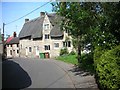
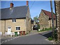
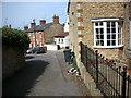
Photos of NN29 7SN


Area Information
NN29 7SN is a small residential cluster in England, covering 1.4 hectares and home to 1,641 people. With a population density of 609 people per square kilometre, it is a compact, tightly knit area. The community is predominantly composed of adults aged 30–64, with a median age of 47, reflecting a mature, stable population. Home ownership is high at 86%, with most properties being houses rather than flats. This suggests a residential character focused on family living and long-term occupancy. The area’s safety is notable, with a crime risk score of 77, placing it below average for the region. Digital connectivity is robust, with a broadband score of 99, ensuring reliable internet access. Living here means balancing proximity to local amenities with a sense of security and practicality, ideal for those seeking a settled, low-risk environment without sacrificing connectivity.
- Area Type
- Postcode
- Area Size
- 1.4 hectares
- Population
- 1641
- Population Density
- 609 people/km²
NN29 7SN is primarily an owner-occupied area, with 86% of residents living in homes they own. The accommodation type is predominantly houses, which is unusual for a small postcode area but suggests a focus on family-friendly housing. This contrasts with areas where flats or rentals dominate, indicating a market more suited to those seeking long-term stability rather than investment or transient living. The small size of the area—just 1.4 hectares—means the housing stock is limited, with properties likely concentrated in a single residential cluster. Buyers should consider the proximity to local amenities and schools, as the area’s appeal is tied to its practicality and safety. The lack of planning constraints or environmental risks further supports its suitability for homeowners looking for a secure, low-maintenance property.
House Prices in NN29 7SN
Showing 25 properties
| Address | Type | Beds | Baths | Last Sale Price | Last Sale Date | |
|---|---|---|---|---|---|---|
| 62 Priory Road, Wollaston, NN29 7SN | Bungalow | 3 | 1 | £335,000 | May 2025 | |
| 69 Priory Road, Wollaston, NN29 7SN | Bungalow | 3 | 2 | £465,000 | Nov 2024 | |
| 64 Priory Road, Wollaston, NN29 7SN | Detached | 4 | 2 | £650,000 | Dec 2022 | |
| 57 Priory Road, Wollaston, NN29 7SN | Retail | 4 | 2 | £340,000 | Aug 2022 | |
| 54 Priory Road, Wollaston, NN29 7SN | house | - | - | £283,000 | Mar 2021 | |
| 49 Priory Road, Wollaston, NN29 7SN | house | - | - | £325,000 | Jul 2020 | |
| 65 Priory Road, Wollaston, NN29 7SN | Detached | 3 | 1 | £247,000 | Dec 2015 | |
| 50 Priory Road, Wollaston, NN29 7SN | house | - | - | £165,000 | Sep 2009 | |
| 51 Priory Road, Wollaston, NN29 7SN | Semi-detached | - | - | £157,637 | Aug 2005 | |
| 46 Priory Road, Wollaston, NN29 7SN | Detached | 4 | 2 | £185,000 | Jul 2004 |
Energy Efficiency in NN29 7SN
Residents of NN29 7SN have access to several retail outlets within practical reach, including Co-op Wollaston, Co-op Irchester, and Tesco Wellingborough. These stores provide everyday shopping needs, from groceries to household items, reducing the need for long journeys. The Wellingborough Railway Station offers rail connectivity, enabling travel to larger towns and cities. While the area lacks explicit references to parks or leisure facilities, the presence of multiple retail options and a train station suggests a lifestyle focused on convenience and accessibility. The compact nature of the area means amenities are closely clustered, supporting a self-contained daily life. However, the absence of specific data on recreational spaces or dining options leaves some aspects of the local lifestyle unexplored.
Amenities
Schools
Residents of NN29 7SN have access to Wollaston School, which operates as both a primary school and an academy with a good Ofsted rating. This dual presence offers families options for education, with the primary school catering to younger children and the academy providing a broader curriculum for older students. The good rating suggests a commitment to quality education, though the absence of additional schools in the data means no alternative institutions are listed. The proximity of these schools to the area reinforces its appeal for families, as it reduces commuting time and ensures children can attend local institutions. However, the lack of diversity in school types—only primary and academy—means parents may need to look beyond the immediate area for specialist provision or alternative educational approaches.
| Rank | School | Type | Entry gender | Ages |
|---|
Explore more schools in this area
Go to Schools tabDemographics
The population of NN29 7SN is 1,641, with a median age of 47. The majority of residents fall within the 30–64 age range, indicating a community centred around working-age adults and families. Home ownership is exceptionally high at 86%, with houses being the primary accommodation type. This suggests a stable, long-term demographic profile rather than a transient rental market. The predominant ethnic group is White, reflecting a homogenous community. The area’s population density of 609 people per square kilometre is significant for its small size, implying a mix of family homes and possibly multi-generational living. While no specific deprivation data is provided, the high home ownership and low crime risk suggest a relatively affluent and secure environment, though the absence of diversity data means the full range of social dynamics remains unexplored.
Household Size
Accommodation Type
Tenure
Ethnic Group
Religion
Household Composition
Age
Household Deprivation
NS-SEC
Explore more demographic insights in this area
Go to Demographics tabPlanning
Planning Constraints
- Flood RiskPremium
- Ramsar Wetland SitesPremium
- Area of Outstanding Natural BeautyPremium
- Protected Nature ReservePremium
- Protected WoodlandPremium