Area Overview for NN29 7QE
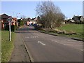
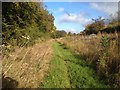
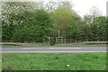
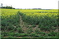
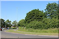
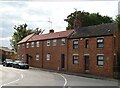
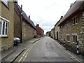
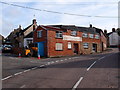
Photos of NN29 7QE


Area Information
NN29 7QE is a compact residential cluster in England, spanning 8.5 hectares and home to 2,474 residents. With a population density of 124 people per square kilometre, it balances quiet living with accessible amenities. The area’s character is shaped by its predominantly older population, with a median age of 47 and a strong presence of adults aged 30–64. This suggests a stable, community-oriented environment where many residents are established in their careers and family life. The area is not densely built, offering a sense of space without sacrificing proximity to essential services. Daily life here is likely defined by a mix of local routines, from shopping at nearby retailers to commuting via the Wellingborough railway station. The absence of major planning constraints or environmental risks means the area is both practical and peaceful, ideal for those seeking a low-maintenance, family-friendly setting without the pressures of urban living.
- Area Type
- Postcode
- Area Size
- 8.5 hectares
- Population
- 2474
- Population Density
- 124 people/km²
The property market in NN29 7QE is characterised by a high rate of home ownership (63%), with houses forming the predominant type of accommodation. This suggests a community where most residents are long-term owners rather than renters, which can influence the local real estate dynamics. The small area size of 8.5 hectares means the housing stock is limited, likely resulting in a competitive market for buyers. However, the surrounding region may offer more options for those seeking a wider selection. The focus on owner-occupied homes indicates a preference for private, family-centric living, which could appeal to buyers looking for a settled, low-traffic environment. Given the area’s low population density, properties here may offer more space per resident compared to denser urban areas, though the limited scale of the postcode means buyers should consider nearby locations for additional choices.
House Prices in NN29 7QE
Showing 28 properties
| Address | Type | Beds | Baths | Last Sale Price | Last Sale Date | |
|---|---|---|---|---|---|---|
| 47 High Street, Wollaston, NN29 7QE | house | - | - | £480,000 | Mar 2022 | |
| 79 High Street, Wollaston, NN29 7QE | Cottage | 3 | 1 | £257,000 | Apr 2021 | |
| 7 High Street, Wollaston, NN29 7QE | Semi-detached | 4 | - | £625,000 | Apr 2021 | |
| 37A High Street, Wollaston, NN29 7QE | Detached | 5 | 4 | £220,000 | Oct 2020 | |
| 87 High Street, Wollaston, NN29 7QE | Detached | 3 | 1 | £230,000 | Apr 2017 | |
| 45 High Street, Wollaston, NN29 7QE | Detached | 4 | 2 | £380,000 | Mar 2016 | |
| 73 High Street, Wollaston, NN29 7QE | Detached | 4 | 2 | £420,000 | Dec 2015 | |
| 75 High Street, Wollaston, NN29 7QE | house | 3 | - | £189,000 | May 2013 | |
| 81 High Street, Wollaston, NN29 7QE | house | 4 | - | £310,000 | May 2012 | |
| Wollaston House, 51 High Street, Wollaston, NN29 7QE | house | 5 | - | £1,725,000 | Mar 2012 |
Energy Efficiency in NN29 7QE
The lifestyle in NN29 7QE is shaped by its proximity to retail and transport hubs. Within practical reach are five retail outlets, including Co-op Wollaston, Co-op Irchester, and Tesco Wellingborough, offering everyday shopping needs. The Wellingborough Railway Station provides access to regional services, enhancing connectivity for commuters or those seeking broader opportunities. While the data does not mention parks or leisure facilities, the absence of planning constraints like protected woodlands or AONBs suggests a flexible environment for local development. The area’s small scale and low population density likely foster a close-knit community, where amenities are accessible without the congestion of larger urban centres. This balance of practicality and tranquillity defines daily life here.
Amenities
Schools
Residents of NN29 7QE have access to three primary schools within practical reach: Wollaston Community Primary School, Grendon Church of England Primary School, and Wollaston Primary School. Both Grendon and Wollaston Primary Schools hold an Ofsted rating of ‘good’, indicating a reliable standard of education. The presence of multiple primary schools provides families with options, though the data does not specify secondary schools or higher education institutions. The concentration of primary schools suggests the area is well-suited for families with young children, offering proximity to early education without the need for long commutes. However, parents should verify the specific curriculum and facilities of each school to align with their child’s needs.
| Rank | School | Type | Entry gender | Ages |
|---|
Explore more schools in this area
Go to Schools tabDemographics
The community in NN29 7QE is predominantly composed of adults aged 30–64, with a median age of 47. This age group makes up the majority of the 2,474 residents, indicating a mature, stable population. Home ownership is high at 63%, with the majority of properties being houses rather than flats or apartments. The predominant ethnic group is White, reflecting a homogenous demographic profile. The population density of 124 people per square kilometre suggests a low-rise, spread-out residential layout, which aligns with the area’s small size and focus on individual homes. While the data does not specify deprivation levels, the combination of high home ownership and a low crime risk (73/100) implies a quality of life that is relatively secure and self-sufficient. This profile suits those prioritising stability, privacy, and a slower pace of life.
Household Size
Accommodation Type
Tenure
Ethnic Group
Religion
Household Composition
Age
Household Deprivation
NS-SEC
Explore more demographic insights in this area
Go to Demographics tabPlanning
Planning Constraints
- Flood RiskPremium
- Ramsar Wetland SitesPremium
- Area of Outstanding Natural BeautyPremium
- Protected Nature ReservePremium
- Protected WoodlandPremium