Area Overview for NN29 7EL
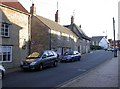
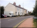
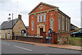
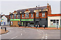
Photos of NN29 7EL


Area Information
Living in NN29 7EL means being part of a compact, residential cluster in England, where 1,787 people reside across 3,935 square metres. This small postcode area has a high population density of 1,016 people per square kilometre, reflecting a tightly knit community. The area is characterised by a mature demographic, with a median age of 47 and a majority of residents aged between 30 and 64. Daily life here is shaped by proximity to essential services and a low crime rate. While the area lacks large-scale amenities, its small size ensures a sense of familiarity. Residents benefit from excellent broadband connectivity and a nearby railway station, offering practical links to surrounding towns. NN29 7EL is not a place for those seeking sprawling landscapes or urban vibrancy, but it suits those prioritising security, stability, and a quiet, established neighbourhood.
- Area Type
- Postcode
- Area Size
- 3935 m²
- Population
- 1787
- Population Density
- 1016 people/km²
The property market in NN29 7EL is dominated by owner-occupied homes, with 82% of properties owned by residents rather than rented. The accommodation type is exclusively houses, which is uncommon in many modern developments but typical of older, rural or semi-rural areas. This suggests a market focused on established, single-family homes rather than apartments or shared housing. Given the area’s small size and high home ownership, the housing stock is likely limited, making it a niche market for buyers seeking a specific type of property. Prospective buyers should consider the lack of new builds and the potential for limited choice, though the existing homes may offer stability and long-term value.
House Prices in NN29 7EL
Showing 9 properties
| Address | Type | Beds | Baths | Last Sale Price | Last Sale Date | |
|---|---|---|---|---|---|---|
| 6 Alexander Court, Irchester, NN29 7EL | Detached | 3 | - | £269,995 | Jan 2021 | |
| 8 Alexander Court, Irchester, NN29 7EL | Detached | 5 | 1 | £310,000 | Oct 2020 | |
| 2 Alexander Court, Irchester, NN29 7EL | Terraced | 4 | 3 | £261,200 | Mar 2020 | |
| 1 Alexander Court, Irchester, NN29 7EL | Terraced | 4 | 2 | £209,995 | Jan 2016 | |
| 5 Alexander Court, Irchester, NN29 7EL | Detached | - | - | £249,950 | Jun 2007 | |
| 9 Alexander Court, Irchester, NN29 7EL | Detached | - | - | £190,000 | Oct 2004 | |
| 4 Alexander Court, Irchester, NN29 7EL | Detached | - | - | £194,995 | Oct 2002 | |
| 3 Alexander Court, Irchester, NN29 7EL | Terraced | - | - | £135,000 | Nov 2001 | |
| 7 Alexander Court, Irchester, NN29 7EL | Semi-detached | - | - | £132,000 | Dec 2000 |
Energy Efficiency in NN29 7EL
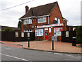
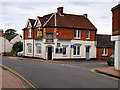
Daily life in NN29 7EL is shaped by its proximity to small, local amenities. Within practical reach are shops such as Co-op Irchester, Spar, and Budgens Rushden, offering essentials for everyday needs. While the area lacks large supermarkets or entertainment venues, these smaller retailers cater to the community’s immediate requirements. The nearest rail station, Wellingborough Railway Station, provides access to broader regional services, though the area itself is not a hub for leisure or cultural activities. The compact nature of NN29 7EL means residents must travel slightly further for larger amenities, but the convenience of local shops and transport links balances this. The lifestyle here is simple, practical, and focused on local connectivity.
Amenities
Schools
| Rank | School | Type | Entry gender | Ages |
|---|
Explore more schools in this area
Go to Schools tabDemographics
The community in NN29 7EL is predominantly composed of adults aged 30 to 64, with a median age of 47. This suggests a population of middle-aged and older residents, many of whom may be settled in long-term homes. Home ownership is high, at 82%, indicating a stable, owner-occupied community rather than a rental-heavy area. The accommodation type is primarily houses, which aligns with the demographic profile of older, established households. The predominant ethnic group is White, though no specific data on diversity or deprivation is provided. The high home ownership rate and age profile suggest a community with strong local ties and limited turnover. For buyers, this implies a market with limited new developments but well-maintained properties.
Household Size
Accommodation Type
Tenure
Ethnic Group
Religion
Household Composition
Age
Household Deprivation
NS-SEC
Explore more demographic insights in this area
Go to Demographics tabPlanning
Planning Constraints
- Flood RiskPremium
- Ramsar Wetland SitesPremium
- Area of Outstanding Natural BeautyPremium
- Protected Nature ReservePremium
- Protected WoodlandPremium