Area Overview for NN29 7HE
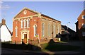
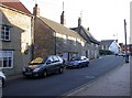
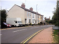
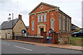
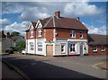
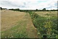
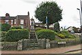
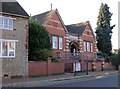
Photos of NN29 7HE
Area Information
NN29 7HE is a compact residential area in England, covering just 1.4 hectares and home to 1,787 residents. Its small size means it feels like a tight-knit community, where daily life revolves around local shops, the nearby railway station, and the surrounding countryside. The area’s population density of 1,016 people per square kilometre suggests a balance between residential comfort and proximity to amenities. With a median age of 47, the neighbourhood is predominantly occupied by adults aged 30–64, many of whom own their homes. This demographic profile hints at a stable, established community where families and long-term residents coexist. The area’s proximity to Wellingborough Railway Station and a cluster of local retailers like Co-op Irchester and Budgens Rushden ensures practicality for everyday needs. While it lacks large-scale infrastructure, its quiet, low-density character appeals to those seeking a slower pace of life, away from urban sprawl but within reach of regional services.
- Area Type
- Postcode
- Area Size
- 1.4 hectares
- Population
- 1787
- Population Density
- 1016 people/km²
NN29 7HE is a predominantly owner-occupied area, with 82% of homes owned by residents rather than rented. The housing stock is largely composed of houses, which is unusual for smaller postcode areas and suggests a focus on family-friendly or semi-detached properties. This mix of home ownership and traditional housing types indicates a market where properties are likely to be long-term investments rather than short-term rentals. The small size of the area—just 1.4 hectares—means the housing stock is limited, so buyers may need to look beyond NN29 7HE for more options. The high home ownership rate also implies a stable market, with fewer fluctuations in property values. For those considering this area, the emphasis on houses may appeal to buyers seeking larger living spaces or gardens, though the limited supply could mean competitive bidding for available properties.
House Prices in NN29 7HE
Showing 48 properties
| Address | Type | Beds | Baths | Last Sale Price | Last Sale Date | |
|---|---|---|---|---|---|---|
| 22 Wantage Road, Irchester, NN29 7HE | Detached | 3 | 1 | £195,000 | Jul 2025 | |
| 36 Wantage Road, Irchester, NN29 7HE | Detached | 3 | 1 | £306,500 | Dec 2024 | |
| 29 Wantage Road, Irchester, NN29 7HE | house | - | - | £315,000 | Feb 2024 | |
| 13 Wantage Road, Irchester, NN29 7HE | Semi-detached | 2 | 1 | £243,750 | Oct 2023 | |
| 23 Wantage Road, Irchester, NN29 7HE | Bungalow | - | - | £179,000 | May 2023 | |
| 8 Wantage Road, Irchester, NN29 7HE | Semi-detached | 3 | - | £175,000 | Apr 2021 | |
| 32 Wantage Road, Irchester, NN29 7HE | house | 3 | - | £206,000 | Mar 2021 | |
| 5 Wantage Road, Irchester, NN29 7HE | Bungalow | 2 | 1 | £110,000 | Jun 2020 | |
| 10 Wantage Road, Irchester, NN29 7HE | house | - | - | £186,000 | Dec 2019 | |
| 16 Wantage Road, Irchester, NN29 7HE | Semi-detached | 3 | 1 | £163,000 | Mar 2019 |
Energy Efficiency in NN29 7HE
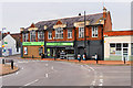
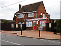
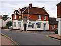
The lifestyle in NN29 7HE is shaped by its proximity to essential retail and transport hubs. Local shops such as Co-op Irchester, Spar, and Budgens Rushden provide everyday convenience, offering groceries and other household essentials within walking distance. The Wellingborough Railway Station is a key asset, connecting residents to nearby towns and cities for work, shopping, or leisure. While the area lacks dedicated parks or recreational spaces, its low density and rural surroundings may offer nearby green spaces for outdoor activities. The presence of these amenities fosters a practical, self-sufficient lifestyle, where residents can meet daily needs without long commutes. The small, close-knit nature of the community also encourages a sense of familiarity, with local businesses and services forming the backbone of daily life.
Amenities
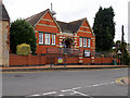
Schools
| Rank | School | Type | Entry gender | Ages |
|---|
Explore more schools in this area
Go to Schools tabDemographics
The population of NN29 7HE is overwhelmingly composed of adults aged 30–64, with a median age of 47. This suggests a mature, settled community with strong family ties and long-term residency. Home ownership is high, at 82%, indicating a preference for stability over rental living. The area is dominated by houses rather than flats, reflecting a traditional housing stock suited to families or retirees. The predominant ethnic group is White, with no specific data on other demographics provided. The absence of detailed diversity metrics means the community’s cultural composition remains less defined. The low population density and high home ownership suggest a lifestyle prioritising privacy and space over urban density. For buyers, this profile implies a neighbourhood where property values are likely to hold their worth, supported by a consistent demographic base.
Household Size
Accommodation Type
Tenure
Ethnic Group
Religion
Household Composition
Age
Household Deprivation
NS-SEC
Explore more demographic insights in this area
Go to Demographics tabPlanning
Planning Constraints
- Flood RiskPremium
- Ramsar Wetland SitesPremium
- Area of Outstanding Natural BeautyPremium
- Protected Nature ReservePremium
- Protected WoodlandPremium