Area Overview for NN29 7AB
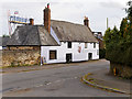
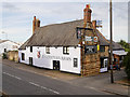
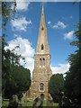
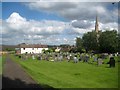
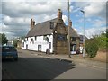
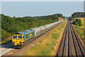
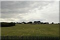
Photos of NN29 7AB

Area Information
Living in NN29 7AB means inhabiting a small, tightly knit residential cluster in England, where 1,658 people reside across 17.9 hectares. The area’s compact size fosters a quiet, low-density lifestyle, with a population density of 237 people per square kilometre. This postcode is defined by its proximity to local amenities and schools, making it practical for families and individuals seeking a balance between seclusion and accessibility. The community is predominantly adult-focused, with a median age of 47 and 60% of residents owning their homes. Daily life here is shaped by nearby primary schools, retail outlets, and a railway station, creating a self-contained environment. While the area lacks large-scale infrastructure, its small footprint ensures a sense of familiarity and manageable living. For those prioritising convenience over urban sprawl, NN29 7AB offers a straightforward, no-frills existence with minimal commuting demands. The absence of environmental constraints like protected woodlands or AONB designations also simplifies planning for homeowners.
- Area Type
- Postcode
- Area Size
- 17.9 hectares
- Population
- 1658
- Population Density
- 237 people/km²
The property market in NN29 7AB is shaped by its small size and high home ownership rate of 60%. With houses being the primary accommodation type, the area is not dominated by rental properties or high-density developments. This suggests a market where long-term residency is common, with fewer speculative investments or short-term lets. The limited area size means housing stock is constrained, which could influence prices and availability. Buyers should consider the proximity to nearby schools and amenities, which may enhance property value. However, the small footprint also means competition for homes is likely to be focused within a narrow radius. For those seeking a quiet, low-maintenance lifestyle, NN29 7AB’s housing offers a straightforward option, though the lack of larger infrastructure or commercial zones may appeal more to those prioritising privacy over expansion.
House Prices in NN29 7AB
Showing 56 properties
| Address | Type | Beds | Baths | Last Sale Price | Last Sale Date | |
|---|---|---|---|---|---|---|
| 60 High Street, Irchester, NN29 7AB | Cottage | - | - | £460,000 | Mar 2025 | |
| 68 High Street, Irchester, NN29 7AB | Detached | 4 | 1 | £430,000 | Jan 2020 | |
| 62A High Street, Irchester, NN29 7AB | Bungalow | - | - | £375,000 | Feb 2018 | |
| 8A High Street, Irchester, NN29 7AB | Maisonette | 1 | 1 | £163,000 | Jun 2017 | |
| 82 High Street, Irchester, NN29 7AB | Detached | 4 | 2 | £315,000 | May 2017 | |
| 84 High Street, Irchester, NN29 7AB | Detached | 4 | 1 | £300,000 | Feb 2017 | |
| 36-38 High Street, Irchester, NN29 7AB | house | - | - | £287,000 | Jan 2016 | |
| 66 High Street, Irchester, NN29 7AB | Bungalow | 3 | 1 | £270,000 | Jun 2015 | |
| 70 High Street, Irchester, NN29 7AB | Detached | 4 | 1 | £280,000 | Jan 2013 | |
| 134 High Street, Irchester, NN29 7AB | Semi-detached | - | - | £240,000 | Apr 2004 |
Energy Efficiency in NN29 7AB
The lifestyle in NN29 7AB is defined by its proximity to local retail and transport. Nearby shops include Co-op Irchester, Spar, and Waitrose Rushden, offering a mix of essential groceries and everyday conveniences. These stores are within practical reach, reducing the need for long trips to larger centres. The Wellingborough Railway Station provides a gateway to broader networks, though its single presence means limited frequency or route options. The area’s small size means leisure and recreational facilities are sparse, but the compact layout ensures amenities are easily accessible. For residents valuing simplicity over sprawling options, NN29 7AB’s lifestyle is efficient, with a focus on immediate needs rather than expansive choices. The combination of retail outlets and rail access creates a self-sufficient environment, though it may not cater to those seeking diverse leisure activities or cultural attractions.
Amenities
Schools
Residents of NN29 7AB have access to several primary schools, including Irchester Junior School, Irchester Infant School, and Irchester Community Primary School, which appears listed twice. Knuston Hall is also noted, though its exact educational role is unclear from the data. The presence of multiple primary schools suggests a focus on early education, which is crucial for families with young children. However, the absence of secondary schools or higher education institutions within the area means students may need to travel to nearby towns for further studies. The duplication of Irchester Community Primary School in the data may indicate a local emphasis on primary education, potentially offering multiple options for parents. While no Ofsted ratings are provided, the variety of schools could imply a range of teaching approaches or specialisms. For families prioritising proximity to schools, NN29 7AB’s offerings are practical, though they may not cater to all educational needs without external travel.
| Rank | School | Type | Entry gender | Ages |
|---|
Explore more schools in this area
Go to Schools tabDemographics
The population of NN29 7AB is characterised by a median age of 47, with the majority of residents falling into the 30-64 age range. This suggests a community of established adults, many of whom may be in their prime working years or nearing retirement. Home ownership is strong here, with 60% of residents owning their properties, compared to 40% renting. The accommodation type is predominantly houses, reflecting a preference for standalone living rather than flats or apartments. The predominant ethnic group is White, though no specific data on diversity or deprivation levels is provided. The age profile indicates a stable, mature demographic, likely with long-term ties to the area. This demographic structure influences local services, with schools and amenities tailored to families and working-age adults. The absence of younger or older population extremes may mean fewer childcare demands or senior care facilities, but the community remains focused on practical, middle-aged needs.
Household Size
Accommodation Type
Tenure
Ethnic Group
Religion
Household Composition
Age
Household Deprivation
NS-SEC
Explore more demographic insights in this area
Go to Demographics tabPlanning
Planning Constraints
- Flood RiskPremium
- Ramsar Wetland SitesPremium
- Area of Outstanding Natural BeautyPremium
- Protected Nature ReservePremium
- Protected WoodlandPremium