Area Overview for NN29 7DD
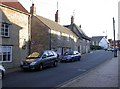
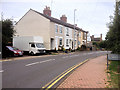
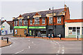
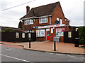
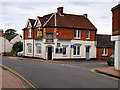
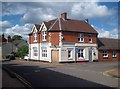
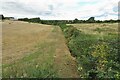
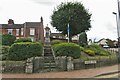
Photos of NN29 7DD


Area Information
Living in NN29 7DD offers a compact, tightly knit residential experience. This small postcode area covers just 1.8 hectares, housing 1,468 people in a density of 579 people per square kilometre. The community is characterised by a mature demographic, with a median age of 47 and most residents aged between 30 and 64. This suggests a stable, established neighbourhood where many residents have lived for years. The area is predominantly composed of houses, with 86% of properties owner-occupied, reflecting a local culture of long-term residency. Proximity to Wellingborough Railway Station and nearby retail hubs like Tesco Wellingborough and Co-op Irchester ensures practical connectivity for daily needs. While the area is small, it balances residential tranquillity with access to essential services. The low crime risk score of 92 and absence of environmental constraints such as protected woodlands or flood zones add to its appeal. For those seeking a quiet, safe place with a strong sense of community, NN29 7DD provides a focused, manageable living environment.
- Area Type
- Postcode
- Area Size
- 1.8 hectares
- Population
- 1468
- Population Density
- 579 people/km²
The property market in NN29 7DD is dominated by owner-occupied homes, with 86% of properties owned by residents rather than rented. This high ownership rate suggests a community where long-term residency is the norm, and property values are likely to be stable. The accommodation type is exclusively houses, not flats or apartments, which is typical of smaller, low-density areas. This configuration may appeal to families or individuals seeking space and privacy, though it limits the availability of rental options. Given the area’s small size and compact layout, the housing stock is likely to be traditional in style, with limited new developments. Buyers should consider that the market is not geared toward investors or renters, making it a niche choice for those prioritising ownership and a quiet, established environment.
House Prices in NN29 7DD
Showing 29 properties
| Address | Type | Beds | Baths | Last Sale Price | Last Sale Date | |
|---|---|---|---|---|---|---|
| 179 Wollaston Road, Irchester, NN29 7DD | Semi-detached | 3 | 1 | £250,000 | Dec 2024 | |
| 181 Wollaston Road, Irchester, NN29 7DD | Semi-detached | 3 | 1 | £335,000 | Feb 2024 | |
| 121 Wollaston Road, Irchester, NN29 7DD | Detached | 4 | 2 | £407,000 | Feb 2023 | |
| 157 Wollaston Road, Irchester, NN29 7DD | house | - | - | £375,000 | Feb 2023 | |
| 119 Wollaston Road, Irchester, NN29 7DD | house | 3 | - | £380,000 | Feb 2023 | |
| 165 Wollaston Road, Irchester, NN29 7DD | Detached | 4 | 2 | £390,000 | Jul 2021 | |
| 163 Wollaston Road, Irchester, NN29 7DD | Detached | 4 | 2 | £278,000 | Jan 2021 | |
| 187 Wollaston Road, Irchester, NN29 7DD | Detached | 3 | 1 | £277,500 | Jul 2019 | |
| 101 Wollaston Road, Irchester, NN29 7DD | house | - | - | £138,000 | Jan 2016 | |
| 177 Wollaston Road, Irchester, NN29 7DD | Detached | 3 | 1 | £217,000 | Nov 2014 |
Energy Efficiency in NN29 7DD
The lifestyle in NN29 7DD is shaped by its proximity to essential amenities. Within practical reach are retail options such as Co-op Irchester, Spar, and Tesco Wellingborough, providing everyday shopping convenience. The Wellingborough Railway Station offers direct access to regional transport networks, enhancing mobility for commuters and visitors. While the area lacks detailed information on parks or leisure facilities, the retail and transport links suggest a practical, service-oriented daily life. The compact size of the postcode means residents are likely to know their neighbours and rely on local businesses for routine needs. The absence of major leisure venues or green spaces is balanced by the area’s simplicity and ease of access to nearby towns for additional activities.
Amenities
Schools
| Rank | School | Type | Entry gender | Ages |
|---|
Explore more schools in this area
Go to Schools tabDemographics
The population of NN29 7DD is predominantly adults aged 30–64, with a median age of 47. This suggests a mature, settled community where most residents are likely in their prime working or retirement years. Home ownership is exceptionally high at 86%, indicating a preference for long-term investment in property rather than rental tenancies. All properties are houses, not flats, which aligns with the area’s low density and family-oriented profile. The predominant ethnic group is White, with no data provided on other demographics. The age profile and ownership rates imply a stable, low-turnover neighbourhood where generational ties are likely strong. With no mention of deprivation levels, the area appears to support a quality of life that meets the needs of its residents, particularly those prioritising security and permanence in housing.
Household Size
Accommodation Type
Tenure
Ethnic Group
Religion
Household Composition
Age
Household Deprivation
NS-SEC
Explore more demographic insights in this area
Go to Demographics tabPlanning
Planning Constraints
- Flood RiskPremium
- Ramsar Wetland SitesPremium
- Area of Outstanding Natural BeautyPremium
- Protected Nature ReservePremium
- Protected WoodlandPremium